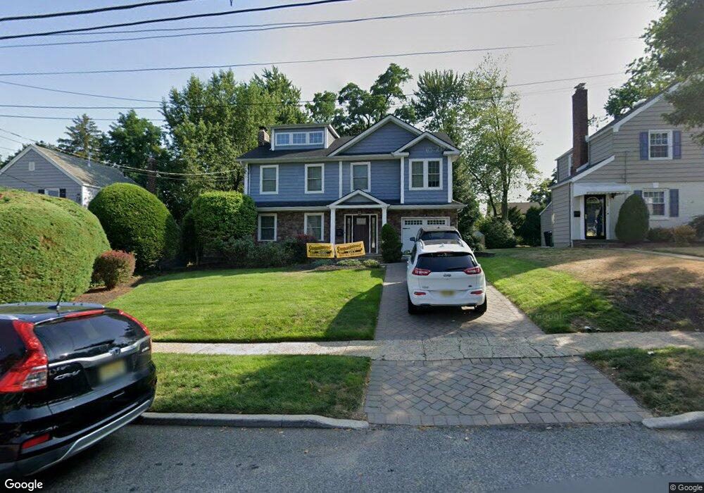
121 Manning Ave River Edge, NJ 07661
Estimated Value: $1,022,000 - $1,192,000
--
Bed
--
Bath
2,940
Sq Ft
$366/Sq Ft
Est. Value
About This Home
This home is located at 121 Manning Ave, River Edge, NJ 07661 and is currently estimated at $1,076,540, approximately $366 per square foot. 121 Manning Ave is a home located in Bergen County with nearby schools including Cherry Hill School, River Dell Middle School, and River Dell Regional High School.
Ownership History
Date
Name
Owned For
Owner Type
Purchase Details
Closed on
Oct 27, 1993
Sold by
Branch Scott
Bought by
Hacker Scot and Hacker Karen
Current Estimated Value
Home Financials for this Owner
Home Financials are based on the most recent Mortgage that was taken out on this home.
Original Mortgage
$180,000
Interest Rate
6.83%
Create a Home Valuation Report for This Property
The Home Valuation Report is an in-depth analysis detailing your home's value as well as a comparison with similar homes in the area
Home Values in the Area
Average Home Value in this Area
Purchase History
| Date | Buyer | Sale Price | Title Company |
|---|---|---|---|
| Hacker Scot | $230,000 | -- |
Source: Public Records
Mortgage History
| Date | Status | Borrower | Loan Amount |
|---|---|---|---|
| Closed | Hacker Scot | $180,000 |
Source: Public Records
Tax History Compared to Growth
Tax History
| Year | Tax Paid | Tax Assessment Tax Assessment Total Assessment is a certain percentage of the fair market value that is determined by local assessors to be the total taxable value of land and additions on the property. | Land | Improvement |
|---|---|---|---|---|
| 2025 | $21,177 | $1,040,400 | $345,000 | $695,400 |
| 2024 | $20,648 | $534,100 | $198,800 | $335,300 |
| 2023 | $19,762 | $534,100 | $198,800 | $335,300 |
| 2022 | $19,762 | $534,100 | $198,800 | $335,300 |
| 2021 | $18,523 | $534,100 | $198,800 | $335,300 |
| 2020 | $19,067 | $534,100 | $198,800 | $335,300 |
| 2019 | $18,523 | $534,100 | $198,800 | $335,300 |
| 2018 | $18,133 | $534,100 | $198,800 | $335,300 |
| 2017 | $17,956 | $534,100 | $198,800 | $335,300 |
| 2016 | $17,551 | $534,100 | $198,800 | $335,300 |
| 2015 | $17,182 | $534,100 | $198,800 | $335,300 |
| 2014 | $17,214 | $534,100 | $198,800 | $335,300 |
Source: Public Records
Map
Nearby Homes
- 378 Windsor Rd
- 168 Voorhis Ave
- 215 Kensington Rd
- 421 Lafayette Ave
- 276 Greenway Terrace
- 12 Gainesborough Terrace Unit 1B
- 195 River Ln
- 204 Woodland Rd
- 293 Bogert Rd Unit 1A
- 42 Howland Ave
- 44 Canterbury Ln
- 1061 Roosevelt Ave
- 302 Howland Ave
- 212 Lozier Terrace
- 1 Westley Ln
- 255 Bogert Rd Unit 2A
- 668 River Rd
- 140 River Edge Ave
- 33 Lincoln Ave
- 222 Zabriskie Place
- 119 Manning Ave
- 123 Manning Ave
- 125 Manning Ave
- 539 Kinderkamack Rd
- 118 Voorhis Ave
- 120 Voorhis Ave
- 116 Voorhis Ave
- 122 Voorhis Ave
- 127 Manning Ave
- 114 Voorhis Ave
- 120 Manning Ave
- 118 Manning Ave
- 124 Voorhis Ave
- 122 Manning Ave
- 110 Voorhis Ave
- 124 Manning Ave
- 540 Bogert Rd
- 550 Bogert Rd
- 536 Kinderkamack Rd
- 126 Manning Ave