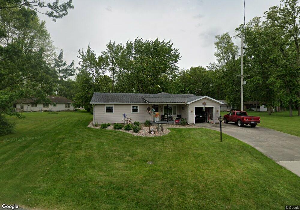
121 Maple Dr Antwerp, OH 45813
Estimated Value: $178,000 - $187,000
3
Beds
2
Baths
1,644
Sq Ft
$112/Sq Ft
Est. Value
About This Home
This home is located at 121 Maple Dr, Antwerp, OH 45813 and is currently estimated at $183,667, approximately $111 per square foot. 121 Maple Dr is a home located in Paulding County with nearby schools including Antwerp Local Elementary School and Antwerp Local High School.
Ownership History
Date
Name
Owned For
Owner Type
Purchase Details
Closed on
Jul 17, 2001
Sold by
Billman Nellie M Lif Est
Bought by
Freshwater Karen J
Current Estimated Value
Purchase Details
Closed on
Jun 29, 2001
Sold by
Savage Peggy A
Bought by
Freshwater Karen J
Purchase Details
Closed on
Jan 23, 1987
Bought by
Freshwater Karen J
Create a Home Valuation Report for This Property
The Home Valuation Report is an in-depth analysis detailing your home's value as well as a comparison with similar homes in the area
Purchase History
| Date | Buyer | Sale Price | Title Company |
|---|---|---|---|
| Freshwater Karen J | $70,000 | -- | |
| Freshwater Karen J | -- | -- | |
| Freshwater Karen J | -- | -- |
Source: Public Records
Tax History
| Year | Tax Paid | Tax Assessment Tax Assessment Total Assessment is a certain percentage of the fair market value that is determined by local assessors to be the total taxable value of land and additions on the property. | Land | Improvement |
|---|---|---|---|---|
| 2025 | $1,715 | $52,850 | $7,910 | $44,940 |
| 2024 | $1,715 | $40,670 | $6,090 | $34,580 |
| 2023 | $1,382 | $40,670 | $6,090 | $34,580 |
| 2022 | $1,294 | $40,670 | $6,090 | $34,580 |
| 2021 | $1,067 | $32,240 | $5,640 | $26,600 |
| 2020 | $1,091 | $32,240 | $5,640 | $26,600 |
| 2019 | $1,104 | $27,410 | $5,640 | $21,770 |
| 2018 | $1,283 | $27,410 | $5,640 | $21,770 |
| 2017 | $1,284 | $27,410 | $5,640 | $21,770 |
| 2016 | $1,284 | $27,410 | $5,640 | $21,770 |
| 2015 | $1,349 | $28,920 | $5,640 | $23,280 |
| 2014 | $1,263 | $28,920 | $5,640 | $23,280 |
| 2013 | $1,382 | $28,920 | $5,640 | $23,280 |
Source: Public Records
Map
Nearby Homes
- 136 Maumee Ln
- 110 Wilcox St
- 314 E Canal St
- 214 Weber St
- 212 Weber St
- 210 Weber St
- 13149 Road 27b
- 3190 Road 204
- 4787 Carson Ct
- 16453 Road 63
- 25812 Maumee Center Rd
- 26100 Worden Rd
- 4616 Homestead Trail
- 11309 State Route 49
- 5038 Chickadee Dr
- 4974 Chickadee Dr
- 22331 Maple Ln
- 22108 State Road 37
- 22428 Ash St Unit 25
- 22489 Ash St Unit 21
Your Personal Tour Guide
Ask me questions while you tour the home.