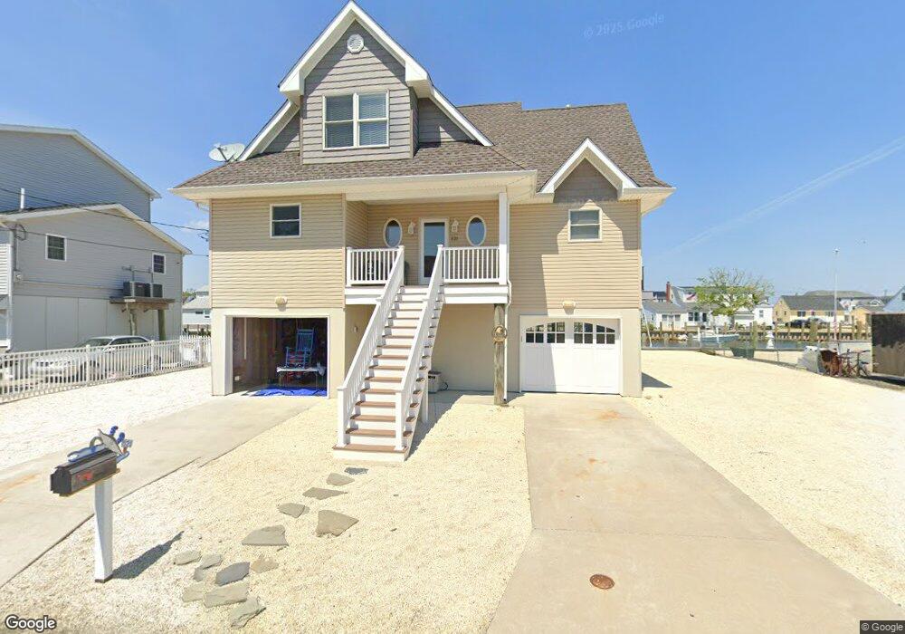
121 Marine Rd Waretown, NJ 08758
Estimated Value: $624,000 - $900,000
3
Beds
3
Baths
2,105
Sq Ft
$373/Sq Ft
Est. Value
About This Home
This home is located at 121 Marine Rd, Waretown, NJ 08758 and is currently estimated at $785,963, approximately $373 per square foot. 121 Marine Rd is a home located in Ocean County with nearby schools including Waretown Elementary School and Frederic A. Priff Elementary School.
Ownership History
Date
Name
Owned For
Owner Type
Purchase Details
Closed on
Jul 22, 2008
Sold by
Allen Margaret M
Bought by
Bloodgood Robert Wayne
Current Estimated Value
Home Financials for this Owner
Home Financials are based on the most recent Mortgage that was taken out on this home.
Original Mortgage
$150,000
Interest Rate
6.47%
Mortgage Type
Purchase Money Mortgage
Purchase Details
Closed on
Jun 9, 1999
Sold by
Allen Margaret M
Bought by
Allen Margaret M
Create a Home Valuation Report for This Property
The Home Valuation Report is an in-depth analysis detailing your home's value as well as a comparison with similar homes in the area
Home Values in the Area
Average Home Value in this Area
Purchase History
| Date | Buyer | Sale Price | Title Company |
|---|---|---|---|
| Bloodgood Robert Wayne | $250,000 | Commonwealth Land Title Insu | |
| Allen Margaret M | -- | -- |
Source: Public Records
Mortgage History
| Date | Status | Borrower | Loan Amount |
|---|---|---|---|
| Closed | Bloodgood Robert Wayne | $150,000 |
Source: Public Records
Tax History Compared to Growth
Tax History
| Year | Tax Paid | Tax Assessment Tax Assessment Total Assessment is a certain percentage of the fair market value that is determined by local assessors to be the total taxable value of land and additions on the property. | Land | Improvement |
|---|---|---|---|---|
| 2025 | $10,672 | $707,200 | $297,000 | $410,200 |
| 2024 | $10,112 | $707,200 | $297,000 | $410,200 |
| 2023 | $9,459 | $435,300 | $212,600 | $222,700 |
| 2022 | $9,459 | $435,300 | $212,600 | $222,700 |
| 2021 | $9,302 | $435,300 | $212,600 | $222,700 |
| 2020 | $9,180 | $435,300 | $212,600 | $222,700 |
| 2019 | $9,002 | $435,300 | $212,600 | $222,700 |
| 2018 | $8,837 | $435,300 | $212,600 | $222,700 |
| 2017 | $8,536 | $435,300 | $212,600 | $222,700 |
| 2016 | $8,292 | $435,300 | $212,600 | $222,700 |
| 2015 | $8,075 | $435,300 | $212,600 | $222,700 |
| 2014 | $3,960 | $215,200 | $212,600 | $2,600 |
Source: Public Records
Map
Nearby Homes
- 92 Marine Rd
- 115 Bonita Rd
- 12 Point Rd
- 46 Baybreeze Dr
- 20 Grand Bay Harbor Dr
- 5 Pohatcong Ave
- 104 Clearwater Dr
- 301 6th St
- 44 Baybreeze Dr
- 38 Baybreeze Dr
- 34 Baybreeze Dr
- 40 Baybreeze Dr
- 42 Baybreeze Dr
- LAFAYETTE Plan at Ocean Isle
- 36 Baybreeze Dr
- 21 Bay Breeze Dr
- 105 Atlantic Ave Unit 4
- 108 Baltic Ave
- 356 U S Highway 9
- 55 Main St