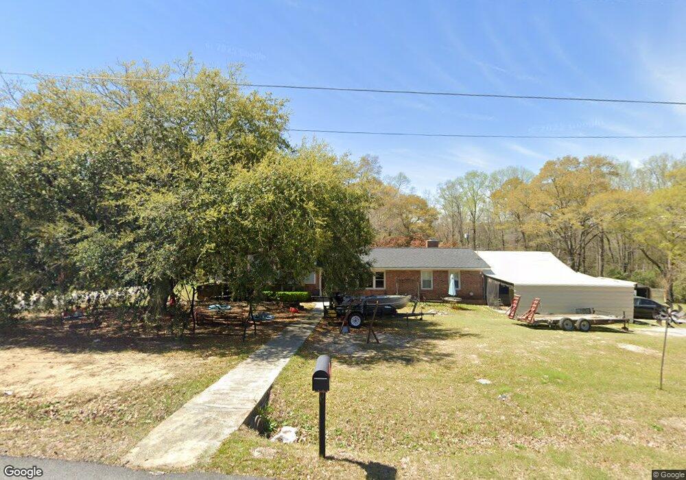
121 Michael St Bonaire, GA 31005
Estimated Value: $188,409 - $208,000
5
Beds
3
Baths
1,775
Sq Ft
$109/Sq Ft
Est. Value
About This Home
This home is located at 121 Michael St, Bonaire, GA 31005 and is currently estimated at $193,602, approximately $109 per square foot. 121 Michael St is a home located in Houston County with nearby schools including Bonaire Elementary School, Huntington Middle School, and Warner Robins High School.
Ownership History
Date
Name
Owned For
Owner Type
Purchase Details
Closed on
Mar 8, 2010
Sold by
Federal Home Loan Mortgage Corporation
Bought by
Tibbetts Tiffany N and Prater Gerald T
Current Estimated Value
Home Financials for this Owner
Home Financials are based on the most recent Mortgage that was taken out on this home.
Original Mortgage
$63,723
Outstanding Balance
$42,213
Interest Rate
4.97%
Mortgage Type
FHA
Estimated Equity
$151,389
Purchase Details
Closed on
Aug 4, 2009
Sold by
Taylor Bean & Whitaker Mortgage Corporat
Bought by
Federal Home Loan Mortgage Corp
Purchase Details
Closed on
Oct 16, 2002
Sold by
Sabal David A and Daniella B*
Bought by
Shaffer Margie Ann
Purchase Details
Closed on
Jul 30, 1999
Sold by
Kleedavid Kleedavid A and Kleedavid Julia
Bought by
Sabal David A and Daniella B*
Purchase Details
Closed on
May 20, 1997
Sold by
Walters Julia D
Bought by
Kleedavid Kleedavid A and Kleedavid Julia
Purchase Details
Closed on
Oct 13, 1993
Sold by
Klee David A and Klee Julia
Bought by
Walters Julia D
Purchase Details
Closed on
Apr 24, 1989
Sold by
Beavers Allen W and Beavers Ethel
Bought by
Klee David A and Klee Julia
Purchase Details
Closed on
Jun 14, 1985
Sold by
Elliott David R and Elliott Linda J
Bought by
Beavers Allen W and Beavers Ethel
Purchase Details
Closed on
Jun 29, 1981
Sold by
Doane Robert C
Bought by
Elliott David R and Elliott Linda J
Purchase Details
Closed on
Feb 28, 1980
Sold by
Propst David L and Propst Jewel C
Bought by
Doane Robert C
Purchase Details
Closed on
Feb 28, 1979
Sold by
Moore Robert E
Bought by
Propst David L and Propst Jewel C
Purchase Details
Closed on
Jun 29, 1972
Sold by
Deane Edward L
Bought by
Moore Robert E
Purchase Details
Closed on
Aug 1, 1971
Sold by
Griffith William B
Bought by
Deane Edward L
Purchase Details
Closed on
Aug 23, 1966
Bought by
Griffith William B
Create a Home Valuation Report for This Property
The Home Valuation Report is an in-depth analysis detailing your home's value as well as a comparison with similar homes in the area
Home Values in the Area
Average Home Value in this Area
Purchase History
| Date | Buyer | Sale Price | Title Company |
|---|---|---|---|
| Tibbetts Tiffany N | -- | None Available | |
| Federal Home Loan Mortgage Corp | -- | None Available | |
| Taylor Bean & Whitaker Mortgage Corp | $78,022 | None Available | |
| Federal Home Loan Mortgage Corporation | $78,000 | -- | |
| Shaffer Margie Ann | $103,500 | -- | |
| Sabal David A | $89,900 | -- | |
| Kleedavid Kleedavid A | -- | -- | |
| Walters Julia D | -- | -- | |
| Klee David A | -- | -- | |
| Beavers Allen W | -- | -- | |
| Elliott David R | -- | -- | |
| Doane Robert C | -- | -- | |
| Propst David L | $50,000 | -- | |
| Moore Robert E | $27,900 | -- | |
| Deane Edward L | -- | -- | |
| Griffith William B | $15,400 | -- |
Source: Public Records
Mortgage History
| Date | Status | Borrower | Loan Amount |
|---|---|---|---|
| Open | Tibbetts Tiffany N | $63,723 |
Source: Public Records
Tax History Compared to Growth
Tax History
| Year | Tax Paid | Tax Assessment Tax Assessment Total Assessment is a certain percentage of the fair market value that is determined by local assessors to be the total taxable value of land and additions on the property. | Land | Improvement |
|---|---|---|---|---|
| 2024 | $1,203 | $50,280 | $5,840 | $44,440 |
| 2023 | $1,006 | $41,640 | $5,840 | $35,800 |
| 2022 | $961 | $39,760 | $5,840 | $33,920 |
| 2021 | $879 | $36,200 | $5,840 | $30,360 |
| 2020 | $877 | $35,920 | $5,840 | $30,080 |
| 2019 | $877 | $35,920 | $5,840 | $30,080 |
| 2018 | $877 | $35,920 | $5,840 | $30,080 |
| 2017 | $878 | $35,920 | $5,840 | $30,080 |
| 2016 | $879 | $35,920 | $5,840 | $30,080 |
| 2015 | $881 | $35,920 | $5,840 | $30,080 |
| 2014 | -- | $33,760 | $5,840 | $27,920 |
| 2013 | -- | $33,760 | $5,840 | $27,920 |
Source: Public Records
Map
Nearby Homes
- 0 Michael Ct Unit 10532063
- 0 Michael Ct Unit 179429
- 0 Michael Ct Unit 252716
- 307 Fleming Dr
- 106 Mulligan Ct
- 202 Sandy Run Rd
- 104 Old Perry Rd
- 114 Saint Augustine Dr
- 204 Thornton Dr
- 100 Deerwood Dr
- 102 Harmony Path
- 109 Harmony Path
- 108 Savannah Ln
- 107 Shadowood Dr
- 91 Stathams Way
- 305 Edgarton Way
- 315 Apalachee Way
- 503 Edgarton Way