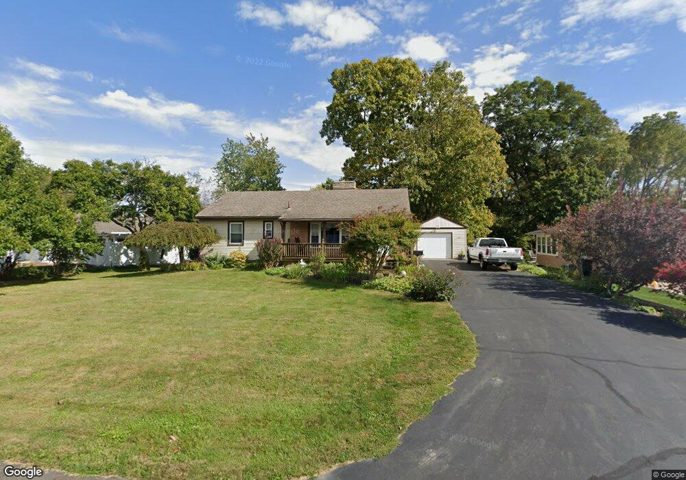
121 Michaels St Plain City, OH 43064
Estimated Value: $307,568 - $372,000
3
Beds
1
Bath
1,092
Sq Ft
$310/Sq Ft
Est. Value
About This Home
This home is located at 121 Michaels St, Plain City, OH 43064 and is currently estimated at $338,892, approximately $310 per square foot. 121 Michaels St is a home located in Union County with nearby schools including Plain City Elementary School, Jonathan Alder Junior High School, and Canaan Middle School.
Ownership History
Date
Name
Owned For
Owner Type
Purchase Details
Closed on
Sep 25, 1997
Sold by
Est Betty B Hughes
Bought by
Pinney Gregory L and Pinney Pamela S
Current Estimated Value
Home Financials for this Owner
Home Financials are based on the most recent Mortgage that was taken out on this home.
Original Mortgage
$75,000
Outstanding Balance
$12,240
Interest Rate
7.63%
Mortgage Type
New Conventional
Estimated Equity
$326,652
Create a Home Valuation Report for This Property
The Home Valuation Report is an in-depth analysis detailing your home's value as well as a comparison with similar homes in the area
Home Values in the Area
Average Home Value in this Area
Purchase History
| Date | Buyer | Sale Price | Title Company |
|---|---|---|---|
| Pinney Gregory L | $114,000 | -- |
Source: Public Records
Mortgage History
| Date | Status | Borrower | Loan Amount |
|---|---|---|---|
| Open | Pinney Gregory L | $75,000 |
Source: Public Records
Tax History Compared to Growth
Tax History
| Year | Tax Paid | Tax Assessment Tax Assessment Total Assessment is a certain percentage of the fair market value that is determined by local assessors to be the total taxable value of land and additions on the property. | Land | Improvement |
|---|---|---|---|---|
| 2024 | $3,111 | $68,940 | $18,460 | $50,480 |
| 2023 | $3,111 | $68,940 | $18,460 | $50,480 |
| 2022 | $3,251 | $68,940 | $18,460 | $50,480 |
| 2021 | $2,591 | $52,730 | $14,190 | $38,540 |
| 2020 | $2,611 | $52,730 | $14,190 | $38,540 |
| 2019 | $2,521 | $52,730 | $14,190 | $38,540 |
| 2018 | $1,710 | $34,830 | $11,360 | $23,470 |
| 2017 | $1,706 | $34,830 | $11,360 | $23,470 |
| 2016 | $1,766 | $34,830 | $11,360 | $23,470 |
| 2015 | $1,690 | $32,290 | $11,360 | $20,930 |
| 2014 | $1,596 | $32,290 | $11,360 | $20,930 |
| 2013 | $1,639 | $32,290 | $11,360 | $20,930 |
Source: Public Records
Map
Nearby Homes
- 2022 Ashby Way
- Bradford Plan at The Run at Hofbauer Preserve
- Charleston Plan at The Run at Hofbauer Preserve
- Wellington Plan at The Run at Hofbauer Preserve
- Hartly Plan at The Run at Hofbauer Preserve
- Richmond Plan at The Run at Hofbauer Preserve
- Barclay Plan at The Run at Hofbauer Preserve
- Brentwood Plan at The Run at Hofbauer Preserve
- Claymont Plan at The Run at Hofbauer Preserve
- Manchester Plan at The Run at Hofbauer Preserve
- Palmer Plan at The Run at Hofbauer Preserve
- 2270 Hofbauer Rd
- 146 E Main St Unit 160
- 180 Jackson St
- 11738 Verbena Place
- 9015 Fox Field Path
- 2 Surrey Ct
- 11901 Converse Rd
- 710 Village Blvd Unit B
- 5148 Country Place Ln
- 159 Anderson Ave
- 135 Michaels St
- 135 Michael St
- 143 Anderson Ave
- 145 Michaels St
- 118 Michaels St
- 160 Anderson Ave
- 146 Anderson Ave
- 140 Michaels St
- 155 Michaels St
- 176 Anderson Ave
- 342 N Chillicothe St
- 348 N Chillicothe St
- 185 Michaels St
- 142 W 2nd Ave
- 324 N Chillicothe St
- 132 W 2nd Ave
- 150 W 2nd Ave
- 164 W 2nd Ave
- 354 N Chillicothe St