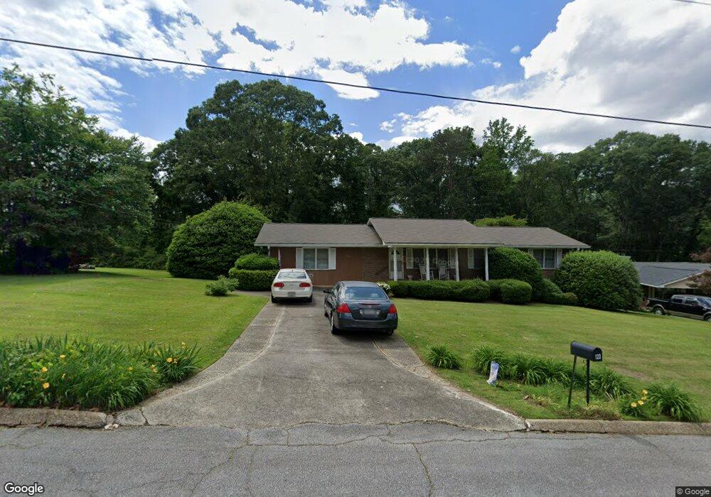
121 Morningside Dr Unit 10 Carrollton, GA 30117
Estimated Value: $297,000 - $335,000
3
Beds
2
Baths
1,972
Sq Ft
$159/Sq Ft
Est. Value
About This Home
This home is located at 121 Morningside Dr Unit 10, Carrollton, GA 30117 and is currently estimated at $313,628, approximately $159 per square foot. 121 Morningside Dr Unit 10 is a home located in Carroll County with nearby schools including Carrollton Elementary School, Carrollton Upper Elementary School, and Carrollton Middle School.
Ownership History
Date
Name
Owned For
Owner Type
Purchase Details
Closed on
Aug 21, 2015
Sold by
Dixon Richard A
Bought by
Dolivo Christopher T and Dolivo Paula F
Current Estimated Value
Purchase Details
Closed on
Jun 16, 2003
Sold by
Dixon Richard A and Dixon Joseph S
Bought by
Dixon Joseph S and Dixon Juanita M
Purchase Details
Closed on
Jun 13, 2003
Sold by
Dixon Joseph S and Dixon Juanita M
Bought by
Dixon Richard A and Dixon Joseph S
Purchase Details
Closed on
May 23, 2003
Sold by
Dixon Joseph S
Bought by
Dixon Richard A and Dixon Joseph S
Purchase Details
Closed on
Jun 8, 1968
Bought by
Dixon Joseph S
Create a Home Valuation Report for This Property
The Home Valuation Report is an in-depth analysis detailing your home's value as well as a comparison with similar homes in the area
Home Values in the Area
Average Home Value in this Area
Purchase History
| Date | Buyer | Sale Price | Title Company |
|---|---|---|---|
| Dolivo Christopher T | $112,000 | -- | |
| Dixon Joseph S | -- | -- | |
| Dixon Richard A | -- | -- | |
| Dixon Richard A | -- | -- | |
| Dixon Joseph S | -- | -- |
Source: Public Records
Tax History Compared to Growth
Tax History
| Year | Tax Paid | Tax Assessment Tax Assessment Total Assessment is a certain percentage of the fair market value that is determined by local assessors to be the total taxable value of land and additions on the property. | Land | Improvement |
|---|---|---|---|---|
| 2024 | $2,659 | $112,597 | $12,099 | $100,498 |
| 2023 | $2,659 | $103,620 | $12,099 | $91,521 |
| 2022 | $2,101 | $81,532 | $8,066 | $73,466 |
| 2021 | $1,816 | $69,149 | $5,975 | $63,174 |
| 2020 | $1,668 | $62,658 | $5,975 | $56,683 |
| 2019 | $1,583 | $58,331 | $5,975 | $52,356 |
| 2018 | $1,454 | $52,593 | $5,975 | $46,618 |
| 2017 | $1,278 | $47,348 | $5,975 | $41,373 |
| 2016 | $1,208 | $47,348 | $5,975 | $41,373 |
| 2015 | $1,105 | $35,778 | $10,000 | $25,778 |
| 2014 | $1,110 | $35,778 | $10,000 | $25,778 |
Source: Public Records
Map
Nearby Homes
- 114 Bennett Cir
- 119 Oxford Square
- 0 Burns Rd Unit LOT 2 10571612
- 0 Burns Rd Unit LOT 3 10571635
- 0 Burns Rd Unit LOT 1 10571595
- 0 Burns Rd Unit 148013
- 208 Lane Dr
- 208 Lane Dr Unit LOT 62
- Plan 2121 at Canterbury Villas
- Plan 2307 at Canterbury Villas
- 204 Chaucer Ln
- Plan 1522 at Canterbury Villas
- Plan 1634 at Canterbury Villas
- Plan 2628 at Canterbury Villas
- 120 Stewart St
- 201 Stewart St
- 317 Bledsoe St
- 112 Lane Dr
- 112 Lane Dr Unit LOT 68
- 8 Horsley Mill Rd
- 121 Morningside Dr
- 123 Morningside Dr
- 119 Morningside Dr
- 311 Belva St
- 225 Belva St
- 127 Morningside Dr
- 115 Morningside Dr
- 305 Belva St
- 112 Morningside Dr
- 221 Belva St
- 116 Morningside Dr
- 165 Eastern Ave
- 165 Eastern Ave
- 315 Belva St
- 175 Eastern Ave
- 113 Morningside Dr
- 120 Jackson St
- 110 Morningside Dr
- 185 Eastern Ave
- 118 Morningside Dr