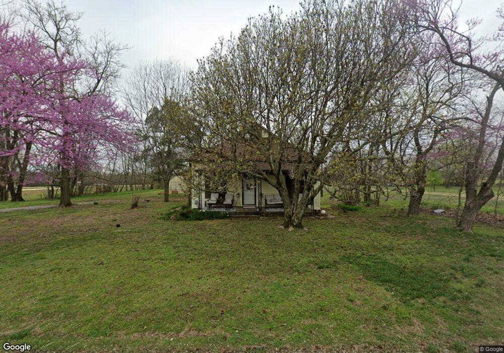
121 N Colt Ave Lincoln, AR 72744
Estimated Value: $107,000 - $141,000
--
Bed
1
Bath
840
Sq Ft
$150/Sq Ft
Est. Value
About This Home
This home is located at 121 N Colt Ave, Lincoln, AR 72744 and is currently estimated at $126,349, approximately $150 per square foot. 121 N Colt Ave is a home located in Washington County with nearby schools including Lincoln Elementary School and Lincoln High School.
Ownership History
Date
Name
Owned For
Owner Type
Purchase Details
Closed on
Oct 23, 2003
Sold by
Sievert Jan and Sievert Robert
Bought by
Whaley Jason W
Current Estimated Value
Home Financials for this Owner
Home Financials are based on the most recent Mortgage that was taken out on this home.
Original Mortgage
$44,300
Outstanding Balance
$20,353
Interest Rate
6.1%
Mortgage Type
FHA
Estimated Equity
$105,996
Purchase Details
Closed on
Jul 26, 1994
Bought by
Guess Cindy Lou
Purchase Details
Closed on
Jul 20, 1987
Bought by
Guess Louie
Purchase Details
Closed on
Feb 20, 1987
Bought by
Guess Louie and Guess Cynthia
Purchase Details
Closed on
Jan 1, 1985
Bought by
Maloney David and Maloney Barbara
Create a Home Valuation Report for This Property
The Home Valuation Report is an in-depth analysis detailing your home's value as well as a comparison with similar homes in the area
Home Values in the Area
Average Home Value in this Area
Purchase History
| Date | Buyer | Sale Price | Title Company |
|---|---|---|---|
| Whaley Jason W | -- | Waco Title Company | |
| Guess Cindy Lou | -- | -- | |
| Guess Louie | -- | -- | |
| Guess Louie | $16,000 | -- | |
| Maloney David | -- | -- |
Source: Public Records
Mortgage History
| Date | Status | Borrower | Loan Amount |
|---|---|---|---|
| Open | Whaley Jason W | $44,300 |
Source: Public Records
Tax History Compared to Growth
Tax History
| Year | Tax Paid | Tax Assessment Tax Assessment Total Assessment is a certain percentage of the fair market value that is determined by local assessors to be the total taxable value of land and additions on the property. | Land | Improvement |
|---|---|---|---|---|
| 2025 | $134 | $21,880 | $8,000 | $13,880 |
| 2024 | $203 | $21,880 | $8,000 | $13,880 |
| 2023 | $256 | $21,880 | $8,000 | $13,880 |
| 2022 | $273 | $12,690 | $3,240 | $9,450 |
| 2021 | $245 | $12,690 | $3,240 | $9,450 |
| 2020 | $217 | $12,690 | $3,240 | $9,450 |
| 2019 | $189 | $10,400 | $3,000 | $7,400 |
| 2018 | $214 | $10,400 | $3,000 | $7,400 |
| 2017 | $208 | $10,400 | $3,000 | $7,400 |
| 2016 | $208 | $10,400 | $3,000 | $7,400 |
| 2015 | $208 | $10,400 | $3,000 | $7,400 |
| 2014 | $196 | $10,160 | $3,150 | $7,010 |
Source: Public Records
Map
Nearby Homes
- 17948 W Highway 62
- 523 & 525 W North St
- 603 Sugar Hill Rd
- 304 Shady St
- 511 W North St
- 0 Shady St
- 0 W Bean St
- 108 Short Ave
- 301 W Bean St
- 116 N West Ave
- 204 N Starr Ave
- 108 N Main Ave
- 711 Applegate Ln
- 210 N Main Ave
- 506 S West Ave
- 733 Applegate Ln
- 724 Applegate Ln
- 924 West Ave
- 608 W Holt Rd
- 504 W South St
- 127 N Colt Ave
- 115 N Colt Ave
- 120 N Colt Ave
- 111 N Colt Ave
- 810 W Pridemore Dr
- 207 N Colt Ave
- 806 W Pridemore Dr
- 800 W Pridemore Dr
- 734 W Pridemore Dr
- 0 Colt Ave Unit 1051965
- 903 Sunnyvale Place
- 811 Sunnyvale Place
- 0 W Highway 62
- 6 AC Highway 62
- 111 S Colt Ave
- 0 S Colt Ave Ave
- 904 W Pridemore Dr
- 807 Sunnyvale Place
- 718 W Pridemore Dr
- 904 Sunnyvale Place