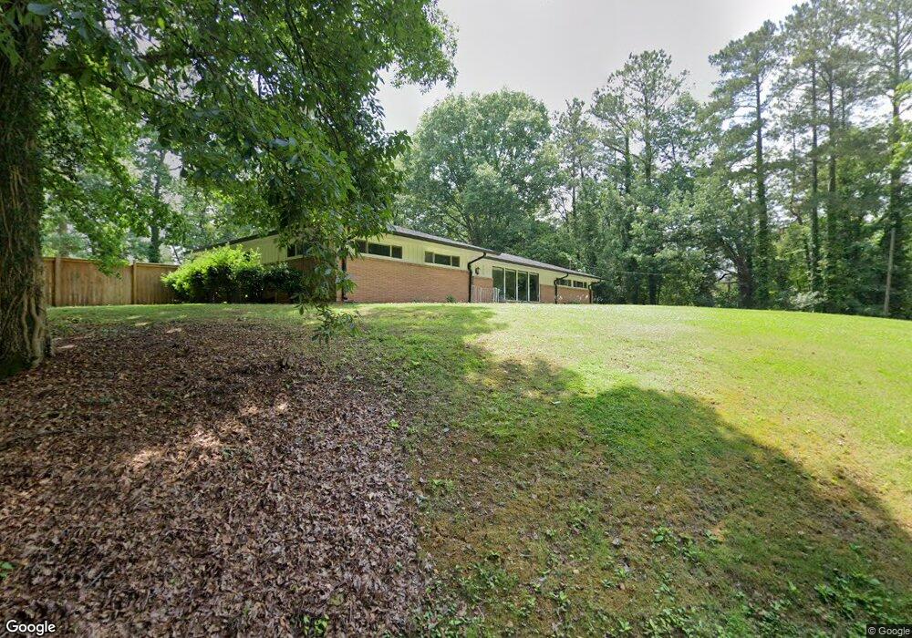
121 Ridge Crest Dr Dalton, GA 30721
Estimated Value: $234,000 - $316,000
3
Beds
3
Baths
1,820
Sq Ft
$145/Sq Ft
Est. Value
About This Home
This home is located at 121 Ridge Crest Dr, Dalton, GA 30721 and is currently estimated at $264,249, approximately $145 per square foot. 121 Ridge Crest Dr is a home located in Whitfield County with nearby schools including Eastside Elementary School, Eastbrook Middle School, and Southeast Whitfield County High School.
Ownership History
Date
Name
Owned For
Owner Type
Purchase Details
Closed on
Dec 13, 2019
Sold by
Craig Ruth Cate
Bought by
Womack Stephanie Jean and Womack William Cade
Current Estimated Value
Home Financials for this Owner
Home Financials are based on the most recent Mortgage that was taken out on this home.
Original Mortgage
$169,575
Outstanding Balance
$148,516
Interest Rate
3.7%
Mortgage Type
New Conventional
Estimated Equity
$115,733
Purchase Details
Closed on
Feb 15, 2005
Sold by
Not Provided
Bought by
Craig Ruth Cate
Create a Home Valuation Report for This Property
The Home Valuation Report is an in-depth analysis detailing your home's value as well as a comparison with similar homes in the area
Purchase History
| Date | Buyer | Sale Price | Title Company |
|---|---|---|---|
| Womack Stephanie Jean | $178,500 | -- | |
| Craig Ruth Cate | -- | -- |
Source: Public Records
Mortgage History
| Date | Status | Borrower | Loan Amount |
|---|---|---|---|
| Open | Womack Stephanie Jean | $169,575 |
Source: Public Records
Tax History
| Year | Tax Paid | Tax Assessment Tax Assessment Total Assessment is a certain percentage of the fair market value that is determined by local assessors to be the total taxable value of land and additions on the property. | Land | Improvement |
|---|---|---|---|---|
| 2025 | $2,021 | $99,489 | $11,200 | $88,289 |
| 2024 | $2,021 | $99,489 | $11,200 | $88,289 |
| 2023 | $1,720 | $63,678 | $7,000 | $56,678 |
| 2022 | $1,485 | $58,893 | $7,350 | $51,543 |
| 2021 | $1,485 | $58,893 | $7,350 | $51,543 |
| 2020 | $1,524 | $58,893 | $7,350 | $51,543 |
| 2019 | $122 | $29,986 | $7,350 | $22,636 |
| 2018 | $114 | $28,957 | $7,350 | $21,607 |
| 2017 | $413 | $52,364 | $7,350 | $45,014 |
| 2016 | $321 | $47,777 | $6,836 | $40,941 |
| 2014 | $1,026 | $45,502 | $6,510 | $38,992 |
| 2013 | -- | $45,501 | $6,510 | $38,991 |
Source: Public Records
Map
Nearby Homes
- 108 Van Buren Dr
- 171 Keith St
- 359 Pacer Ln Unit 4
- 213 Nashville St
- 258 Richardson Dr
- 264 Richardson Dr
- 143 Staten St
- 1902 Bartenfield Dr
- 406 Lester Ave
- 2905 E Walnut Ave
- 119 Wooten Dr
- 117 Wooten Dr
- 216 Scobie Ave
- 306 Robinwood Dr
- 2410 Martin Luther King Junior Blvd
- 1217 Hair St Unit 1
- 165 Stanley St Unit 560-561
- 514 Sheridan Ave
- 1118 Dozier St
- 311 Shady Ln
- 112 Moonlight Dr
- 113 Moonlight Dr
- 106 Moonlight Dr
- 115 Ridge Crest Dr
- 305 Van Buren Dr
- 105 Moonlight Dr
- 215 Van Buren Dr
- 307 Van Buren Dr
- LOT 19 Ridgecrest Dr
- 0 Ridgecrest Dr
- 120 Moonlight Dr
- 111 Ridge Crest Dr
- 205 Ridge Crest Dr
- 309 Van Buren Dr
- 210 Ridge Crest Dr
- 210 Ridgecrest Dr
- 300 Van Buren Dr
- 211 Van Buren Dr
- 212 Van Buren Dr
- 209 Ridge Crest Dr
Your Personal Tour Guide
Ask me questions while you tour the home.