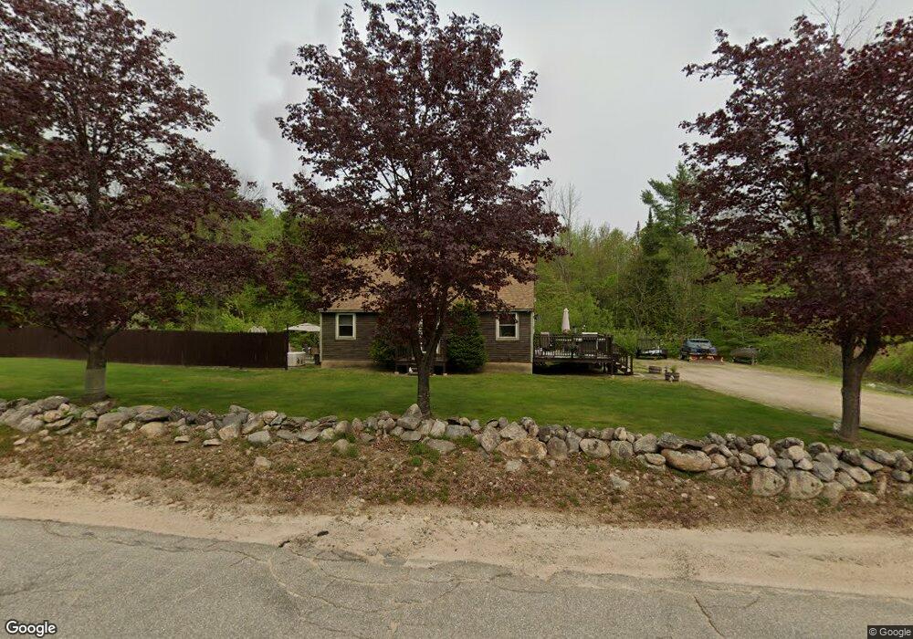
121 Ridge Rd Middleton, NH 03887
Estimated Value: $424,380 - $468,000
4
Beds
2
Baths
2,077
Sq Ft
$215/Sq Ft
Est. Value
About This Home
This home is located at 121 Ridge Rd, Middleton, NH 03887 and is currently estimated at $445,595, approximately $214 per square foot. 121 Ridge Rd is a home located in Strafford County with nearby schools including Valley View Community School, Henry Wilson Memorial School, and Farmington Senior High School.
Ownership History
Date
Name
Owned For
Owner Type
Purchase Details
Closed on
Jun 7, 2024
Sold by
Green Debra L and Green Steven B
Bought by
Green Ft and Green
Current Estimated Value
Purchase Details
Closed on
Sep 5, 2017
Sold by
Green Debra L
Bought by
Green Debra L and Green Steven B
Create a Home Valuation Report for This Property
The Home Valuation Report is an in-depth analysis detailing your home's value as well as a comparison with similar homes in the area
Home Values in the Area
Average Home Value in this Area
Purchase History
| Date | Buyer | Sale Price | Title Company |
|---|---|---|---|
| Green Ft | -- | None Available | |
| Green Ft | -- | None Available | |
| Green Debra L | -- | -- | |
| Green Debra L | -- | -- |
Source: Public Records
Mortgage History
| Date | Status | Borrower | Loan Amount |
|---|---|---|---|
| Previous Owner | Green Debra L | $22,000 | |
| Previous Owner | Green Debra L | $152,000 | |
| Previous Owner | Green Debra L | $150,000 |
Source: Public Records
Tax History
| Year | Tax Paid | Tax Assessment Tax Assessment Total Assessment is a certain percentage of the fair market value that is determined by local assessors to be the total taxable value of land and additions on the property. | Land | Improvement |
|---|---|---|---|---|
| 2025 | $5,170 | $327,419 | $119,119 | $208,300 |
| 2024 | $5,088 | $327,431 | $119,131 | $208,300 |
| 2023 | $4,955 | $329,434 | $119,134 | $210,300 |
| 2022 | $4,704 | $180,309 | $50,409 | $129,900 |
| 2021 | $4,953 | $180,365 | $50,465 | $129,900 |
| 2020 | $5,100 | $180,397 | $50,497 | $129,900 |
| 2019 | $4,741 | $180,416 | $50,516 | $129,900 |
| 2018 | $5,050 | $180,406 | $50,506 | $129,900 |
| 2017 | $4,557 | $169,092 | $47,292 | $121,800 |
| 2016 | $6,114 | $169,087 | $47,287 | $121,800 |
| 2015 | $4,843 | $169,023 | $47,223 | $121,800 |
| 2014 | $4,256 | $169,023 | $47,223 | $121,800 |
| 2013 | $3,989 | $169,023 | $51,523 | $117,500 |
Source: Public Records
Map
Nearby Homes
- 10 New Durham Rd
- 57 Pinkham Rd
- 0 Pine Ridge Rd Unit 51
- 15 Adams Way
- 46-2 & 47 New Hampshire 153
- 0 Pinkham Rd Unit Map 8 Lot 6-4
- 123 Pinkham Rd
- 44 Shore Dr Unit 100
- 66 Chapel St
- 288 Pinkham Rd
- 271 Main St
- 336 Main St
- 372 Wakefield Rd
- 0 Fox Rd Unit 5010590
- 715 Kings Hwy
- Lot 330 Nicola Rd
- 130 Nicola Rd
- lot 20 Access Rd
- Lot 19 Access Rd
- lot 15 Access Rd
- 113 Ridge Rd
- 76 Ridge Rd
- 118 Ridge Rd
- 176 Ridge Rd
- 177 Ridge Rd
- 61 Ridge Rd
- Pinkham Rd None Rd Unit map 8 lot 6-9
- 196 Ridge Rd
- 211 Ridge Rd
- 24 Ridge Rd
- 21 Lot Number
- 476 Route Lot #16 Unit 16
- 17 Ridge Rd
- 0 Ridge Rd
- Lot# 24 Ridge Rd
- 237 Ridge Rd
- 7 Ridge Rd
- 151 Kings Hwy
- 157 Kings Hwy
- 358 Route 153 (Aka Tag Hollow Road)
Your Personal Tour Guide
Ask me questions while you tour the home.