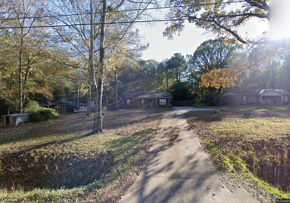
121 Robert Taylor Rd Lagrange, GA 30240
Estimated Value: $144,000 - $196,000
3
Beds
1
Bath
1,125
Sq Ft
$147/Sq Ft
Est. Value
About This Home
This home is located at 121 Robert Taylor Rd, Lagrange, GA 30240 and is currently estimated at $165,605, approximately $147 per square foot. 121 Robert Taylor Rd is a home located in Troup County with nearby schools including Long Cane Elementary School, Whitesville Road Elementary School, and Berta Weathersbee Elementary School.
Ownership History
Date
Name
Owned For
Owner Type
Purchase Details
Closed on
Oct 6, 2017
Bought by
Camp Kasie S
Current Estimated Value
Home Financials for this Owner
Home Financials are based on the most recent Mortgage that was taken out on this home.
Original Mortgage
$90,808
Outstanding Balance
$75,032
Interest Rate
3.78%
Mortgage Type
New Conventional
Estimated Equity
$90,573
Purchase Details
Closed on
May 1, 2015
Sold by
Latulippe Anna M
Bought by
Latulippe Properties Llc
Purchase Details
Closed on
Jun 2, 2012
Sold by
Latulippe Anna M
Bought by
Latulippe Anna M and Latulippe Raymond J
Purchase Details
Closed on
Jan 28, 2000
Sold by
Raymond J Latulippe
Bought by
Latulippe Anna M
Purchase Details
Closed on
Dec 19, 1989
Bought by
Raymond J Latulippe
Purchase Details
Closed on
Dec 1, 1989
Purchase Details
Closed on
Apr 30, 1983
Purchase Details
Closed on
Nov 1, 1982
Create a Home Valuation Report for This Property
The Home Valuation Report is an in-depth analysis detailing your home's value as well as a comparison with similar homes in the area
Purchase History
| Date | Buyer | Sale Price | Title Company |
|---|---|---|---|
| Camp Kasie S | $89,900 | -- | |
| Latulippe Properties Llc | -- | -- | |
| Latulippe Anna M | -- | -- | |
| Latulippe Anna M | -- | -- | |
| Raymond J Latulippe | $45,400 | -- | |
| Raymond J Latulippe | $45,400 | -- | |
| -- | -- | -- | |
| -- | -- | -- | |
| -- | -- | -- |
Source: Public Records
Mortgage History
| Date | Status | Borrower | Loan Amount |
|---|---|---|---|
| Open | Camp Kasie S | $90,808 |
Source: Public Records
Tax History
| Year | Tax Paid | Tax Assessment Tax Assessment Total Assessment is a certain percentage of the fair market value that is determined by local assessors to be the total taxable value of land and additions on the property. | Land | Improvement |
|---|---|---|---|---|
| 2025 | $1,330 | $53,880 | $5,000 | $48,880 |
| 2024 | $1,175 | $45,080 | $5,000 | $40,080 |
| 2023 | $1,139 | $43,760 | $5,000 | $38,760 |
| 2022 | $1,096 | $41,240 | $5,000 | $36,240 |
| 2021 | $1,051 | $36,840 | $4,240 | $32,600 |
| 2020 | $1,051 | $36,840 | $4,240 | $32,600 |
| 2019 | $1,077 | $35,720 | $3,600 | $32,120 |
| 2018 | $989 | $32,800 | $3,600 | $29,200 |
| 2017 | $683 | $22,640 | $3,600 | $19,040 |
| 2016 | $687 | $22,781 | $3,600 | $19,181 |
| 2015 | $629 | $22,781 | $3,600 | $19,181 |
| 2014 | $599 | $21,772 | $3,600 | $18,172 |
| 2013 | -- | $23,203 | $3,600 | $19,603 |
Source: Public Records
Map
Nearby Homes
- 102 Bridgewater Dr
- 5714 W Point Rd
- Sandtown Road Unit: 1 2+ - Acre
- 0 Sandtown Rd Unit 10255987
- 105 Redwood Dr
- 107 Waters Edge Dr
- 3009 Old West Point Rd
- 0 Warner Rd Unit 10686116
- 648 Warner Rd
- 22 Freeman Rd
- 640 Hudson Rd
- 101 Garden Walk
- 101 Garden Walk Unit 85
- 0 Glass Bridge Rd Unit 10679358
- 90 Hickory Ln
- 288 Bradfield Dr
- 104 Independence Ct
- 107 Amhurst Dr
- 808 S Fling Rd
- 2239 Pegasus Pkwy
- 115 Robert Taylor Rd
- 141 Robert Taylor Rd
- 83 Robert Taylor Rd
- 96 Robert Taylor Rd
- 116 Robert Taylor Rd
- 88 Robert Taylor Rd
- 79 Robert Taylor Rd
- 221 Robert Taylor Rd
- 164 Robert Taylor Rd
- 0 Robert Hayes Rd Unit 8309783
- 0 Robert Hayes Rd Unit 8218274
- 0 Robert Hayes Rd Unit 3243345
- 0 Robert Hayes Rd Unit 7311374
- 0 Robert Hayes Rd Unit 2.2AC 7418214
- 0 Robert Hayes Rd Unit 10611067
- 0 Robert Hayes Rd Unit 10386440
- 0 Robert Hayes Rd Unit 7458076
- 0 Robert Hayes Rd Unit 10126234
- 0 Robert Hayes Rd Unit 7168882
- 0 Robert Hayes Rd Unit 7514457
Your Personal Tour Guide
Ask me questions while you tour the home.