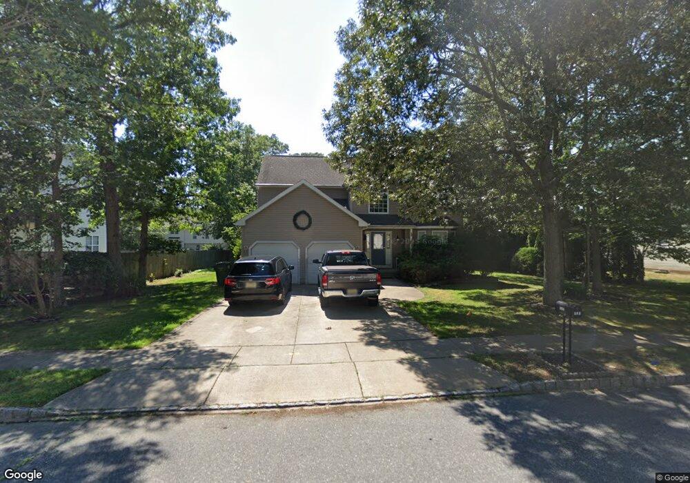
121 Ruby Dr Egg Harbor Township, NJ 08234
Estimated Value: $431,000 - $575,000
Studio
--
Bath
2,668
Sq Ft
$192/Sq Ft
Est. Value
About This Home
This home is located at 121 Ruby Dr, Egg Harbor Township, NJ 08234 and is currently estimated at $511,109, approximately $191 per square foot. 121 Ruby Dr is a home located in Atlantic County with nearby schools including Egg Harbor Township High School, ChARTer TECH High School for the Performing Arts, and Trinity Learning Center-Holy.
Ownership History
Date
Name
Owned For
Owner Type
Purchase Details
Closed on
Apr 18, 2014
Sold by
Wright Jill A
Bought by
Wright Robert J
Current Estimated Value
Purchase Details
Closed on
Feb 26, 2004
Sold by
Group Ten Builders Inc
Bought by
Wright Robert J and Wright Jill A
Home Financials for this Owner
Home Financials are based on the most recent Mortgage that was taken out on this home.
Original Mortgage
$194,000
Outstanding Balance
$87,558
Interest Rate
5.62%
Mortgage Type
Purchase Money Mortgage
Estimated Equity
$423,551
Purchase Details
Closed on
Aug 27, 2003
Sold by
Hidden Forest Development Llc
Bought by
Group Ten Builders Inc
Purchase Details
Closed on
Apr 30, 2003
Sold by
Gelif Realty Llc
Bought by
Hidden Forest Development Llc
Create a Home Valuation Report for This Property
The Home Valuation Report is an in-depth analysis detailing your home's value as well as a comparison with similar homes in the area
Home Values in the Area
Average Home Value in this Area
Purchase History
| Date | Buyer | Sale Price | Title Company |
|---|---|---|---|
| Wright Robert J | -- | None Available | |
| Wright Robert J | $242,900 | Commonwealth Title | |
| Group Ten Builders Inc | $270,000 | Congress Title Corp | |
| Hidden Forest Development Llc | $480,000 | Congress Title Corp |
Source: Public Records
Mortgage History
| Date | Status | Borrower | Loan Amount |
|---|---|---|---|
| Open | Wright Robert J | $194,000 |
Source: Public Records
Tax History
| Year | Tax Paid | Tax Assessment Tax Assessment Total Assessment is a certain percentage of the fair market value that is determined by local assessors to be the total taxable value of land and additions on the property. | Land | Improvement |
|---|---|---|---|---|
| 2025 | $8,868 | $264,400 | $64,000 | $200,400 |
| 2024 | $8,868 | $264,400 | $64,000 | $200,400 |
| 2023 | $8,818 | $264,400 | $64,000 | $200,400 |
| 2022 | $8,818 | $264,400 | $64,000 | $200,400 |
| 2021 | $8,889 | $264,400 | $64,000 | $200,400 |
| 2020 | $8,728 | $264,400 | $64,000 | $200,400 |
| 2019 | $8,490 | $264,400 | $64,000 | $200,400 |
| 2018 | $8,307 | $264,400 | $64,000 | $200,400 |
| 2017 | $8,278 | $264,400 | $64,000 | $200,400 |
| 2016 | $8,459 | $281,300 | $64,000 | $217,300 |
| 2015 | $8,335 | $281,300 | $64,000 | $217,300 |
| 2014 | $8,169 | $281,300 | $64,000 | $217,300 |
Source: Public Records
Map
Nearby Homes
- 416 Delaware Ave
- 522 Zion Rd
- 7106 Ridge Ave
- 34 N Mount Airy Ave
- 422 Delaware Ave
- 117 Offshore Rd
- 225 Daytona Rd
- 506 Zion Rd
- 207 Waterford Rd
- 223 Daytona Rd
- 2163 Ocean Heights Ave
- 617 Zion Rd
- 218 Surf Rd
- 106 Rochelle Ln
- 7013 Ridge Ave
- 7212 Tremont Ave
- 317 Discovery Ln
- 1249 Old Zion Rd
- 103 Anchorage Dr Unit 103A, 103B, 105B
- 7 Olivia Dr
Your Personal Tour Guide
Ask me questions while you tour the home.