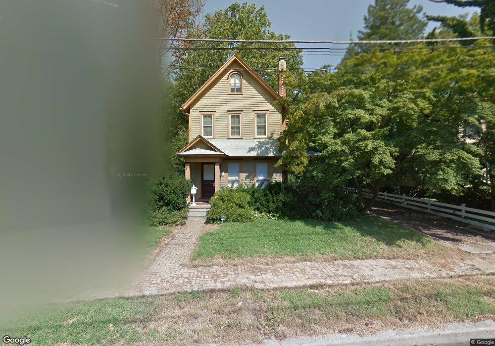
121 S Atlantic Ave Haddonfield, NJ 08033
Estimated Value: $674,071 - $910,000
--
Bed
--
Bath
1,910
Sq Ft
$419/Sq Ft
Est. Value
About This Home
This home is located at 121 S Atlantic Ave, Haddonfield, NJ 08033 and is currently estimated at $799,518, approximately $418 per square foot. 121 S Atlantic Ave is a home located in Camden County with nearby schools including Haddonfield Memorial High School and Christ the King Regional School.
Ownership History
Date
Name
Owned For
Owner Type
Purchase Details
Closed on
Jun 1, 2007
Sold by
Gibbons Joseph G and Davies Dana R
Bought by
Duncan Catherine
Current Estimated Value
Home Financials for this Owner
Home Financials are based on the most recent Mortgage that was taken out on this home.
Original Mortgage
$313,500
Interest Rate
6.72%
Mortgage Type
New Conventional
Purchase Details
Closed on
Feb 28, 1995
Sold by
Fiorillo John K
Bought by
Gibbons Joseph and Davies Dana
Home Financials for this Owner
Home Financials are based on the most recent Mortgage that was taken out on this home.
Original Mortgage
$128,000
Interest Rate
8.89%
Create a Home Valuation Report for This Property
The Home Valuation Report is an in-depth analysis detailing your home's value as well as a comparison with similar homes in the area
Home Values in the Area
Average Home Value in this Area
Purchase History
| Date | Buyer | Sale Price | Title Company |
|---|---|---|---|
| Duncan Catherine | $330,000 | -- | |
| Gibbons Joseph | $160,000 | -- |
Source: Public Records
Mortgage History
| Date | Status | Borrower | Loan Amount |
|---|---|---|---|
| Previous Owner | Duncan Catherine | $313,500 | |
| Previous Owner | Gibbons Joseph | $128,000 |
Source: Public Records
Tax History Compared to Growth
Tax History
| Year | Tax Paid | Tax Assessment Tax Assessment Total Assessment is a certain percentage of the fair market value that is determined by local assessors to be the total taxable value of land and additions on the property. | Land | Improvement |
|---|---|---|---|---|
| 2025 | $10,724 | $331,900 | $201,500 | $130,400 |
| 2024 | $10,581 | $331,900 | $201,500 | $130,400 |
| 2023 | $10,581 | $331,900 | $201,500 | $130,400 |
| 2022 | $10,498 | $331,900 | $201,500 | $130,400 |
| 2021 | $10,445 | $331,900 | $201,500 | $130,400 |
| 2020 | $10,372 | $331,900 | $201,500 | $130,400 |
| 2019 | $103 | $331,900 | $201,500 | $130,400 |
| 2018 | $10,166 | $331,900 | $201,500 | $130,400 |
| 2017 | $9,924 | $331,900 | $201,500 | $130,400 |
| 2016 | $9,701 | $331,900 | $201,500 | $130,400 |
| 2015 | $9,433 | $331,900 | $201,500 | $130,400 |
| 2014 | $9,224 | $331,900 | $201,500 | $130,400 |
Source: Public Records
Map
Nearby Homes
- 127 S Atlantic Ave
- 133 S Atlantic Ave
- 1 E Park Ave
- 109 S Atlantic Ave Unit 3
- 109 S Atlantic Ave Unit 1
- 109 S Atlantic Ave
- 109 S Atlantic Ave Unit 2
- 120 Chestnut St
- 116 Chestnut St
- 112 Chestnut St
- 12 Lincoln Ave
- 16 Lincoln Ave Unit 3
- 16 Lincoln Ave Unit 4
- 16 Lincoln Ave Unit 5
- 16 Lincoln Ave
- 130 Chestnut St
- 4 Lincoln Ave
- 2 E Park Ave
- 2 E Park Ave Unit 1
- 3 W Park Ave