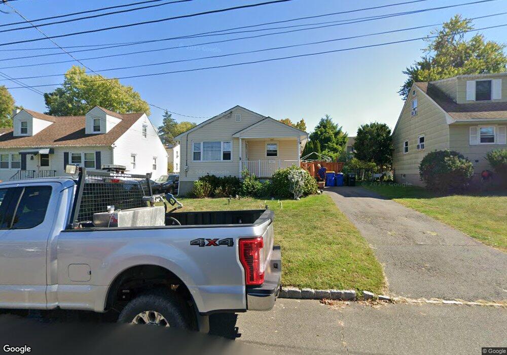
121 Sanders Ave South Bound Brook, NJ 08880
Estimated Value: $396,000 - $480,000
2
Beds
1
Bath
1,036
Sq Ft
$431/Sq Ft
Est. Value
About This Home
This home is located at 121 Sanders Ave, South Bound Brook, NJ 08880 and is currently estimated at $446,436, approximately $430 per square foot. 121 Sanders Ave is a home located in Somerset County with nearby schools including Robert Morris School and Green Brook Academy.
Ownership History
Date
Name
Owned For
Owner Type
Purchase Details
Closed on
Sep 28, 2006
Sold by
Rodenberg Katherine L
Bought by
Rodriguez Jackson and Rodriguez Leslie C
Current Estimated Value
Home Financials for this Owner
Home Financials are based on the most recent Mortgage that was taken out on this home.
Original Mortgage
$278,000
Outstanding Balance
$166,620
Interest Rate
6.54%
Mortgage Type
New Conventional
Estimated Equity
$279,816
Purchase Details
Closed on
Feb 11, 2005
Sold by
Yannetta Anthony L
Bought by
Rodenberg Katherine L
Create a Home Valuation Report for This Property
The Home Valuation Report is an in-depth analysis detailing your home's value as well as a comparison with similar homes in the area
Home Values in the Area
Average Home Value in this Area
Purchase History
| Date | Buyer | Sale Price | Title Company |
|---|---|---|---|
| Rodriguez Jackson | $278,000 | -- | |
| Rodriguez Jackson | $278,000 | Lawyers Title Insurance Corp | |
| Rodenberg Katherine L | $200,000 | -- |
Source: Public Records
Mortgage History
| Date | Status | Borrower | Loan Amount |
|---|---|---|---|
| Open | Rodriguez Jackson | $278,000 | |
| Closed | Rodriguez Jackson | $278,000 |
Source: Public Records
Tax History Compared to Growth
Tax History
| Year | Tax Paid | Tax Assessment Tax Assessment Total Assessment is a certain percentage of the fair market value that is determined by local assessors to be the total taxable value of land and additions on the property. | Land | Improvement |
|---|---|---|---|---|
| 2025 | $8,351 | $218,500 | $91,000 | $127,500 |
| 2024 | $8,351 | $218,500 | $91,000 | $127,500 |
| 2023 | $8,272 | $218,500 | $91,000 | $127,500 |
| 2022 | $7,731 | $218,500 | $91,000 | $127,500 |
| 2021 | $7,619 | $218,500 | $91,000 | $127,500 |
| 2020 | $7,248 | $218,500 | $91,000 | $127,500 |
| 2019 | $7,436 | $218,500 | $91,000 | $127,500 |
| 2018 | $7,394 | $218,500 | $91,000 | $127,500 |
| 2017 | $7,368 | $218,500 | $91,000 | $127,500 |
| 2016 | $7,202 | $218,500 | $91,000 | $127,500 |
| 2015 | $7,012 | $218,500 | $91,000 | $127,500 |
| 2014 | $6,843 | $218,500 | $91,000 | $127,500 |
Source: Public Records
Map
Nearby Homes
- 208 Sanders Ave
- 206 Bathgate Ave
- 231 Beck Ave
- 105 La Monte Ave
- 432 Talmage Ave
- 165 Prospect St
- 535 Madison Ave
- 123 Elizabeth St
- 34 van Keuren Ave Unit 38
- 40 van Keuren Ave Unit 42
- 2 Drake St
- 542 Wheatland Ave
- 512 W 2nd St
- 130 W High St Unit 132
- 126 W High St
- 71 Remsen St
- 510 Dalay Place
- 102 W Franklin St
- 20 Patriots Path
- 320 Church St
- 119 Sanders Ave
- 127 Sanders Ave
- 134 Howard Ave
- 115 Sanders Ave
- 130 Howard Ave
- 131 Sanders Ave
- 136 Howard Ave Unit 138
- 126 Howard Ave
- 371 Canal Rd
- 111 Sanders Ave
- 122 Sanders Ave
- 140 Howard Ave Unit 144
- 126 Sanders Ave
- 124 Howard Ave
- 379 Canal Rd
- 132 Sanders Ave
- 120 Howard Ave
- 361 Canal Rd
- 381 Canal Rd Unit 383
- 141 Howard Ave