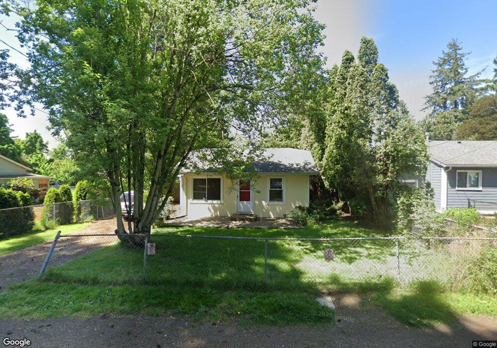
121 SE 126th Ave Portland, OR 97233
Hazelwood NeighborhoodEstimated Value: $290,000 - $326,111
2
Beds
1
Bath
720
Sq Ft
$433/Sq Ft
Est. Value
About This Home
This home is located at 121 SE 126th Ave, Portland, OR 97233 and is currently estimated at $311,528, approximately $432 per square foot. 121 SE 126th Ave is a home located in Multnomah County with nearby schools including Menlo Park Elementary School, Floyd Light Middle School, and David Douglas High School.
Ownership History
Date
Name
Owned For
Owner Type
Purchase Details
Closed on
Sep 9, 2013
Sold by
Burnett Gregory E
Bought by
Bristow Rebecca J
Current Estimated Value
Home Financials for this Owner
Home Financials are based on the most recent Mortgage that was taken out on this home.
Original Mortgage
$113,000
Outstanding Balance
$84,191
Interest Rate
4.36%
Mortgage Type
New Conventional
Estimated Equity
$227,337
Purchase Details
Closed on
Jun 19, 2012
Sold by
Bank Of America Na
Bought by
Burnett James R
Purchase Details
Closed on
Mar 6, 2012
Sold by
Kelso David
Bought by
Bank Of America Na
Purchase Details
Closed on
Apr 16, 2007
Sold by
Fobi Aloysius N
Bought by
Kelso David
Home Financials for this Owner
Home Financials are based on the most recent Mortgage that was taken out on this home.
Original Mortgage
$22,000
Interest Rate
6.11%
Mortgage Type
Stand Alone Second
Purchase Details
Closed on
Dec 16, 2005
Sold by
Denardis Phil and Denardis Ann
Bought by
Fobi Aloysius N
Home Financials for this Owner
Home Financials are based on the most recent Mortgage that was taken out on this home.
Original Mortgage
$32,620
Interest Rate
6.36%
Mortgage Type
Fannie Mae Freddie Mac
Purchase Details
Closed on
Oct 20, 1999
Sold by
Va
Bought by
Denardis Phil and Denardis Ann
Home Financials for this Owner
Home Financials are based on the most recent Mortgage that was taken out on this home.
Original Mortgage
$62,000
Interest Rate
7.86%
Mortgage Type
Seller Take Back
Purchase Details
Closed on
Jul 26, 1999
Sold by
Vance Ernest I
Bought by
Countrywide Home Loans Inc
Purchase Details
Closed on
Dec 5, 1995
Sold by
Hatfield George W
Bought by
Vance Ernest I
Home Financials for this Owner
Home Financials are based on the most recent Mortgage that was taken out on this home.
Original Mortgage
$77,520
Interest Rate
7.48%
Mortgage Type
VA
Create a Home Valuation Report for This Property
The Home Valuation Report is an in-depth analysis detailing your home's value as well as a comparison with similar homes in the area
Home Values in the Area
Average Home Value in this Area
Purchase History
| Date | Buyer | Sale Price | Title Company |
|---|---|---|---|
| Bristow Rebecca J | $125,000 | Wfg Title | |
| Burnett James R | $70,000 | Fidelity Natl Title Co Of Or | |
| Bank Of America Na | $99,000 | Nextitle | |
| Kelso David | $220,000 | Ticor Title Insurance Compan | |
| Fobi Aloysius N | $165,100 | Ticor Title Insurance Compan | |
| Denardis Phil | $72,000 | Transnation Title Insurance | |
| Countrywide Home Loans Inc | $65,876 | Transnation Title Insurance | |
| Vance Ernest I | $76,000 | Ticor Title Insurance |
Source: Public Records
Mortgage History
| Date | Status | Borrower | Loan Amount |
|---|---|---|---|
| Open | Bristow Rebecca J | $113,000 | |
| Previous Owner | Kelso David | $22,000 | |
| Previous Owner | Kelso David | $176,000 | |
| Previous Owner | Fobi Aloysius N | $32,620 | |
| Previous Owner | Fobi Aloysius N | $130,480 | |
| Previous Owner | Denardis Phil | $62,000 | |
| Previous Owner | Vance Ernest I | $77,520 |
Source: Public Records
Tax History Compared to Growth
Tax History
| Year | Tax Paid | Tax Assessment Tax Assessment Total Assessment is a certain percentage of the fair market value that is determined by local assessors to be the total taxable value of land and additions on the property. | Land | Improvement |
|---|---|---|---|---|
| 2024 | $2,733 | $114,550 | -- | -- |
| 2023 | $2,614 | $111,220 | $0 | $0 |
| 2022 | $2,478 | $107,990 | $0 | $0 |
| 2021 | $2,437 | $104,850 | $0 | $0 |
| 2020 | $2,208 | $101,800 | $0 | $0 |
| 2019 | $2,138 | $98,840 | $0 | $0 |
| 2018 | $2,072 | $95,970 | $0 | $0 |
| 2017 | $1,996 | $93,180 | $0 | $0 |
| 2016 | $1,943 | $90,470 | $0 | $0 |
| 2015 | $1,897 | $87,840 | $0 | $0 |
| 2014 | $1,861 | $85,290 | $0 | $0 |
Source: Public Records
Map
Nearby Homes
- 307 SE 127th Ave
- 15 NE 127th Ave
- 301 SE 129th Ave
- 12827 SE Stark St Unit B4
- 12841 SE Stark St Unit A19
- 12871 SE Stark St Unit A16
- 12071 SE Oak St
- 12026 SE Ash St
- 13035 SE Stark St
- 142 NE 128th Ave
- 13045 SE Stark St Unit 124
- 13045 SE Stark St
- 13045 SE Stark St Unit 6
- 105 SE 119th Ave
- 11845 SE Pine St Unit 11849
- 11828 SE Pine St
- 13241 SE Washington St
- 12950 NE Glisan St
- 13050 SE Morrison St
- 59 NE 134th Place
- 111 SE 126th Ave
- 125 SE 126th Ave
- 101 SE 126th Ave
- 146 SE 124th Ave
- 134 SE 124th Ave
- 55 SE 126th Ave
- 180 SE 124th Ave
- 211 SE 126th Ave Unit 9
- 211 SE 126th Ave Unit 8
- 211 SE 126th Ave Unit 7
- 211 SE 126th Ave Unit 6
- 211 SE 126th Ave Unit 4
- 211 SE 126th Ave Unit 3
- 211 SE 126th Ave Unit 2
- 211 SE 126th Ave Unit 1
- 211 SE 126th Ave
- 122 SE 124th Ave
- 120 SE 126th Ave
- 114 SE 126th Ave
- 205 SE 126th Ave Unit 10