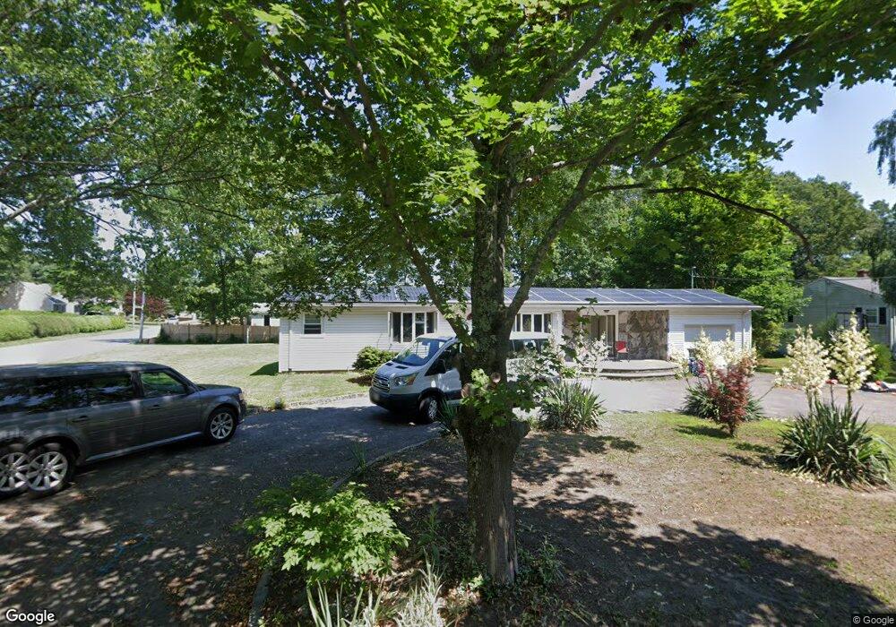
121 Sharplot Rd Swansea, MA 02777
Northeast Swansea NeighborhoodEstimated Value: $504,000 - $600,000
3
Beds
1
Bath
1,280
Sq Ft
$427/Sq Ft
Est. Value
About This Home
This home is located at 121 Sharplot Rd, Swansea, MA 02777 and is currently estimated at $546,315, approximately $426 per square foot. 121 Sharplot Rd is a home located in Bristol County with nearby schools including Joseph Case High School, SCEC Life Academy, and Swansea Wood School.
Ownership History
Date
Name
Owned For
Owner Type
Purchase Details
Closed on
Aug 14, 2017
Sold by
Soares Paulo J and Soares Maria F
Bought by
Blair John S
Current Estimated Value
Home Financials for this Owner
Home Financials are based on the most recent Mortgage that was taken out on this home.
Original Mortgage
$299,475
Outstanding Balance
$251,818
Interest Rate
4.25%
Mortgage Type
FHA
Estimated Equity
$294,497
Purchase Details
Closed on
Aug 17, 2009
Sold by
Wheelgate Realty Llc
Bought by
Soares Paulo J and Soares Maria F
Home Financials for this Owner
Home Financials are based on the most recent Mortgage that was taken out on this home.
Original Mortgage
$191,920
Interest Rate
5.36%
Mortgage Type
Purchase Money Mortgage
Purchase Details
Closed on
Aug 26, 2008
Sold by
Cit Group Consumer Fin
Bought by
Wheelgate Realty Llc
Purchase Details
Closed on
Oct 23, 2007
Sold by
Marchan Cheryl A
Bought by
Cit Grp Consumer Fin I
Purchase Details
Closed on
Sep 29, 1994
Sold by
Ferreira William T and Ferreira Deborah M
Bought by
Marchand Michael R and Marchand Cheryl A
Create a Home Valuation Report for This Property
The Home Valuation Report is an in-depth analysis detailing your home's value as well as a comparison with similar homes in the area
Home Values in the Area
Average Home Value in this Area
Purchase History
| Date | Buyer | Sale Price | Title Company |
|---|---|---|---|
| Blair John S | $305,000 | -- | |
| Soares Paulo J | $239,900 | -- | |
| Wheelgate Realty Llc | $139,400 | -- | |
| Cit Grp Consumer Fin I | $196,000 | -- | |
| Marchand Michael R | $118,000 | -- |
Source: Public Records
Mortgage History
| Date | Status | Borrower | Loan Amount |
|---|---|---|---|
| Open | Blair John S | $299,475 | |
| Previous Owner | Marchand Michael R | $191,000 | |
| Previous Owner | Soares Paulo J | $191,920 | |
| Previous Owner | Marchand Michael R | $270,000 |
Source: Public Records
Tax History Compared to Growth
Tax History
| Year | Tax Paid | Tax Assessment Tax Assessment Total Assessment is a certain percentage of the fair market value that is determined by local assessors to be the total taxable value of land and additions on the property. | Land | Improvement |
|---|---|---|---|---|
| 2025 | $5,221 | $438,000 | $151,000 | $287,000 |
| 2024 | $5,216 | $435,000 | $151,000 | $284,000 |
| 2023 | $5,039 | $383,800 | $110,600 | $273,200 |
| 2022 | $5,015 | $348,500 | $100,600 | $247,900 |
| 2021 | $4,628 | $296,100 | $100,600 | $195,500 |
| 2020 | $4,610 | $295,900 | $100,600 | $195,300 |
| 2019 | $4,417 | $284,800 | $89,500 | $195,300 |
| 2018 | $4,228 | $276,700 | $87,300 | $189,400 |
| 2017 | $3,675 | $276,700 | $87,300 | $189,400 |
| 2016 | $3,592 | $265,700 | $75,300 | $190,400 |
| 2015 | $3,269 | $249,000 | $75,300 | $173,700 |
| 2014 | $3,223 | $251,000 | $75,300 | $175,700 |
Source: Public Records
Map
Nearby Homes
- 265 Stevens Rd
- 34 Base Lodge Ln
- 0 Bark St Unit 1342599
- 0 Bark St Unit 73152576
- 33 Rhinecliffe Rd
- 745 Bark St
- 0 Hortonville Rd Unit 73242268
- 194 Hortonville Rd
- 24 Front St
- 8 2nd St
- 30 Front St
- 197 Alberta Ave
- 675 Lees River Ave
- 1067 Bark St
- Lot 11 Lynch
- 0 Proprietors Way Unit 73324662
- Lot 10 Lynch
- 58 Randall Ave
- 51 Linden Dr
- 0B Cummings Rd
- 121 Sharps Lot Rd
- 111 Sharps Lot Rd
- 52 Lancelot Terrace
- 36 Lancelot Terrace
- 101 Sharps Lot Rd
- 101 Sharps Lot Rd
- 28 Lancelot Terrace
- 34 Merlin Dr
- 18 Lancelot Terrace
- 53 Lancelot Terrace
- 89 Sharps Lot Rd
- 43 Lancelot Terrace
- 156 Sharps Lot Rd
- 156 Sharps Lot Rd Unit 1
- 163 Sharps Lot Rd
- 44 Merlin Dr
- 88 Sharps Lot Rd
- 21 Lancelot Terrace
- 20 Tennyson Dr
- 174 Sharps Lot Rd