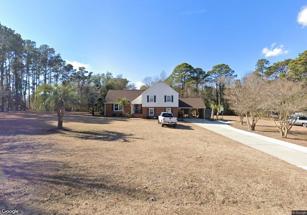
121 Sherrill Loop Rd Sneads Ferry, NC 28460
Estimated Value: $333,000 - $443,000
3
Beds
2
Baths
2,578
Sq Ft
$152/Sq Ft
Est. Value
About This Home
This home is located at 121 Sherrill Loop Rd, Sneads Ferry, NC 28460 and is currently estimated at $393,065, approximately $152 per square foot. 121 Sherrill Loop Rd is a home located in Onslow County with nearby schools including Dixon Elementary School and Dixon High School.
Ownership History
Date
Name
Owned For
Owner Type
Purchase Details
Closed on
Jun 27, 2008
Sold by
Everett Lonnie Thomas and Everett Laura Ann Parker
Bought by
Woolley Andrea and Woolley Chris
Current Estimated Value
Home Financials for this Owner
Home Financials are based on the most recent Mortgage that was taken out on this home.
Original Mortgage
$275,000
Outstanding Balance
$176,509
Interest Rate
5.97%
Mortgage Type
Purchase Money Mortgage
Estimated Equity
$216,556
Create a Home Valuation Report for This Property
The Home Valuation Report is an in-depth analysis detailing your home's value as well as a comparison with similar homes in the area
Home Values in the Area
Average Home Value in this Area
Purchase History
| Date | Buyer | Sale Price | Title Company |
|---|---|---|---|
| Woolley Andrea | $350,000 | None Available |
Source: Public Records
Mortgage History
| Date | Status | Borrower | Loan Amount |
|---|---|---|---|
| Open | Woolley Andrea | $275,000 |
Source: Public Records
Tax History
| Year | Tax Paid | Tax Assessment Tax Assessment Total Assessment is a certain percentage of the fair market value that is determined by local assessors to be the total taxable value of land and additions on the property. | Land | Improvement |
|---|---|---|---|---|
| 2025 | $1,710 | $261,811 | $52,050 | $209,761 |
| 2024 | $1,710 | $261,004 | $52,050 | $208,954 |
| 2023 | $1,710 | $261,004 | $52,050 | $208,954 |
| 2022 | $1,710 | $261,004 | $52,050 | $208,954 |
| 2021 | $1,317 | $186,820 | $52,050 | $134,770 |
| 2020 | $1,317 | $186,820 | $52,050 | $134,770 |
| 2019 | $1,317 | $186,820 | $52,050 | $134,770 |
| 2018 | $1,317 | $186,820 | $52,050 | $134,770 |
| 2017 | $1,250 | $185,130 | $47,320 | $137,810 |
| 2016 | $1,250 | $185,130 | $0 | $0 |
| 2015 | $1,250 | $185,130 | $0 | $0 |
| 2014 | $1,250 | $185,130 | $0 | $0 |
Source: Public Records
Map
Nearby Homes
- 113 Tillett Ln
- 1.75ac Flamingo Ln
- 1 Bay Dr
- 657 Canady Rd
- 10 Bay Dr
- 200 Smallberry Ct
- 306 Bond Ln
- 104 Justice Farm Dr
- 139 Hall Point Rd
- 136 Cedar Hollow Ln
- 128 Missie Cove Ln
- 121 Dolphin Ln
- 222 Fulcher Landing Rd
- 175 Fulcher Landing Rd
- 643 Riva Ridge Rd
- 1027 Meridian Dr
- 302 Whirlaway Blvd
- 527 Chadwick Shores Dr
- 814 Chadwick Shores Dr
- 1065 Chadwick Shores Dr
- 000 Sherrill Loop Rd
- 0 Sherrill Loop Rd
- 539 Peru Rd
- 120 Sherrill Loop Rd
- 111 Sherrill Loop Rd
- 128 Sherrill Loop Rd
- 133 Sherrill Loop Rd
- 207 Stacie Ln
- 112 Sherrill Loop Rd
- 132 Sherrill Loop Rd
- 105 Sherrill Loop Rd
- 543 Peru Rd
- 120 Vernelle Ct
- 180 Sherrill Loop Rd
- 114 Vernelle Ct
- 104 Sherrill Loop Rd
- 172 Sherrill Loop Rd
- 108 Vernelle Ct
- 531 Peru Rd
- 559 Peru Rd
Your Personal Tour Guide
Ask me questions while you tour the home.