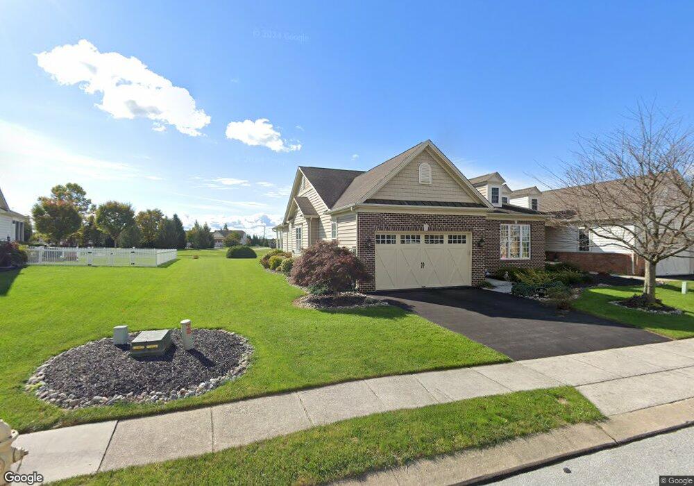
121 St Michaels Way Unit 40 Hanover, PA 17331
Estimated Value: $379,000 - $424,000
3
Beds
2
Baths
1,964
Sq Ft
$201/Sq Ft
Est. Value
About This Home
This home is located at 121 St Michaels Way Unit 40, Hanover, PA 17331 and is currently estimated at $394,875, approximately $201 per square foot. 121 St Michaels Way Unit 40 is a home located in Adams County with nearby schools including New Oxford Senior High School, St. Teresa of Calcutta Catholic School - McSherrystown Campus, and St. Teresa of Calcutta Catholic School - Conewago Campus.
Ownership History
Date
Name
Owned For
Owner Type
Purchase Details
Closed on
Jul 24, 2007
Sold by
Harvest Investment Group Llc
Bought by
Hensley Junior L and Hensley Patricia A
Current Estimated Value
Home Financials for this Owner
Home Financials are based on the most recent Mortgage that was taken out on this home.
Original Mortgage
$95,500
Outstanding Balance
$60,497
Interest Rate
6.67%
Mortgage Type
New Conventional
Estimated Equity
$334,378
Create a Home Valuation Report for This Property
The Home Valuation Report is an in-depth analysis detailing your home's value as well as a comparison with similar homes in the area
Home Values in the Area
Average Home Value in this Area
Purchase History
| Date | Buyer | Sale Price | Title Company |
|---|---|---|---|
| Hensley Junior L | $318,556 | -- |
Source: Public Records
Mortgage History
| Date | Status | Borrower | Loan Amount |
|---|---|---|---|
| Open | Hensley Junior L | $95,500 | |
| Open | Hensley Junior L | $188,000 |
Source: Public Records
Tax History Compared to Growth
Tax History
| Year | Tax Paid | Tax Assessment Tax Assessment Total Assessment is a certain percentage of the fair market value that is determined by local assessors to be the total taxable value of land and additions on the property. | Land | Improvement |
|---|---|---|---|---|
| 2025 | $6,605 | $275,800 | $54,200 | $221,600 |
| 2024 | $6,101 | $275,800 | $54,200 | $221,600 |
| 2023 | $5,875 | $275,800 | $54,200 | $221,600 |
| 2022 | $5,695 | $275,800 | $54,200 | $221,600 |
| 2021 | $5,549 | $275,800 | $54,200 | $221,600 |
| 2020 | $5,557 | $275,800 | $54,200 | $221,600 |
| 2019 | $5,308 | $275,800 | $54,200 | $221,600 |
| 2018 | $5,196 | $275,800 | $54,200 | $221,600 |
| 2017 | $4,982 | $275,800 | $54,200 | $221,600 |
| 2016 | -- | $275,800 | $54,200 | $221,600 |
| 2015 | -- | $275,800 | $54,200 | $221,600 |
| 2014 | -- | $275,800 | $54,200 | $221,600 |
Source: Public Records
Map
Nearby Homes
- 152 St Michaels Way Unit 18
- 51 Michael St Unit 6
- 124 Flint Dr Unit 61
- 105 Flint Dr
- 108 Flint Dr
- 5955 Hanover Rd
- 73 Flint Dr
- 11 Flint Dr
- 24 Red Stone Ln Unit 47
- 62 Flint Dr
- 54 Flint Dr
- 3211 Centennial Rd
- 11 Shawl Dr
- 46 Flint Dr
- 84 Red Stone Ln Unit 41
- 92 Red Stone Ln Unit 40
- 9 Westview Dr Unit 2A
- 1 Sease Dr Unit 1
- 49 North St
- 128 North St
- 115 Saint Michaels Way
- 122 St Michaels Way Unit 13
- 115 St Michaels Way Unit 39
- 125 St Michaels Way Unit 41
- 125 Saint Michaels Way
- 116 St Michaels Way Unit 12
- 0 Saint Michaels Way Unit 21208215
- 0 Saint Michaels Way Unit 21208212
- 0 Saint Michaels Way Unit 21208219
- 110 St Michaels Way Unit 11
- 116 Saint Michaels Way
- 131 St Michaels Way Unit 42
- 128 St Michaels Way Unit 14
- 95 Saint Michaels Way
- 137 St Michaels Way
- 137 St Michaels Way Unit 43
- 134 St Michaels Way Unit 15
- 98 St Michaels Way Unit 9
- 104 Saint Michaels Way
- 104 St Michaels Way Unit 10