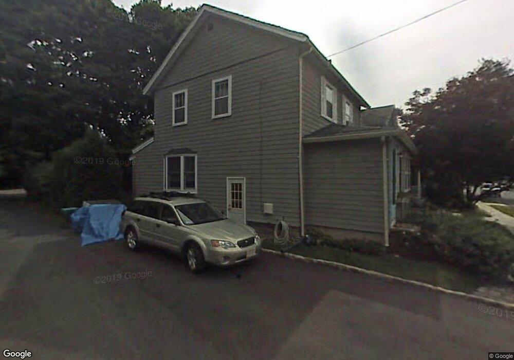
121 Sylvester Ave Winchester, MA 01890
North Main NeighborhoodEstimated Value: $895,000 - $1,026,000
4
Beds
2
Baths
1,618
Sq Ft
$600/Sq Ft
Est. Value
About This Home
This home is located at 121 Sylvester Ave, Winchester, MA 01890 and is currently estimated at $971,318, approximately $600 per square foot. 121 Sylvester Ave is a home located in Middlesex County with nearby schools including Lynch Elementary School, McCall Middle School, and Winchester High School.
Ownership History
Date
Name
Owned For
Owner Type
Purchase Details
Closed on
Oct 31, 1996
Sold by
Wright Michael J and Wright Sally Z
Bought by
Deming Lynn C and Deming Ross W
Current Estimated Value
Purchase Details
Closed on
Jul 29, 1993
Sold by
Lalande Marc and Dina-Lalande Marie
Bought by
Wright Michael J and Wright Sally Z
Purchase Details
Closed on
Sep 19, 1988
Sold by
Devash Yair
Bought by
Lalande Marc
Create a Home Valuation Report for This Property
The Home Valuation Report is an in-depth analysis detailing your home's value as well as a comparison with similar homes in the area
Home Values in the Area
Average Home Value in this Area
Purchase History
| Date | Buyer | Sale Price | Title Company |
|---|---|---|---|
| Deming Lynn C | $234,900 | -- | |
| Wright Michael J | $187,000 | -- | |
| Lalande Marc | $196,000 | -- |
Source: Public Records
Mortgage History
| Date | Status | Borrower | Loan Amount |
|---|---|---|---|
| Open | Lalande Marc | $150,000 | |
| Closed | Lalande Marc | $211,000 | |
| Closed | Lalande Marc | $211,000 |
Source: Public Records
Tax History
| Year | Tax Paid | Tax Assessment Tax Assessment Total Assessment is a certain percentage of the fair market value that is determined by local assessors to be the total taxable value of land and additions on the property. | Land | Improvement |
|---|---|---|---|---|
| 2025 | $103 | $928,300 | $549,900 | $378,400 |
| 2024 | $9,868 | $871,000 | $520,900 | $350,100 |
| 2023 | $9,654 | $818,100 | $477,500 | $340,600 |
| 2022 | $9,478 | $757,600 | $434,100 | $323,500 |
| 2021 | $5,270 | $692,500 | $369,000 | $323,500 |
| 2020 | $2,110 | $692,500 | $369,000 | $323,500 |
| 2019 | $7,509 | $620,100 | $296,600 | $323,500 |
| 2018 | $7,277 | $597,000 | $282,200 | $314,800 |
| 2017 | $1,875 | $565,300 | $267,700 | $297,600 |
| 2016 | $6,403 | $548,200 | $267,700 | $280,500 |
| 2015 | $6,223 | $512,600 | $242,400 | $270,200 |
| 2014 | $5,967 | $471,300 | $209,800 | $261,500 |
Source: Public Records
Map
Nearby Homes
- 149 Horn Pond Brook Rd
- 40 Pickering St
- 38 Pickering St Unit A
- 8 Russell Rd Unit 10
- 76 Woodside Rd
- 2 Maria Ct
- 62 Richardson St
- 20 Arthur St
- 237 Swanton St
- 200 Swanton St Unit 228
- 200 Swanton St Unit T28
- 53 Lake St
- 171 Swanton St Unit 73
- 9 Charles Rd
- 20 Charles Rd
- 6 Ivy Cir
- 10 Dartmouth St
- 4 Dartmouth St
- 6 Porter St
- 666 Main St Unit 315
- 117 Sylvester Ave
- 111 Sylvester Ave
- 129 Sylvester Ave
- 116 Sylvester Ave
- 122 Sylvester Ave
- 107 Sylvester Ave
- 42 Sheridan Cir
- 5 Sylvester Ct
- 11 Upland Rd
- 126 Sylvester Ave
- 28 Glenwood Ave
- 108 Sylvester Ave
- 130 Sylvester Ave
- 137 Sylvester Ave
- 137 Sylvester Ave
- 9 Upland Rd
- 40 Sheridan Cir
- 104 Sylvester Ave
- 7 Upland Rd
- 50 Sheridan Cir Unit 52
Your Personal Tour Guide
Ask me questions while you tour the home.