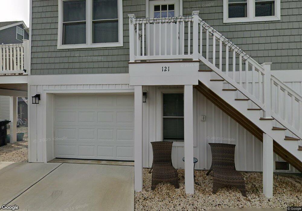
121 Throssell Rd Lavallette, NJ 08735
Dover Beaches North NeighborhoodEstimated Value: $879,434 - $964,000
2
Beds
1
Bath
912
Sq Ft
$999/Sq Ft
Est. Value
About This Home
This home is located at 121 Throssell Rd, Lavallette, NJ 08735 and is currently estimated at $910,859, approximately $998 per square foot. 121 Throssell Rd is a home located in Ocean County.
Ownership History
Date
Name
Owned For
Owner Type
Purchase Details
Closed on
Aug 19, 2022
Sold by
Cynthia Seniuk
Bought by
Seniuk Cynthia J and Seniuk Andrew M
Current Estimated Value
Purchase Details
Closed on
Jul 10, 2020
Sold by
Seniuk Cynthia and Ferraro Courtney
Bought by
Seniuk Cynthia and Curtis Thomas J
Purchase Details
Closed on
Mar 29, 2018
Sold by
Curtis Trust
Bought by
Seniuk Cynthia and Ferraro Courtney
Purchase Details
Closed on
Dec 30, 2004
Purchase Details
Closed on
Jun 4, 2001
Sold by
Petrucelli Salvatore
Bought by
Curtis Thomas and Curtis Marilyn Ann
Home Financials for this Owner
Home Financials are based on the most recent Mortgage that was taken out on this home.
Original Mortgage
$60,000
Interest Rate
7.08%
Create a Home Valuation Report for This Property
The Home Valuation Report is an in-depth analysis detailing your home's value as well as a comparison with similar homes in the area
Home Values in the Area
Average Home Value in this Area
Purchase History
| Date | Buyer | Sale Price | Title Company |
|---|---|---|---|
| Seniuk Cynthia J | -- | Merlino John R | |
| Seniuk Cynthia | -- | First American Title Ins Co | |
| Seniuk Cynthia | -- | -- | |
| -- | $100 | -- | |
| Curtis Thomas J | -- | -- | |
| Curtis Thomas | $214,900 | -- | |
| Curtis Thomas | $214,900 | -- |
Source: Public Records
Mortgage History
| Date | Status | Borrower | Loan Amount |
|---|---|---|---|
| Previous Owner | Curtis Thomas | $60,000 |
Source: Public Records
Tax History
| Year | Tax Paid | Tax Assessment Tax Assessment Total Assessment is a certain percentage of the fair market value that is determined by local assessors to be the total taxable value of land and additions on the property. | Land | Improvement |
|---|---|---|---|---|
| 2025 | $11,767 | $602,200 | $239,000 | $363,200 |
| 2024 | $8,830 | $239,000 | $239,000 | -- |
| 2023 | $8,514 | $510,100 | $239,000 | $271,100 |
| 2022 | $8,514 | $510,100 | $239,000 | $271,100 |
| 2021 | $6,626 | $264,500 | $196,400 | $68,100 |
| 2020 | $6,597 | $264,500 | $196,400 | $68,100 |
| 2019 | $6,311 | $264,500 | $196,400 | $68,100 |
| 2018 | $6,226 | $264,500 | $196,400 | $68,100 |
| 2017 | $6,173 | $264,500 | $196,400 | $68,100 |
| 2016 | $6,012 | $264,500 | $196,400 | $68,100 |
| 2015 | $5,785 | $264,500 | $196,400 | $68,100 |
| 2014 | $5,507 | $264,500 | $196,400 | $68,100 |
Source: Public Records
Map
Nearby Homes
- 170 W Beach Way
- 155 W Atlantic Way
- 109 W Tarpon Way
- 348 Venice Dr
- 111 W Marlin Way
- 53 E Bay Way
- 417 Delray Dr
- 33 E Penguin Way
- 20 E Bonita Way
- 354 Naples Ct
- 100 3rd Ave
- 359 Naples Ct
- 459 Boca Raton Dr
- 201 5th Ave
- 254 Harbor Ct
- 351 W Bayview Dr
- 545 New Jersey 35
- 3201 Route 35 N Unit B
- 208 Mallard Ln
- 21 E Dune Way Unit 121
- 122 Brooks Rd
- 120 Brooks Rd
- 119 Throssell Rd
- 123 Throssell Rd
- 121 Brooks Rd
- 120 Throssell Rd
- 122 Throssell Rd
- 118 Brooks Rd
- 124 Brooks Rd
- 119 Brooks Rd
- 123 Brooks Rd
- 117 Throssell Rd
- 125 Throssell Rd
- 118 Throssell Rd
- 120 Johnson Rd
- 122 Johnson Rd
- 133 S Bayside Rd
- 117 Brooks Rd
- 137 S Bayside Rd
- 129 S Bayside Rd
Your Personal Tour Guide
Ask me questions while you tour the home.