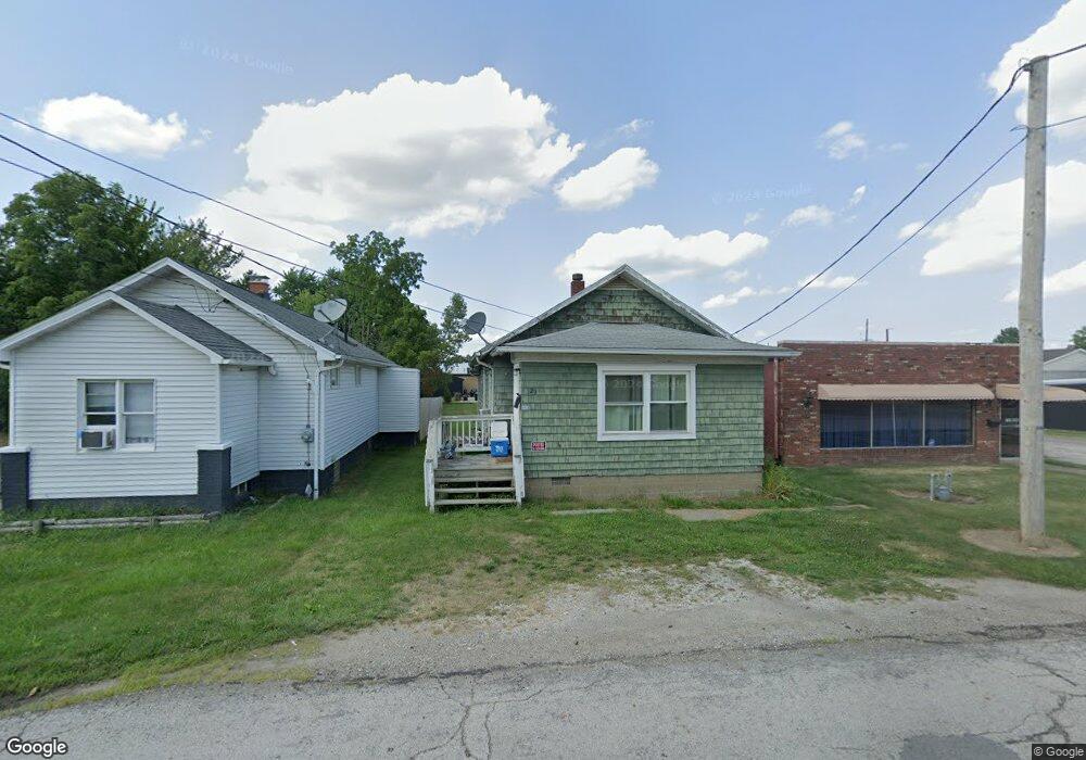
121 W 23rd St Alliance, OH 44601
Estimated Value: $71,000 - $110,000
2
Beds
1
Bath
786
Sq Ft
$106/Sq Ft
Est. Value
About This Home
This home is located at 121 W 23rd St, Alliance, OH 44601 and is currently estimated at $83,397, approximately $106 per square foot. 121 W 23rd St is a home located in Stark County with nearby schools including Alliance Elementary School at Rockhill, Alliance Intermediate School at Northside, and Alliance Middle School.
Ownership History
Date
Name
Owned For
Owner Type
Purchase Details
Closed on
Apr 2, 2024
Sold by
Bailey Michael A and Bailey Debra J
Bought by
Sweet Run Properties Llc
Current Estimated Value
Purchase Details
Closed on
Feb 21, 2007
Sold by
Frank Harold R and Frank Judith A
Bought by
Bailey Michael A and Bailey Debra J
Purchase Details
Closed on
Sep 20, 1994
Sold by
Schmidt John
Bought by
Frank Harold R and Frank Judith
Create a Home Valuation Report for This Property
The Home Valuation Report is an in-depth analysis detailing your home's value as well as a comparison with similar homes in the area
Home Values in the Area
Average Home Value in this Area
Purchase History
| Date | Buyer | Sale Price | Title Company |
|---|---|---|---|
| Sweet Run Properties Llc | -- | None Listed On Document | |
| Bailey Michael A | $42,400 | Union Title Company | |
| Frank Harold R | $23,000 | -- |
Source: Public Records
Tax History Compared to Growth
Tax History
| Year | Tax Paid | Tax Assessment Tax Assessment Total Assessment is a certain percentage of the fair market value that is determined by local assessors to be the total taxable value of land and additions on the property. | Land | Improvement |
|---|---|---|---|---|
| 2025 | -- | $15,120 | $3,290 | $11,830 |
| 2024 | -- | $15,120 | $3,290 | $11,830 |
| 2023 | $597 | $14,500 | $4,170 | $10,330 |
| 2022 | $601 | $14,500 | $4,170 | $10,330 |
| 2021 | $602 | $14,500 | $4,170 | $10,330 |
| 2020 | $565 | $12,710 | $3,640 | $9,070 |
| 2019 | $558 | $12,710 | $3,640 | $9,070 |
| 2018 | $560 | $12,710 | $3,640 | $9,070 |
| 2017 | $484 | $10,790 | $3,050 | $7,740 |
| 2016 | $528 | $11,660 | $3,050 | $8,610 |
| 2015 | $532 | $11,660 | $3,050 | $8,610 |
| 2014 | $457 | $9,530 | $2,490 | $7,040 |
| 2013 | $228 | $9,530 | $2,490 | $7,040 |
Source: Public Records
Map
Nearby Homes
- 317 E State St
- 236 E Milton St
- 2460 S Arch Ave
- 112 E College St
- 2408 S Linden Ave
- 2218 S Freedom Ave
- 390 E College St
- 1846 S Freedom Ave
- 2376 S Seneca Ave
- 1475 Chatauqua Ct
- 2839 S Rockhill Ave
- 884 W College Rd
- 555 E Milton St
- 1515 S Rockhill Ave
- 1437 S Linden Ave
- 3101 Ridgehill Ave
- 853 Fairway Dr
- 1059 Oakwood Dr
- 815 Grace St
- 729 Waugh St
- 131 W 23rd St
- 109 W 23rd St
- 2248 Miller Ave
- 2234 Miller Ave
- 2220 Miller Ave
- 120 W 23rd St
- 2306 Miller Ave
- 2208 Miller Ave
- 2324 Miller Ave
- 2324 Miller Ave
- 2328 1/2 Miller Ave
- 2330 Miller Ave
- 2328 Miller Ave
- 2328 Miller Ave
- 2245 Miller Ave
- 2233 Miller Ave
- 2221 Miller Ave
- 2144 Miller Ave
- 2305 Miller Ave
- 2205 Miller Ave