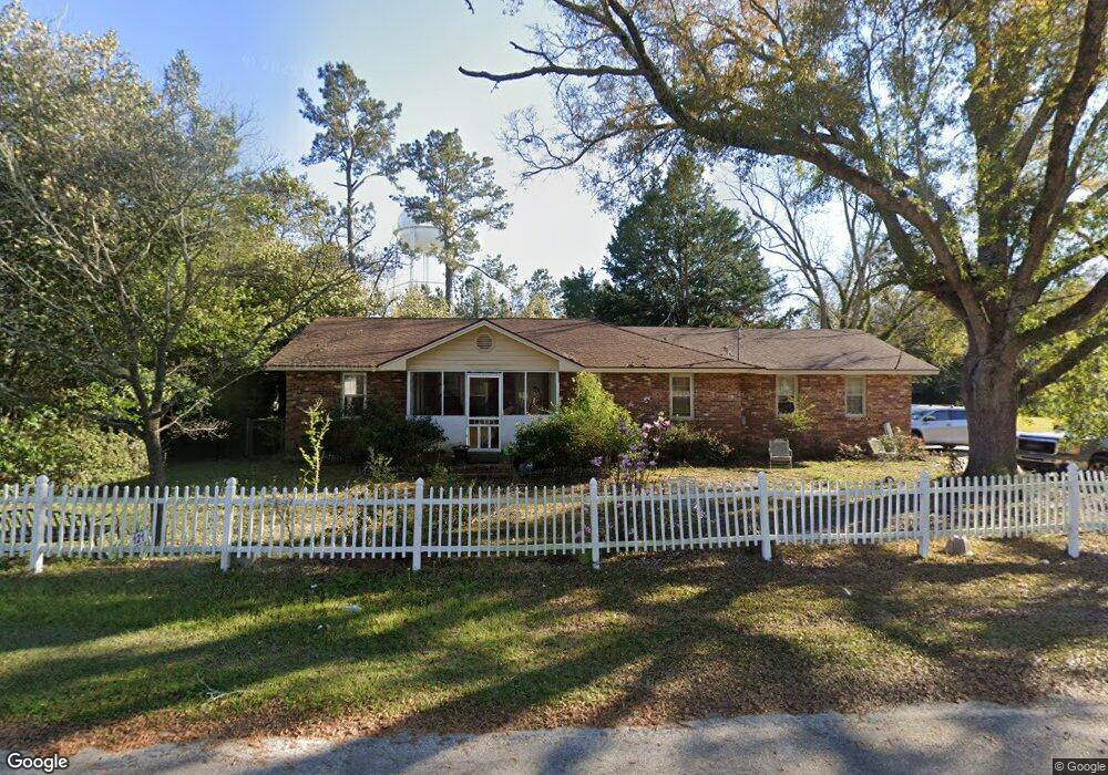
121 W Bryan St Sparks, GA 31647
Estimated Value: $143,714 - $163,000
3
Beds
2
Baths
2,003
Sq Ft
$76/Sq Ft
Est. Value
About This Home
This home is located at 121 W Bryan St, Sparks, GA 31647 and is currently estimated at $151,429, approximately $75 per square foot. 121 W Bryan St is a home located in Cook County with nearby schools including Cook Primary School, Cook Elementary School, and Cook County Middle School.
Ownership History
Date
Name
Owned For
Owner Type
Purchase Details
Closed on
Feb 26, 2016
Sold by
Taylor Jeffery David
Bought by
Wilcox J H and Wilcox R
Current Estimated Value
Purchase Details
Closed on
Apr 7, 2015
Sold by
Newbern Colin
Bought by
Branch Banking & Trust Co
Purchase Details
Closed on
Dec 10, 2012
Sold by
Newbern Shirley A
Bought by
Newbern Colin
Purchase Details
Closed on
Feb 17, 2012
Sold by
Newbern Shirley A
Create a Home Valuation Report for This Property
The Home Valuation Report is an in-depth analysis detailing your home's value as well as a comparison with similar homes in the area
Home Values in the Area
Average Home Value in this Area
Purchase History
| Date | Buyer | Sale Price | Title Company |
|---|---|---|---|
| Wilcox J H | $61,000 | -- | |
| Taylor Jeffery David | $61,000 | -- | |
| Branch Banking & Trust Co | $32,399 | -- | |
| Newbern Colin | $75,000 | -- | |
| -- | $5,000 | -- |
Source: Public Records
Tax History Compared to Growth
Tax History
| Year | Tax Paid | Tax Assessment Tax Assessment Total Assessment is a certain percentage of the fair market value that is determined by local assessors to be the total taxable value of land and additions on the property. | Land | Improvement |
|---|---|---|---|---|
| 2024 | $1,076 | $37,395 | $2,693 | $34,702 |
| 2023 | $193 | $32,529 | $2,405 | $30,124 |
| 2022 | $678 | $32,529 | $2,405 | $30,124 |
| 2021 | $572 | $27,360 | $2,405 | $24,955 |
| 2020 | $790 | $27,360 | $2,405 | $24,955 |
| 2019 | $791 | $27,360 | $2,405 | $24,955 |
| 2018 | $1,002 | $27,360 | $2,405 | $24,955 |
| 2017 | $706 | $27,360 | $2,405 | $24,955 |
| 2016 | $792 | $27,360 | $2,405 | $24,955 |
| 2015 | $954 | $32,890 | $2,405 | $30,485 |
| 2014 | -- | $32,890 | $2,405 | $30,485 |
| 2013 | -- | $32,890 | $2,404 | $30,485 |
Source: Public Records
Map
Nearby Homes
- 103 N College St
- 134 Brandy Ct
- 105 Orchard Cir
- 120 Westover Dr
- 284 Barrett Rd
- 123 Westover Dr
- 1402 Bear Creek Rd
- 1306 Bear Creek Rd
- 2302 Thomas St
- 2603 Dianne St
- 2503 Dianne St
- 4711 Highway 37
- 701 Gloria St
- 304 E 3rd St
- 418 E 3rd St
- 315 Newton Dr
- 211 S Gordon Ave
- 729 W 7th St
- 625 Coxstill Rd
- 901 E 4th St
- 107 W Bryan St
- 105 W Bryan St
- 115 S College St
- 202 S College St
- 113 S College St
- 104 Bryan St
- 103 Bryan St
- 103 W Bryan St
- 203 W Bryan St
- 109 S College St
- 110 S College St
- 211 Giddens Ln
- 112 S Goodman St
- 114 S Goodman St
- 107 S College St
- 108 S College St Unit 5
- 108 S College St
- 302 S College St
- 205 W Bryan St
- 208 S Goodman St