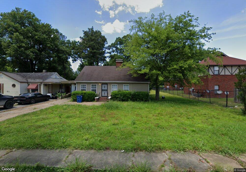
121 W Danner Ave West Memphis, AR 72301
Estimated Value: $62,000 - $149,000
2
Beds
1
Bath
1,038
Sq Ft
$96/Sq Ft
Est. Value
About This Home
This home is located at 121 W Danner Ave, West Memphis, AR 72301 and is currently estimated at $99,930, approximately $96 per square foot. 121 W Danner Ave is a home located in Crittenden County with nearby schools including Bragg Elementary School, West Junior High School, and The Academies of West Memphis Charter School.
Ownership History
Date
Name
Owned For
Owner Type
Purchase Details
Closed on
Apr 9, 2024
Sold by
Smith Liana Y
Bought by
Market Equities Llc
Current Estimated Value
Home Financials for this Owner
Home Financials are based on the most recent Mortgage that was taken out on this home.
Original Mortgage
$148,000
Outstanding Balance
$142,903
Interest Rate
6.94%
Mortgage Type
Construction
Estimated Equity
-$42,973
Purchase Details
Closed on
Feb 20, 2013
Purchase Details
Closed on
Aug 29, 1997
Sold by
Not Provided
Bought by
Bowden Benita J
Create a Home Valuation Report for This Property
The Home Valuation Report is an in-depth analysis detailing your home's value as well as a comparison with similar homes in the area
Home Values in the Area
Average Home Value in this Area
Purchase History
| Date | Buyer | Sale Price | Title Company |
|---|---|---|---|
| Market Equities Llc | $185,000 | Stewart Title | |
| -- | -- | -- | |
| Bowden Benita J | $49,900 | -- |
Source: Public Records
Mortgage History
| Date | Status | Borrower | Loan Amount |
|---|---|---|---|
| Open | Market Equities Llc | $148,000 |
Source: Public Records
Tax History Compared to Growth
Tax History
| Year | Tax Paid | Tax Assessment Tax Assessment Total Assessment is a certain percentage of the fair market value that is determined by local assessors to be the total taxable value of land and additions on the property. | Land | Improvement |
|---|---|---|---|---|
| 2024 | $615 | $12,660 | $4,080 | $8,580 |
| 2023 | $615 | $12,660 | $4,080 | $8,580 |
| 2022 | $615 | $12,660 | $4,080 | $8,580 |
| 2021 | $615 | $12,660 | $4,080 | $8,580 |
| 2020 | $574 | $12,660 | $4,080 | $8,580 |
| 2019 | $469 | $12,420 | $4,080 | $8,340 |
| 2018 | $510 | $12,420 | $4,080 | $8,340 |
| 2017 | $510 | $12,420 | $4,080 | $8,340 |
| 2016 | $474 | $12,420 | $4,080 | $8,340 |
| 2015 | $515 | $12,420 | $4,080 | $8,340 |
| 2014 | $539 | $13,010 | $5,000 | $8,010 |
Source: Public Records
Map
Nearby Homes
- 303 N Rhodes St
- 216 Roosevelt Ave
- 301 Pine St
- 104 Ross Ave
- 222 E Oliver Ave
- 112 Ross Ave
- 221 W Barton Ave
- 307 W Cooper Ave
- 235 W Barton Ave
- 323 W Oliver Ave
- 2217 E Broadway Blvd
- 501 W Cooper Ave
- 503 W Oliver Ave
- 413 Gibson Ave
- 703-707 N Missouri St
- 1397 N Missouri St
- Lot 1-A N Missouri St
- 1399 N Missouri St
- 321 S Worthington Dr
- 607 W Barton Ave
- 123 W Danner Ave
- 125 W Danner Ave
- 127 W Danner Ave
- 113 W Danner Ave
- 129 W Danner Ave
- 120 W Cooper Ave
- 122 W Cooper Ave
- 118 W Cooper Ave
- 124 W Cooper Ave
- 303 N Rhodes St Unit 48
- 303 N Rhodes St Unit 47
- 303 N Rhodes St Unit 46
- 303 N Rhodes St Unit 45
- 303 N Rhodes St Unit 44
- 303 N Rhodes St Unit 43
- 303 N Rhodes St Unit 42
- 303 N Rhodes St Unit 41
- 303 N Rhodes St Unit 40
- 303 N Rhodes St Unit 39
- 303 N Rhodes St Unit 38