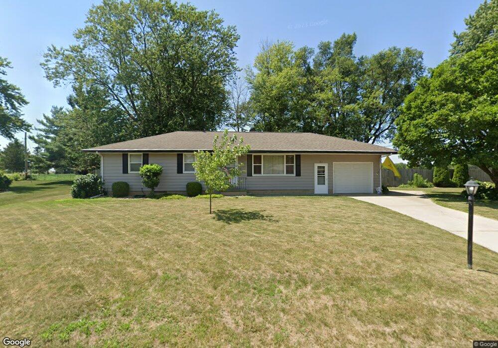
121 Westshore Dr Morton, IL 61550
Estimated Value: $186,845 - $224,000
3
Beds
1
Bath
1,130
Sq Ft
$178/Sq Ft
Est. Value
About This Home
This home is located at 121 Westshore Dr, Morton, IL 61550 and is currently estimated at $201,461, approximately $178 per square foot. 121 Westshore Dr is a home located in Tazewell County with nearby schools including Morton High School, Blessed Sacrament School, and Bethel Lutheran School.
Ownership History
Date
Name
Owned For
Owner Type
Purchase Details
Closed on
Jul 16, 2015
Sold by
Marvin Steven P and Marvin Nicole S
Bought by
Smith Luke
Current Estimated Value
Home Financials for this Owner
Home Financials are based on the most recent Mortgage that was taken out on this home.
Original Mortgage
$124,320
Outstanding Balance
$97,843
Interest Rate
4.13%
Mortgage Type
New Conventional
Estimated Equity
$103,618
Purchase Details
Closed on
Apr 19, 2006
Sold by
Dluski Frank and Dluski Jolanta K
Bought by
Marvin Steven P and Marvin Nicole S
Home Financials for this Owner
Home Financials are based on the most recent Mortgage that was taken out on this home.
Original Mortgage
$114,000
Interest Rate
6.48%
Mortgage Type
Fannie Mae Freddie Mac
Purchase Details
Closed on
Mar 25, 2005
Sold by
Kirchner Mary E
Bought by
Dluski Frank and Dluski Jolantak
Home Financials for this Owner
Home Financials are based on the most recent Mortgage that was taken out on this home.
Original Mortgage
$80,000
Interest Rate
4.27%
Mortgage Type
New Conventional
Create a Home Valuation Report for This Property
The Home Valuation Report is an in-depth analysis detailing your home's value as well as a comparison with similar homes in the area
Home Values in the Area
Average Home Value in this Area
Purchase History
| Date | Buyer | Sale Price | Title Company |
|---|---|---|---|
| Smith Luke | $155,500 | -- | |
| Marvin Steven P | $129,000 | None Available | |
| Dluski Frank | $67,333 | -- |
Source: Public Records
Mortgage History
| Date | Status | Borrower | Loan Amount |
|---|---|---|---|
| Open | Smith Luke | $124,320 | |
| Previous Owner | Marvin Steven P | $114,000 | |
| Previous Owner | Dluski Frank | $80,000 |
Source: Public Records
Tax History Compared to Growth
Tax History
| Year | Tax Paid | Tax Assessment Tax Assessment Total Assessment is a certain percentage of the fair market value that is determined by local assessors to be the total taxable value of land and additions on the property. | Land | Improvement |
|---|---|---|---|---|
| 2024 | $3,274 | $54,360 | $8,670 | $45,690 |
| 2023 | $3,274 | $50,650 | $8,080 | $42,570 |
| 2022 | $3,128 | $46,510 | $7,420 | $39,090 |
| 2021 | $2,991 | $44,720 | $7,130 | $37,590 |
| 2020 | $2,895 | $44,280 | $7,060 | $37,220 |
| 2019 | $2,888 | $44,280 | $7,060 | $37,220 |
| 2018 | $2,835 | $44,280 | $7,060 | $37,220 |
| 2017 | $2,762 | $42,230 | $6,730 | $35,500 |
| 2016 | $2,704 | $42,230 | $6,730 | $35,500 |
| 2015 | $2,595 | $0 | $0 | $0 |
| 2013 | $2,569 | $42,230 | $6,730 | $35,500 |
Source: Public Records
Map
Nearby Homes
- 121 Jay Ave
- 101 Cottonwood Dr Unit 101Cot
- 112 Hemlock Dr
- 109 Mulberry Dr Unit 109Mul
- 110 White Oak Dr Unit 110Whi
- 116 E Sassafras Dr Unit 116Sas
- 111 Willow Oak Dr Unit 111Wil
- 614 Thornridge Dr
- 26 Linden Ct
- 26 Jasper Ct
- 450 Coral Dr
- 1224 Autumn Ridge Ct
- 12 Crystal Ct
- 115 S Liberty Ave
- 118 S Liberty Ave
- 329 S Nelson Ave
- 101 Patricia Ave
- 504 S Glen Ave
- 43 Lynnwood Ct
- 600 S Columbus Ave
- 201 Westshore Dr
- 117 Westshore Dr
- 120 Westshore Dr
- 202 Westshore Dr
- 205 Westshore Dr
- 204 Westshore Dr
- 209 Westshore Dr
- 208 Westshore Dr
- 116 Westshore Dr
- 213 Westshore Dr
- 212 Westshore Dr
- 118 Westshore Dr
- 1507 W Jefferson St
- 1611 W Jefferson St
- 1509 W Jefferson St
- 218 Westshore Dr
- 105 Ridge St
- 109 Ridge St
- 216 Westshore Dr
- 217 Westshore Dr