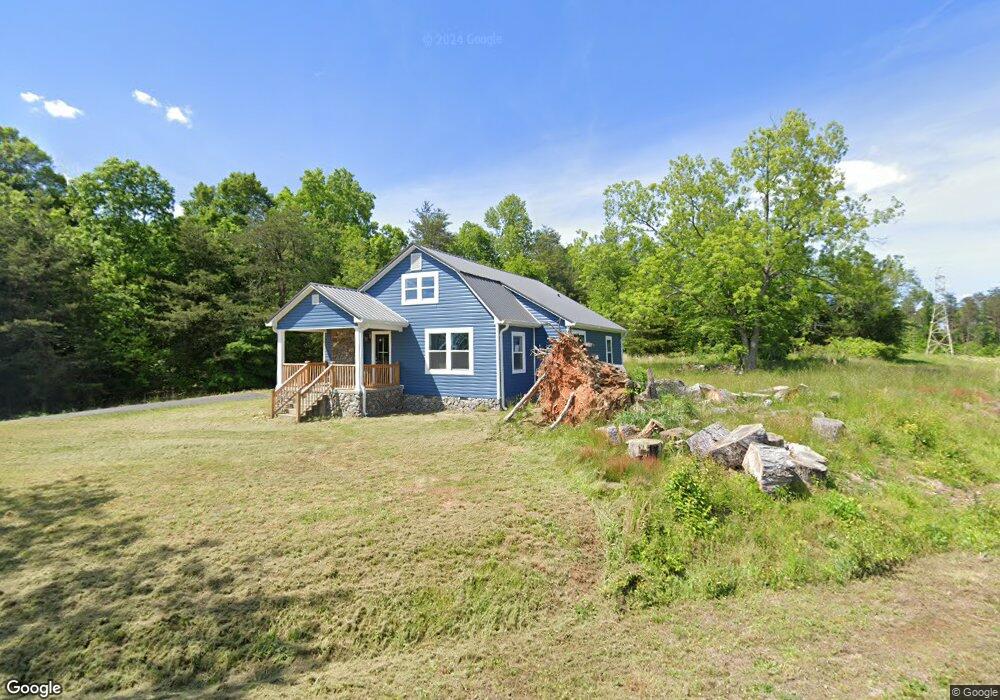
1210 Airport Rhodhiss Rd Unit 1220 Hickory, NC 28601
Estimated Value: $301,849 - $359,000
3
Beds
2
Baths
1,682
Sq Ft
$189/Sq Ft
Est. Value
About This Home
This home is located at 1210 Airport Rhodhiss Rd Unit 1220, Hickory, NC 28601 and is currently estimated at $318,712, approximately $189 per square foot. 1210 Airport Rhodhiss Rd Unit 1220 is a home located in Burke County with nearby schools including Ray Childers Elementary School, East Burke Middle School, and East Burke High School.
Ownership History
Date
Name
Owned For
Owner Type
Purchase Details
Closed on
Jun 1, 2022
Sold by
Aah Homes Llc
Bought by
Mcalee Kevin A
Current Estimated Value
Home Financials for this Owner
Home Financials are based on the most recent Mortgage that was taken out on this home.
Original Mortgage
$271,982
Outstanding Balance
$258,428
Interest Rate
5.11%
Mortgage Type
New Conventional
Estimated Equity
$60,284
Create a Home Valuation Report for This Property
The Home Valuation Report is an in-depth analysis detailing your home's value as well as a comparison with similar homes in the area
Home Values in the Area
Average Home Value in this Area
Purchase History
| Date | Buyer | Sale Price | Title Company |
|---|---|---|---|
| Mcalee Kevin A | $270,000 | Keller Dewey L | |
| Mcalee Kevin A | $270,000 | None Listed On Document |
Source: Public Records
Mortgage History
| Date | Status | Borrower | Loan Amount |
|---|---|---|---|
| Open | Mcalee Kevin A | $271,982 | |
| Closed | Mcalee Kevin A | $271,982 |
Source: Public Records
Tax History Compared to Growth
Tax History
| Year | Tax Paid | Tax Assessment Tax Assessment Total Assessment is a certain percentage of the fair market value that is determined by local assessors to be the total taxable value of land and additions on the property. | Land | Improvement |
|---|---|---|---|---|
| 2025 | $1,735 | $243,430 | $16,132 | $227,298 |
| 2024 | $1,743 | $243,430 | $16,132 | $227,298 |
| 2023 | $1,743 | $243,430 | $16,132 | $227,298 |
| 2022 | $1,330 | $153,108 | $16,132 | $136,976 |
| 2021 | $181 | $22,172 | $16,132 | $6,040 |
| 2020 | $163 | $19,943 | $16,132 | $3,811 |
| 2019 | $163 | $19,943 | $16,132 | $3,811 |
| 2018 | $192 | $23,619 | $16,132 | $7,487 |
| 2017 | $192 | $23,619 | $16,132 | $7,487 |
| 2016 | $189 | $23,619 | $16,132 | $7,487 |
| 2015 | $189 | $23,619 | $16,132 | $7,487 |
| 2014 | $189 | $23,632 | $16,132 | $7,500 |
| 2013 | $189 | $23,632 | $16,132 | $7,500 |
Source: Public Records
Map
Nearby Homes
- 0 Liberty Church Rd
- 676 Cape Hickory Rd Unit 20
- 2764 Cliftwood Cir
- 137 River Ridge Ln
- 2488 Harvest Dr Unit 14 and 12
- 2484 Harvest Dr Unit 15
- 2480 Harvest Dr Unit 16
- 4955 Midway Sand Rd
- 2478 Harvest Dr Unit 17
- 2359 Settlemyre Lail St Unit 33
- 106 Dogwood Dr
- 108 Dogwood Dr
- 9459 Westridge Dr
- 0 R and Cir S Unit CAR3835569
- 209 Catawba Ave
- 204 Shelby St
- 465 S Main St
- 9165 Cherokee Dr
- 6664 Lake Shore Dr
- 103 Burch St
- 2113 Lake Acres Dr
- 2114 Lake Acres Dr
- 2110 Lake Acres Dr
- 2106 Lake Acres Dr
- 1203 Airport Rhodhiss Rd
- 1202 Airport Rhodhiss Rd
- 1198 Airport Rhodhiss Rd Unit 1202
- 1198 Airport Rhodhiss Rd Unit 1
- 2064 Beulah Rd
- 1352 Airport Rhodhiss Rd
- 2091 Wildwood Dr
- 2028 Landon Ave
- 2047 Bailey Dr
- 2059 Bailey Dr
- 2033 Bailey Dr
- 2017 Bailey Dr
- 2020 Bailey Dr
- 2038 Bailey Dr
- 0 Landon Ave Unit 4 3745776
- 0 Landon Ave Unit 5