Estimated Value: $288,000 - $365,000
4
Beds
3
Baths
2,762
Sq Ft
$115/Sq Ft
Est. Value
About This Home
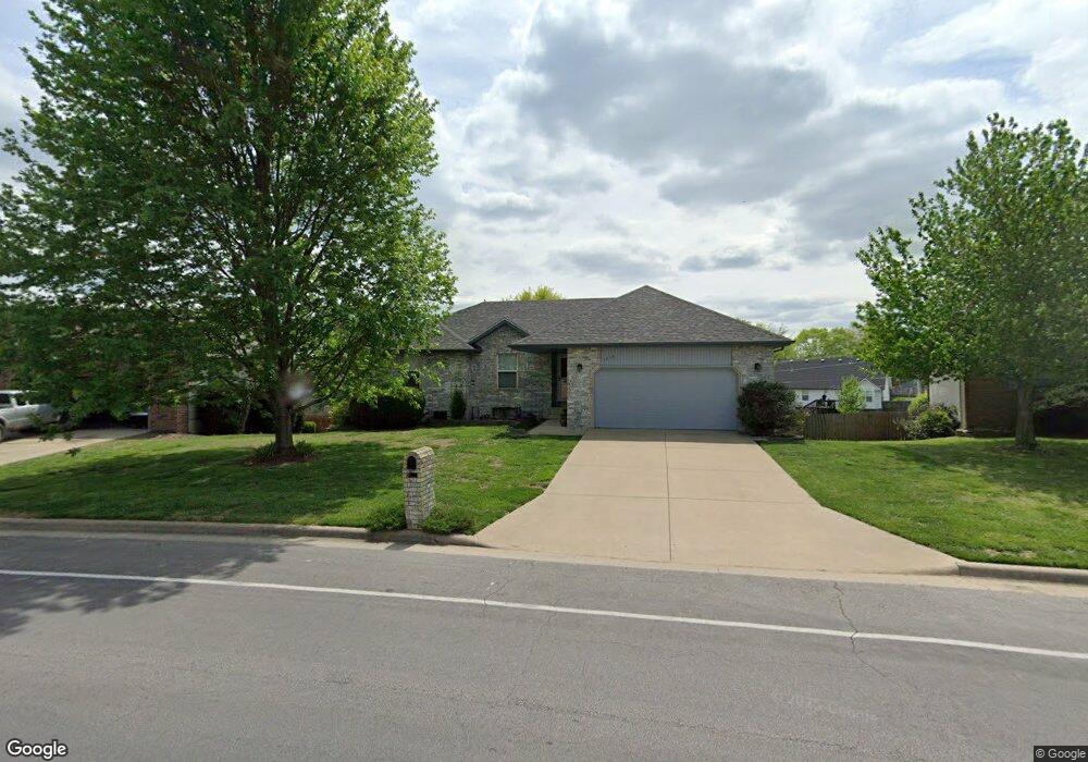
This home is located at 1210 Butterfield Dr, Nixa, MO 65714 and is currently estimated at $317,894, approximately $115 per square foot. 1210 Butterfield Dr is a home located in Christian County with nearby schools including Mathews Elementary School, Queens Gateway to Health Sciences Secondary School, and Nicholas A. Inman Intermediate School.
Ownership History
Date
Name
Owned For
Owner Type
Purchase Details
Closed on
Jul 6, 2007
Sold by
Robertson Rodney Eugene
Bought by
Robertson Jennifer Lee
Current Estimated Value
Purchase Details
Closed on
Nov 10, 2005
Sold by
Drc Properties Inc
Bought by
Robertson Rodney E and Robertson Jennifer L
Home Financials for this Owner
Home Financials are based on the most recent Mortgage that was taken out on this home.
Original Mortgage
$137,738
Outstanding Balance
$75,469
Interest Rate
6.04%
Mortgage Type
FHA
Estimated Equity
$242,425
Create a Home Valuation Report for This Property
The Home Valuation Report is an in-depth analysis detailing your home's value as well as a comparison with similar homes in the area
Home Values in the Area
Average Home Value in this Area
Purchase History
| Date | Buyer | Sale Price | Title Company |
|---|---|---|---|
| Robertson Jennifer Lee | -- | None Available | |
| Robertson Rodney E | -- | None Available |
Source: Public Records
Mortgage History
| Date | Status | Borrower | Loan Amount |
|---|---|---|---|
| Open | Robertson Rodney E | $137,738 |
Source: Public Records
Tax History Compared to Growth
Tax History
| Year | Tax Paid | Tax Assessment Tax Assessment Total Assessment is a certain percentage of the fair market value that is determined by local assessors to be the total taxable value of land and additions on the property. | Land | Improvement |
|---|---|---|---|---|
| 2024 | $1,777 | $28,520 | -- | -- |
| 2023 | $1,777 | $28,520 | $0 | $0 |
| 2022 | $1,655 | $26,520 | $0 | $0 |
| 2021 | $1,656 | $26,520 | $0 | $0 |
| 2020 | $1,440 | $22,020 | $0 | $0 |
| 2019 | $1,440 | $22,020 | $0 | $0 |
| 2018 | $1,277 | $22,020 | $0 | $0 |
| 2017 | $1,277 | $22,020 | $0 | $0 |
| 2016 | $1,277 | $21,260 | $0 | $0 |
| 2015 | $1,277 | $21,260 | $21,260 | $0 |
| 2014 | $1,242 | $21,190 | $0 | $0 |
| 2013 | $12 | $21,190 | $0 | $0 |
| 2011 | $12 | $42,480 | $0 | $0 |
Source: Public Records
Map
Nearby Homes
- 1222 W Butterfield Dr
- 1209 W Belwood Ct
- 708 S Aurora Ct
- 701 S Cedarwood Ct
- 975 S Pinewood Ln
- 1340 W Mesa Dr
- Tract 3c S Gregg Rd
- 985 W Pembrook Ave
- 931 W Butterfield Dr
- 000 S Nicholas Rd
- 886 W Paddington Dr
- 601 S Gregg Rd
- 1216 W Verna Ln
- 955 S Silverwood Ln
- 915 S Silverwood Ln
- 911 S Silverwood Ln
- 919 S Silverwood Ln
- 965 S Silverwood Ln
- 959 S Silverwood Ln
- 951 S Silverwood Ln
- 1208 W Butterfield Dr
- 1212 W Butterfield Dr
- 1212 W Butterfield Dr
- 1214 W Butterfield Dr
- 1209 W Butterfield Dr
- 1206 Butterfield Dr
- 1213 Butterfield Dr
- 1205 W Butterfield Dr
- 1205 W Sherwood Ct
- 716 S Ballard Dr
- 714 S Ballard Dr
- 718 S Ballard Dr
- 1216 Butterfield Dr
- 1205 Sherwood Ct
- 1204 W Butterfield Dr
- 1215 Butterfield Dr
- 712 S Ballard Dr
- 802 S Ballard Dr
- 1207 Sherwood Ct
- 1203 W Sherwood Ct