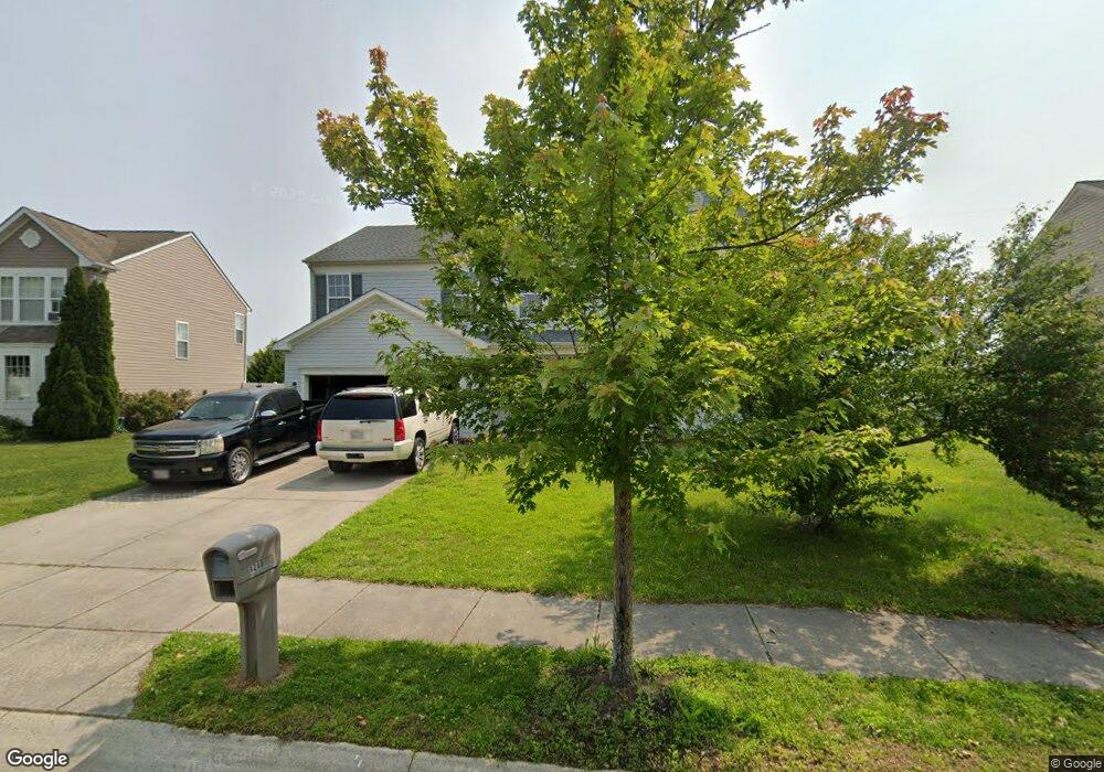
1210 Cattail Commons Way Denton, MD 21629
Estimated Value: $383,987 - $445,000
Studio
3
Baths
3,073
Sq Ft
$134/Sq Ft
Est. Value
About This Home
This home is located at 1210 Cattail Commons Way, Denton, MD 21629 and is currently estimated at $410,247, approximately $133 per square foot. 1210 Cattail Commons Way is a home located in Caroline County with nearby schools including Denton Elementary School, Lockerman Middle School, and North Caroline High School.
Ownership History
Date
Name
Owned For
Owner Type
Purchase Details
Closed on
Nov 14, 2015
Sold by
Jeffries William H
Bought by
Jeffries William H and Barnes David
Current Estimated Value
Purchase Details
Closed on
Feb 1, 2006
Sold by
Ryl& Group Inc
Bought by
Jeffries William H
Home Financials for this Owner
Home Financials are based on the most recent Mortgage that was taken out on this home.
Original Mortgage
$236,400
Outstanding Balance
$132,847
Interest Rate
6.17%
Mortgage Type
Purchase Money Mortgage
Estimated Equity
$277,400
Purchase Details
Closed on
Nov 29, 2005
Sold by
Ryl& Group Inc
Bought by
Jeffries William H
Home Financials for this Owner
Home Financials are based on the most recent Mortgage that was taken out on this home.
Original Mortgage
$236,400
Interest Rate
6.17%
Mortgage Type
Purchase Money Mortgage
Create a Home Valuation Report for This Property
The Home Valuation Report is an in-depth analysis detailing your home's value as well as a comparison with similar homes in the area
Home Values in the Area
Average Home Value in this Area
Purchase History
| Date | Buyer | Sale Price | Title Company |
|---|---|---|---|
| Jeffries William H | -- | Attorney | |
| Jeffries William H | $295,516 | -- | |
| Jeffries William H | $295,516 | -- |
Source: Public Records
Mortgage History
| Date | Status | Borrower | Loan Amount |
|---|---|---|---|
| Open | Jeffries William H | $236,400 | |
| Previous Owner | Jeffries William H | $236,400 |
Source: Public Records
Tax History
| Year | Tax Paid | Tax Assessment Tax Assessment Total Assessment is a certain percentage of the fair market value that is determined by local assessors to be the total taxable value of land and additions on the property. | Land | Improvement |
|---|---|---|---|---|
| 2025 | $5,837 | $345,000 | $42,600 | $302,400 |
| 2024 | $5,433 | $315,533 | $0 | $0 |
| 2023 | $5,012 | $286,067 | $0 | $0 |
| 2022 | $4,547 | $256,600 | $42,600 | $214,000 |
| 2021 | $4,258 | $246,433 | $0 | $0 |
| 2020 | $4,258 | $236,267 | $0 | $0 |
| 2019 | $4,074 | $226,100 | $25,600 | $200,500 |
| 2018 | $4,024 | $224,567 | $0 | $0 |
| 2017 | $3,952 | $223,033 | $0 | $0 |
| 2016 | -- | $221,500 | $0 | $0 |
| 2015 | $3,380 | $219,333 | $0 | $0 |
| 2014 | $3,380 | $217,167 | $0 | $0 |
Source: Public Records
Map
Nearby Homes
- 1108 Camp Rd
- 1107 Osprey Ln
- 1106 Osprey Ln
- 1404 Blue Heron Dr
- 1204 Blue Heron Dr
- 1202 Blue Heron Dr
- 1507 Blue Heron Dr
- 1907 Blue Heron Dr
- 1203 Tuckahoe Ct
- 1303 Fairfield Ct
- 1005 Market St
- 315 Morning Glory Dr
- 406 Morning Glory Dr
- 10819 Greensboro Rd
- 207 S 7th St
- 501 Lincoln St
- 106 S 6th St
- 406 Lincoln St
- 112 S 5th Ave
- 341 Academy Ave
- 1212 Cattail Commons Way
- 1208 Cattail Commons Way
- 1214 Cattail Commons Way
- 1209 Cattail Commons Way
- 1206 Cattail Commons Way
- 1211 Cattail Commons Way
- 1205 Cattail Commons Way
- 1213 Cattail Commons Way
- 1300 Cattail Commons Way
- 1203 Cattail Commons Way
- 1301 Cattail Commons Way
- 1204 Cattail Commons Way
- 1107 Weeping Willow Ct
- 1109 Weeping Willow Ct
- 1111 Weeping Willow Ct
- 1111 Cypress Ct
- 1202 Cattail Commons Way
- 1113 Weeping Willow Ct
- 1302 Cattail Commons Way
- 1105 Weeping Willow Ct
Your Personal Tour Guide
Ask me questions while you tour the home.