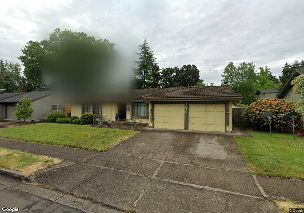
1210 Cedar Ridge Dr Eugene, OR 97401
Cal Young NeighborhoodEstimated Value: $520,493 - $574,000
3
Beds
2
Baths
1,511
Sq Ft
$358/Sq Ft
Est. Value
About This Home
This home is located at 1210 Cedar Ridge Dr, Eugene, OR 97401 and is currently estimated at $541,123, approximately $358 per square foot. 1210 Cedar Ridge Dr is a home located in Lane County with nearby schools including Willagillespie Elementary School, Cal Young Middle School, and Sheldon High School.
Ownership History
Date
Name
Owned For
Owner Type
Purchase Details
Closed on
Jul 8, 2024
Sold by
Lee James
Bought by
James Young-Sup Lee Trust and Eun-Hee Elaine Lee Trust
Current Estimated Value
Purchase Details
Closed on
Dec 17, 2012
Sold by
Koons Donald Keith and Koons Joan Elsie
Bought by
Lee James
Home Financials for this Owner
Home Financials are based on the most recent Mortgage that was taken out on this home.
Original Mortgage
$161,250
Interest Rate
2.68%
Mortgage Type
New Conventional
Create a Home Valuation Report for This Property
The Home Valuation Report is an in-depth analysis detailing your home's value as well as a comparison with similar homes in the area
Home Values in the Area
Average Home Value in this Area
Purchase History
| Date | Buyer | Sale Price | Title Company |
|---|---|---|---|
| James Young-Sup Lee Trust | -- | None Listed On Document | |
| Lee James | $215,000 | Western Title & Escrow Compa |
Source: Public Records
Mortgage History
| Date | Status | Borrower | Loan Amount |
|---|---|---|---|
| Previous Owner | Lee James | $161,250 |
Source: Public Records
Tax History
| Year | Tax Paid | Tax Assessment Tax Assessment Total Assessment is a certain percentage of the fair market value that is determined by local assessors to be the total taxable value of land and additions on the property. | Land | Improvement |
|---|---|---|---|---|
| 2025 | $6,130 | $314,612 | -- | -- |
| 2024 | $6,054 | $305,449 | -- | -- |
| 2023 | $6,054 | $296,553 | $0 | $0 |
| 2022 | $5,671 | $287,916 | $0 | $0 |
| 2021 | $5,327 | $279,531 | $0 | $0 |
| 2020 | $5,345 | $271,390 | $0 | $0 |
| 2019 | $5,163 | $263,486 | $0 | $0 |
| 2018 | $4,821 | $248,361 | $0 | $0 |
| 2017 | $4,578 | $248,361 | $0 | $0 |
| 2016 | $4,347 | $241,127 | $0 | $0 |
| 2015 | $4,207 | $234,104 | $0 | $0 |
| 2014 | $4,114 | $227,285 | $0 | $0 |
Source: Public Records
Map
Nearby Homes
- 1165 Skylark Ln
- 2281 Ridgeway Dr
- 1455 Holly Ave
- 1332 Jeppesen Ave
- 2817 Applewood Ln
- 1810 Happy Ln
- 1697 Elanco Ave
- 1440 Amberland Ave
- 1750 Tabor St
- 1475 Green Acres Rd Unit 125
- 0 Piper Ln Unit Lot 1
- 0 Piper Ln Unit Lot 3
- 0 Piper Ln Unit Lot 2
- 0 Piper Ln Unit Lot 5
- 1500 Norkenzie Rd Unit 12
- 1500 Norkenzie Rd Unit 43
- 1475 Green Acres Rd Unit 76
- 1475 Green Acres Rd Unit 41
- 1475 Green Acres Rd Unit 150
- 1475 Green Acres Rd Unit 168
- 1220 Cedar Ridge Dr
- 1200 Cedar Ridge Dr
- 2175 Ironwood St
- 1225 Inglewood Ave
- 1230 Cedar Ridge Dr
- 1205 Cedar Ridge Dr
- 1245 Inglewood Ave
- 1203 Cedar Ridge Dr Unit 1
- 2155 Ironwood St
- 1210 Inglewood Ave
- 1235 Cedar Ridge Dr
- 1250 Cedar Ridge Dr
- 2170 Ironwood St
- 1265 Inglewood Ave
- 2145 Ironwood St
- 2150 Ironwood St
- 2221 Ironwood St
- 1255 Cedar Ridge Dr
- 2206 Ironwood St
- 2233 Ironwood St
Your Personal Tour Guide
Ask me questions while you tour the home.