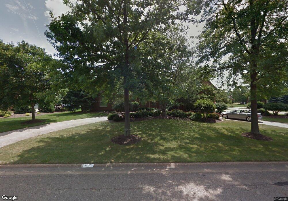
1210 Cobblefield St NE Canton, OH 44721
Estimated Value: $517,000 - $707,000
4
Beds
6
Baths
4,181
Sq Ft
$150/Sq Ft
Est. Value
About This Home
This home is located at 1210 Cobblefield St NE, Canton, OH 44721 and is currently estimated at $628,815, approximately $150 per square foot. 1210 Cobblefield St NE is a home located in Stark County with nearby schools including Charles L. Warstler Elementary School, Oakwood Middle School, and GlenOak High School.
Ownership History
Date
Name
Owned For
Owner Type
Purchase Details
Closed on
Jul 6, 2021
Sold by
Basista Michele A and Michele A Basista Revocable Tr
Bought by
Basista Robert L and Basista Michele A
Current Estimated Value
Purchase Details
Closed on
Oct 8, 2009
Sold by
Basista Michele A and Basista Robert L
Bought by
Basista Michele A and Michele A Basista Revocable Tr
Purchase Details
Closed on
Apr 9, 1992
Purchase Details
Closed on
Jul 17, 1991
Purchase Details
Closed on
Mar 26, 1991
Create a Home Valuation Report for This Property
The Home Valuation Report is an in-depth analysis detailing your home's value as well as a comparison with similar homes in the area
Home Values in the Area
Average Home Value in this Area
Purchase History
| Date | Buyer | Sale Price | Title Company |
|---|---|---|---|
| Basista Robert L | -- | None Available | |
| Basista Michele A | -- | Attorney | |
| -- | $389,000 | -- | |
| -- | $55,000 | -- | |
| -- | -- | -- |
Source: Public Records
Tax History Compared to Growth
Tax History
| Year | Tax Paid | Tax Assessment Tax Assessment Total Assessment is a certain percentage of the fair market value that is determined by local assessors to be the total taxable value of land and additions on the property. | Land | Improvement |
|---|---|---|---|---|
| 2025 | -- | $238,710 | $48,690 | $190,020 |
| 2024 | -- | $238,710 | $48,690 | $190,020 |
| 2023 | $9,706 | $205,040 | $43,930 | $161,110 |
| 2022 | $4,810 | $205,040 | $43,930 | $161,110 |
| 2021 | $9,636 | $205,040 | $43,930 | $161,110 |
| 2020 | $8,148 | $157,750 | $37,870 | $119,880 |
| 2019 | $8,080 | $157,750 | $37,870 | $119,880 |
| 2018 | $8,862 | $157,750 | $37,870 | $119,880 |
| 2017 | $8,259 | $149,910 | $35,070 | $114,840 |
| 2016 | $8,279 | $149,910 | $35,070 | $114,840 |
| 2015 | $8,003 | $149,910 | $35,070 | $114,840 |
| 2014 | $1,833 | $143,510 | $33,570 | $109,940 |
| 2013 | $3,814 | $143,510 | $33,570 | $109,940 |
Source: Public Records
Map
Nearby Homes
- 1023 55th St NE
- 5845 Royal Hill Cir NE
- 5315 Loma Linda Ln NE
- 5225 Loma Linda Ln NE
- 404 Brookpoint St NW
- 5111 Johnnycake Ridge NE
- 1920 Birk Cir NE
- 308 52nd St NW
- 4904 Market Ave N
- 808 47th St NE
- 1614 Bellview St NE
- 4654 Beverly Ave NE
- 2317 Raintree St NE
- 1573 Lancaster Gate SE
- 6473 Saint Leger Ave NE
- 1514 Lancaster Gate SE
- 2216 49th St NE
- 2533 57th St NE
- 6533 Pine Bluff Ave NE
- 2419 Bur Oak St NE
- 1224 Cobblefield St NE
- 5591 Loma Linda Ln NE
- 5577 Loma Linda Ln NE
- 1238 Cobblefield St NE
- 1211 Cobblefield St NE
- 5607 Loma Linda Ln NE
- 1225 Cobblefield St NE
- 1252 Cobblefield St NE
- 5554 Loma Linda Ln NE
- 1241 Cobblefield St NE
- 5621 Loma Linda Ln NE
- 5557 Loma Linda Ln NE
- 0 Cobblefield St NE
- 1118 Cobblefield St NE
- 5715 Loma Linda Ln NE
- 1255 Cobblefield St NE
- 1117 Cobblefield St NE
- 963 S Commons Cir NE
- 1264 Cobblefield St NE
- 1310 Chantilly Cir NE