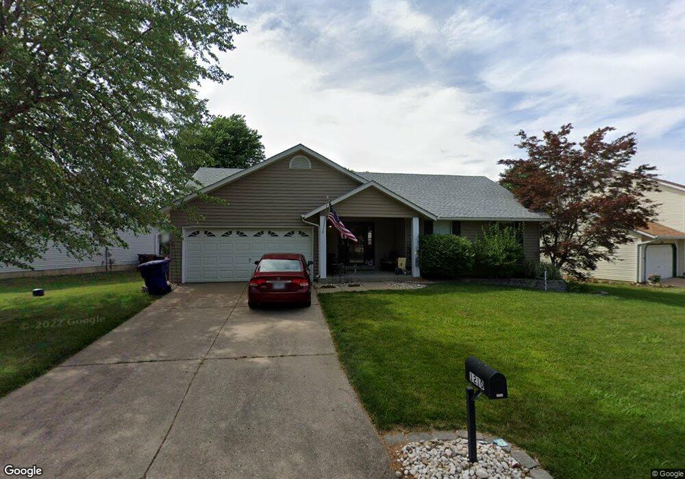
1210 Colby Dr Saint Peters, MO 63376
Estimated Value: $320,380 - $334,000
3
Beds
2
Baths
1,388
Sq Ft
$235/Sq Ft
Est. Value
About This Home
This home is located at 1210 Colby Dr, Saint Peters, MO 63376 and is currently estimated at $326,845, approximately $235 per square foot. 1210 Colby Dr is a home located in St. Charles County with nearby schools including Lewis & Clark Elementary School, Dr. Bernard J. Dubray Middle School, and Fort Zumwalt East High School.
Ownership History
Date
Name
Owned For
Owner Type
Purchase Details
Closed on
Feb 18, 2011
Sold by
Becklean Judith A and Becklean Christopher M
Bought by
Narsh Lloyd and Narsh Cindy
Current Estimated Value
Home Financials for this Owner
Home Financials are based on the most recent Mortgage that was taken out on this home.
Original Mortgage
$120,250
Outstanding Balance
$81,971
Interest Rate
4.7%
Mortgage Type
New Conventional
Estimated Equity
$244,874
Purchase Details
Closed on
Nov 30, 2004
Sold by
Wuest Ronald and Wuest Judith A
Bought by
Wuest Judith A
Home Financials for this Owner
Home Financials are based on the most recent Mortgage that was taken out on this home.
Original Mortgage
$105,000
Interest Rate
5.8%
Mortgage Type
New Conventional
Create a Home Valuation Report for This Property
The Home Valuation Report is an in-depth analysis detailing your home's value as well as a comparison with similar homes in the area
Home Values in the Area
Average Home Value in this Area
Purchase History
| Date | Buyer | Sale Price | Title Company |
|---|---|---|---|
| Narsh Lloyd | $141,500 | Assured Title Company West | |
| Wuest Judith A | -- | -- |
Source: Public Records
Mortgage History
| Date | Status | Borrower | Loan Amount |
|---|---|---|---|
| Open | Narsh Lloyd | $120,250 | |
| Previous Owner | Wuest Judith A | $105,000 |
Source: Public Records
Tax History Compared to Growth
Tax History
| Year | Tax Paid | Tax Assessment Tax Assessment Total Assessment is a certain percentage of the fair market value that is determined by local assessors to be the total taxable value of land and additions on the property. | Land | Improvement |
|---|---|---|---|---|
| 2025 | $3,809 | $55,375 | -- | -- |
| 2023 | $3,806 | $53,421 | $0 | $0 |
| 2022 | $3,191 | $41,911 | $0 | $0 |
| 2021 | $3,186 | $41,911 | $0 | $0 |
| 2020 | $3,068 | $39,107 | $0 | $0 |
| 2019 | $3,060 | $39,107 | $0 | $0 |
| 2018 | $2,825 | $34,661 | $0 | $0 |
| 2017 | $2,812 | $34,661 | $0 | $0 |
| 2016 | $2,491 | $30,599 | $0 | $0 |
| 2015 | $2,332 | $30,599 | $0 | $0 |
| 2014 | $2,161 | $27,763 | $0 | $0 |
Source: Public Records
Map
Nearby Homes
- 17 Forrel Tree Ct
- 1196 Colby Ct
- 537 Ryehill Dr
- 114 Long And Winding Rd
- 99 Long And Winding Rd
- 404 Kaliedoscope Ln
- 22 Shadow Creek Dr
- 10 Eagles Glen Ct
- 1126 Spencer Rd
- 1309 Whispering Ridge Ln
- 19 Galaxy Dr
- 44 Dogwood Ln
- 47 Dogwood Ln
- 5 Victoria Square
- 29 Vanguard Dr
- 88 Spencer Trail
- 54 Dogwood Ln
- 31 Carriage Way W
- 26 Jane Dr
- 4 Trailview Ct