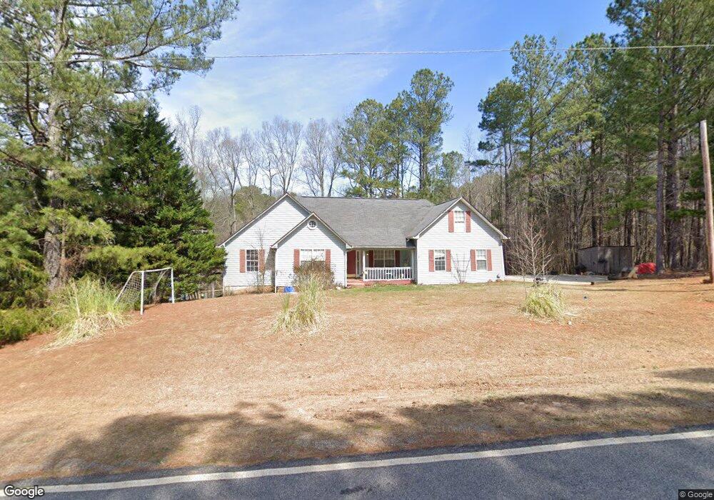
1210 Cooper Gin Rd Statham, GA 30666
Estimated Value: $412,000 - $594,000
6
Beds
3
Baths
1,687
Sq Ft
$287/Sq Ft
Est. Value
About This Home
This home is located at 1210 Cooper Gin Rd, Statham, GA 30666 and is currently estimated at $484,739, approximately $287 per square foot. 1210 Cooper Gin Rd is a home located in Oconee County with nearby schools including Rocky Branch Elementary School, Malcom Bridge Middle School, and North Oconee High School.
Ownership History
Date
Name
Owned For
Owner Type
Purchase Details
Closed on
Jun 14, 2012
Sold by
Magnolia Valley Properties
Bought by
Chasteen Regina L
Current Estimated Value
Purchase Details
Closed on
Aug 17, 1998
Sold by
Alewine Alewine S and Alewine Todd
Bought by
Chasteen Stanley G
Purchase Details
Closed on
Aug 15, 1995
Bought by
Alewine Alewine S and Alewine Todd
Create a Home Valuation Report for This Property
The Home Valuation Report is an in-depth analysis detailing your home's value as well as a comparison with similar homes in the area
Home Values in the Area
Average Home Value in this Area
Purchase History
| Date | Buyer | Sale Price | Title Company |
|---|---|---|---|
| Chasteen Regina L | -- | -- | |
| Chasteen Stanley G | $130,900 | -- | |
| Alewine Alewine S | $7,500 | -- |
Source: Public Records
Tax History Compared to Growth
Tax History
| Year | Tax Paid | Tax Assessment Tax Assessment Total Assessment is a certain percentage of the fair market value that is determined by local assessors to be the total taxable value of land and additions on the property. | Land | Improvement |
|---|---|---|---|---|
| 2024 | $2,563 | $133,316 | $37,599 | $95,717 |
| 2023 | $2,491 | $124,167 | $34,815 | $89,352 |
| 2022 | $2,296 | $107,008 | $27,852 | $79,156 |
| 2021 | $2,150 | $92,870 | $21,739 | $71,131 |
| 2020 | $2,095 | $90,344 | $21,313 | $69,031 |
| 2019 | $2,011 | $86,731 | $17,761 | $68,970 |
| 2018 | $1,923 | $81,184 | $15,444 | $65,740 |
| 2017 | $1,726 | $72,868 | $14,040 | $58,828 |
| 2016 | $1,675 | $70,728 | $11,876 | $58,852 |
| 2015 | $1,689 | $71,154 | $11,876 | $59,278 |
| 2014 | $1,488 | $61,254 | $10,797 | $50,458 |
| 2013 | -- | $59,856 | $10,394 | $49,461 |
Source: Public Records
Map
Nearby Homes
- 0 Hebron Church Rd Unit 25176734
- 0 Hebron Church Rd Unit 10624104
- 1201 Dove Creek Cir
- 1849 Bradley Gin Rd
- 0 Monroe Hwy Unit 1025333
- 142 Brockton Way Unit 9
- Marlene Plan at Westland
- 1547 Westland Ct
- Hampshire Plan at Westland
- 1621 Westland Ct
- Jean Lee Plan at Westland
- Edison Plan at Westland
- 1547 Westland Ct Unit 2015
- Summit Plan at Westland
- 111 Mockingbird Ln Unit 15
- 291 Mockingbird Ln Unit 21
- 271 Mockingbird Ln Unit 20
- 247 Mockingbird Ln Unit 19
- 225 Mockingbird Ln Unit 18
- 199 Mockingbird Ln Unit 17
- 1130 Cooper Gin Rd
- 1230 Cooper Gin Rd
- 1170 Cooper Gin Rd
- 1151 Cooper Gin Rd
- n/a Cooper Gin Rd
- 1092 Cooper Gin Rd
- 1080 Cooper Gin Rd
- 1291 Cooper Gin Rd
- 1370 Cooper Gin Rd
- 1240 Cooper Gin Rd
- 1741 Hebron Church Rd
- 1741 Hebron Church Rd
- 1360 Treadwell Bridge Rd
- 1021 Cooper Gin Rd
- 1290 Treadwell Bridge Rd
- 1327 Cooper Gin Rd
- 1230 Treadwell Bridge Rd Unit Lot 6
- 1230 Treadwell Bridge Rd Unit Lot 3
- 1281 Treadwell Bridge Rd
- 1335 Cooper Gin Rd