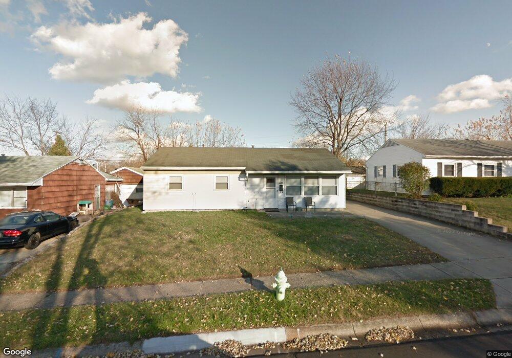
1210 Date St Fairborn, OH 45324
Estimated Value: $158,000 - $162,143
3
Beds
1
Bath
1,008
Sq Ft
$159/Sq Ft
Est. Value
About This Home
This home is located at 1210 Date St, Fairborn, OH 45324 and is currently estimated at $159,786, approximately $158 per square foot. 1210 Date St is a home located in Greene County with nearby schools including Fairborn Primary School, Fairborn Intermediate School, and Fairborn Middle School.
Ownership History
Date
Name
Owned For
Owner Type
Purchase Details
Closed on
Dec 17, 2021
Sold by
Haddix Properties Llc
Bought by
Hunley Stephanie L and Hunley Sandra L
Current Estimated Value
Purchase Details
Closed on
Jul 14, 2017
Sold by
Haddix Trust
Bought by
Haddix Family Trust
Purchase Details
Closed on
Jul 3, 2003
Sold by
Haddix Joe and Haddix Eliza C
Bought by
Haddix Joe and Joe Haddix Revocable Living Trust
Purchase Details
Closed on
May 29, 2001
Sold by
Haddix Joe and Haddix Eliza C
Bought by
Haddix Joe and Joe Haddix Revocable Living Trust
Purchase Details
Closed on
Apr 6, 1994
Bought by
Haddix Joe Trustee
Create a Home Valuation Report for This Property
The Home Valuation Report is an in-depth analysis detailing your home's value as well as a comparison with similar homes in the area
Home Values in the Area
Average Home Value in this Area
Purchase History
| Date | Buyer | Sale Price | Title Company |
|---|---|---|---|
| Hunley Stephanie L | $124,900 | First American Title | |
| Haddix Family Trust | -- | -- | |
| Haddix Joe | -- | Tri Source Title Agency Inc | |
| Haddix Joe | -- | Tri Source Title Agency Inc | |
| Haddix Joe | -- | -- | |
| Haddix Joe Trustee | $55,600 | -- |
Source: Public Records
Tax History
| Year | Tax Paid | Tax Assessment Tax Assessment Total Assessment is a certain percentage of the fair market value that is determined by local assessors to be the total taxable value of land and additions on the property. | Land | Improvement |
|---|---|---|---|---|
| 2024 | $1,751 | $36,290 | $8,190 | $28,100 |
| 2023 | $1,738 | $36,290 | $8,190 | $28,100 |
| 2022 | $1,377 | $24,200 | $6,300 | $17,900 |
| 2021 | $1,397 | $24,200 | $6,300 | $17,900 |
| 2020 | $1,404 | $24,200 | $6,300 | $17,900 |
| 2019 | $1,410 | $23,200 | $6,380 | $16,820 |
| 2018 | $1,424 | $23,200 | $6,380 | $16,820 |
| 2017 | $1,394 | $23,200 | $6,380 | $16,820 |
| 2016 | $1,430 | $23,290 | $6,380 | $16,910 |
| 2015 | $1,367 | $23,290 | $6,380 | $16,910 |
| 2014 | $1,259 | $23,290 | $6,380 | $16,910 |
Source: Public Records
Map
Nearby Homes
- 1267 Beech St
- 1222 Hemlock Dr
- 1108 Lexington Ave
- 0 W Garland Ave
- 135 E Garland Ave
- 1878 Wildflower Rd
- 239-241 Euclid Ave
- 201 State St
- 256 Euclid Ave
- 1408 Mapleridge Dr
- 38 Lindway Dr
- 1463 Maplegrove Dr
- 45 Regina Dr
- 349 Forest St
- 849 Flintridge Dr
- 153 Diana Ln N
- Lot 4 W Dayton-Yellow Springs Rd
- Lot 3 W Dayton-Yellow Springs Rd
- 1531-1533 Miami Ave
- 504 Greene St
- 1204 Date St
- 1216 Date St
- 1203 S Central Ave
- 1209 S Central Ave
- 1176 Date St
- 1175 S Central Ave
- 1222 Date St
- 1215 S Central Ave
- 1211 Date St
- 1217 Date St
- 1205 Date St
- 1169 S Central Ave
- 1170 Date St
- 7515 Bluff Blvd Unit 35
- 1223 Date St
- 1228 Date St
- 1177 Date St
- 1163 S Central Ave
- 1164 Date St
- 127 Ebony Ln
Your Personal Tour Guide
Ask me questions while you tour the home.