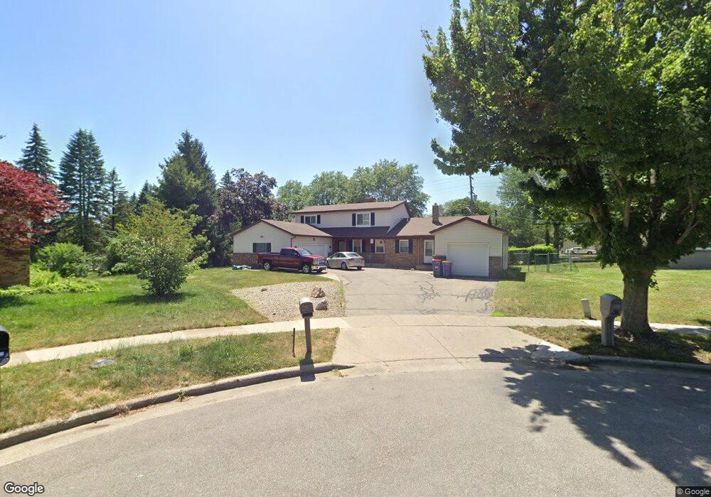
1210 Drexel Ct NE Unit 1212 Grand Rapids, MI 49505
North East Citizens Action NeighborhoodEstimated Value: $555,000 - $589,015
6
Beds
6
Baths
3,188
Sq Ft
$180/Sq Ft
Est. Value
About This Home
This home is located at 1210 Drexel Ct NE Unit 1212, Grand Rapids, MI 49505 and is currently estimated at $574,004, approximately $180 per square foot. 1210 Drexel Ct NE Unit 1212 is a home located in Kent County with nearby schools including Riverside Middle School, Union High School, and Lighthouse Academy - Waalkes Campus.
Ownership History
Date
Name
Owned For
Owner Type
Purchase Details
Closed on
Jul 31, 2014
Sold by
Witherspoon Willie and Witherspoon Alice
Bought by
Witherspoon Alice
Current Estimated Value
Purchase Details
Closed on
Mar 16, 2004
Sold by
Witherspoon Alice and Estate Of Minnie Mae Lawrence
Bought by
Witherspoon Alice and Estate Of Minnie Mae Lawrence
Purchase Details
Closed on
Apr 24, 1997
Bought by
Jailor Jailor J and Jailor G
Purchase Details
Closed on
Dec 18, 1995
Sold by
Adams Adams J J and Adams Moaier H
Bought by
Moaier Hamid and Witherspoon Alice
Create a Home Valuation Report for This Property
The Home Valuation Report is an in-depth analysis detailing your home's value as well as a comparison with similar homes in the area
Home Values in the Area
Average Home Value in this Area
Purchase History
| Date | Buyer | Sale Price | Title Company |
|---|---|---|---|
| Witherspoon Alice | -- | None Available | |
| Witherspoon Alice | -- | -- | |
| Jailor Jailor J | $169,900 | -- | |
| Moaier Hamid | $140,000 | -- |
Source: Public Records
Tax History Compared to Growth
Tax History
| Year | Tax Paid | Tax Assessment Tax Assessment Total Assessment is a certain percentage of the fair market value that is determined by local assessors to be the total taxable value of land and additions on the property. | Land | Improvement |
|---|---|---|---|---|
| 2025 | $4,060 | $293,800 | $0 | $0 |
| 2024 | $4,060 | $268,800 | $0 | $0 |
| 2023 | $3,886 | $189,700 | $0 | $0 |
| 2022 | $197 | $177,400 | $0 | $0 |
| 2021 | $191 | $167,400 | $0 | $0 |
| 2020 | $3,635 | $146,700 | $0 | $0 |
| 2019 | $3,773 | $137,700 | $0 | $0 |
| 2018 | $3,649 | $131,800 | $0 | $0 |
| 2017 | $3,555 | $114,900 | $0 | $0 |
| 2016 | $3,588 | $105,100 | $0 | $0 |
| 2015 | $3,369 | $105,100 | $0 | $0 |
| 2013 | -- | $85,000 | $0 | $0 |
Source: Public Records
Map
Nearby Homes
- 1119 Kentwood Dr NE
- 1237 Dale Ct NE
- 1824 Herrick Ave NE
- 1666 Carlton Ave NE
- 1335 Knapp St NE
- 1444 Sweet St NE
- 2027 Joan Ave NE
- 1848 Emerald Ave NE
- 2100 Dawson Ave NE
- 1452 Carlton Ave NE
- 1119 Spencer St NE
- 1524 Sweet St NE
- 1825 Meadowfield Dr NE
- 1757 Westlane Dr NE
- 1339 Fuller Ave NE
- 1455 Ball Ave NE
- 1256 Diamond Ave NE
- 921 Eleanor St NE
- 1228 Spring Ave NE
- 1238 Carlton Ave NE
- 1210 Drexel Ct NE
- 1218 Drexel Ct NE
- 1207 Drexel Ct NE
- 1207 Drexel Ct NE Unit 1209
- 1209 Drexel Ct NE
- 2034 Fuller Ave NE
- 1217 Travis St NE
- 1232 Drexel Ct NE
- 1138 Kentwood St NE
- 1217 Drexel Ct NE
- 1135 Kentwood St NE
- 1225 Travis St NE
- 1231 Drexel Ct NE
- 1130 Kentwood Dr NE
- 1130 Kentwood St NE
- 1733 Fuller Ave NE
- 1131 Kentwood St NE
- 1231 Travis St NE
- 1801 Fuller Ave NE
- 1725 Fuller Ave NE