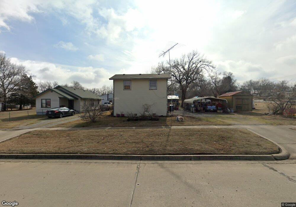
1210 E 15th St Pawhuska, OK 74056
Estimated Value: $111,000 - $116,000
3
Beds
2
Baths
1,625
Sq Ft
$70/Sq Ft
Est. Value
About This Home
This home is located at 1210 E 15th St, Pawhuska, OK 74056 and is currently estimated at $113,500, approximately $69 per square foot. 1210 E 15th St is a home with nearby schools including Indian Camp Elementary School, Pawhuska Elementary School, and Pawhuska Middle School.
Ownership History
Date
Name
Owned For
Owner Type
Purchase Details
Closed on
Nov 4, 2019
Sold by
Milleson Charlotte J and Milleson Wilfred I
Bought by
Milleson Lance and Milleson Bren
Current Estimated Value
Purchase Details
Closed on
Aug 19, 2010
Sold by
Milleson Lance R and Milleson Pamela J
Bought by
Milleson Charlotte J and Milleson Wilfred I
Purchase Details
Closed on
Aug 3, 2010
Sold by
Milleson Charlotte J and Milleson Wilfred I
Bought by
Milleson Lance R
Create a Home Valuation Report for This Property
The Home Valuation Report is an in-depth analysis detailing your home's value as well as a comparison with similar homes in the area
Home Values in the Area
Average Home Value in this Area
Purchase History
| Date | Buyer | Sale Price | Title Company |
|---|---|---|---|
| Milleson Lance | -- | None Available | |
| Milleson Charlotte J | -- | None Available | |
| Milleson Lance R | -- | None Available |
Source: Public Records
Tax History Compared to Growth
Tax History
| Year | Tax Paid | Tax Assessment Tax Assessment Total Assessment is a certain percentage of the fair market value that is determined by local assessors to be the total taxable value of land and additions on the property. | Land | Improvement |
|---|---|---|---|---|
| 2025 | $496 | $5,367 | $476 | $4,891 |
| 2024 | $472 | $5,111 | $453 | $4,658 |
| 2023 | $472 | $4,868 | $432 | $4,436 |
| 2022 | $413 | $4,415 | $391 | $4,024 |
| 2021 | $395 | $4,415 | $391 | $4,024 |
| 2020 | $0 | $4,415 | $391 | $4,024 |
| 2019 | $370 | $4,286 | $356 | $3,930 |
| 2018 | $370 | $4,162 | $322 | $3,840 |
| 2017 | $0 | $3,435 | $322 | $3,113 |
| 2016 | -- | $3,335 | $322 | $3,013 |
| 2015 | -- | $3,238 | $322 | $2,916 |
| 2014 | -- | $3,144 | $322 | $2,822 |
| 2013 | $279 | $2,933 | $322 | $2,611 |
Source: Public Records
Map
Nearby Homes
- 1322 Boundary Ave
- 1119 E 13th St
- 1205 Brenner Ave
- 421 E 11th St
- 0 Prudom Ave
- 1419 Leahy Ave
- 1719 Leahy Ave
- 1700 Grandview Ave
- 1715 Grandview Ave
- 101 E 11th St
- 320 E 7th St
- 225 E 6th St
- 501 W 17th St
- 102 Oak Rd
- 1127 5205 Rd
- 627 Tinker Ave
- 00000 County Road 2801
- 2951 County Road 2625
- 0 Rd Unit HMS2583311
- 002 Cr 5101
- 1212 E 15th St
- 1412 Smith Ave
- 1220 E 15th St
- 1423 E Boundary St
- 1116 E 15th St
- 1215 E 14th St
- 1201 E 14th St
- 1419 E Boundary St
- 1413 Smith Ave
- 1219 E 14th St
- 1227 E 14th St
- 1117 E 14th St
- 1229 E 14th St
- 1110 E 15th St
- 1422 Boundary Ave
- 1424 Boundary Ave
- 1416 Brenner Ave
- 1424 E Boundary St
- 1113 E 14th St
- 1406 E Boundary St