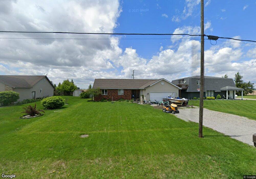
1210 Emerald Rd Paulding, OH 45879
Estimated Value: $156,520 - $180,000
3
Beds
2
Baths
1,372
Sq Ft
$123/Sq Ft
Est. Value
About This Home
This home is located at 1210 Emerald Rd, Paulding, OH 45879 and is currently estimated at $168,840, approximately $123 per square foot. 1210 Emerald Rd is a home located in Paulding County with nearby schools including Paulding High School.
Ownership History
Date
Name
Owned For
Owner Type
Purchase Details
Closed on
Jan 24, 2025
Sold by
Schlueter Michael V and Schlueter Andrea N
Bought by
Schlueter Michael V and Schlueter Andrea N
Current Estimated Value
Purchase Details
Closed on
Jan 23, 2025
Sold by
Webster Dionicia R
Bought by
Schlueter Michael V
Purchase Details
Closed on
Jul 29, 2010
Sold by
Labounty Jason R and Labounty Melissa K
Bought by
Webster Dionicia R
Purchase Details
Closed on
Nov 26, 2003
Sold by
Taylor Bradley R
Bought by
Webster Dionicia R
Purchase Details
Closed on
May 13, 1996
Bought by
Webster Dionicia R
Create a Home Valuation Report for This Property
The Home Valuation Report is an in-depth analysis detailing your home's value as well as a comparison with similar homes in the area
Home Values in the Area
Average Home Value in this Area
Purchase History
| Date | Buyer | Sale Price | Title Company |
|---|---|---|---|
| Schlueter Michael V | -- | None Listed On Document | |
| Schlueter Michael V | -- | None Listed On Document | |
| Schlueter Michael V | $5,000 | None Listed On Document | |
| Schlueter Michael V | $5,000 | None Listed On Document | |
| Webster Dionicia R | $89,900 | None Available | |
| Webster Dionicia R | $80,500 | -- | |
| Webster Dionicia R | $69,000 | -- |
Source: Public Records
Tax History
| Year | Tax Paid | Tax Assessment Tax Assessment Total Assessment is a certain percentage of the fair market value that is determined by local assessors to be the total taxable value of land and additions on the property. | Land | Improvement |
|---|---|---|---|---|
| 2025 | $2,370 | $53,700 | $7,110 | $46,590 |
| 2024 | $2,370 | $39,760 | $5,250 | $34,510 |
| 2023 | $1,823 | $39,760 | $5,250 | $34,510 |
| 2022 | $1,771 | $39,760 | $5,250 | $34,510 |
| 2021 | $1,496 | $29,930 | $4,730 | $25,200 |
| 2020 | $1,344 | $29,930 | $4,730 | $25,200 |
| 2019 | $1,355 | $28,740 | $4,730 | $24,010 |
| 2018 | $1,291 | $28,740 | $4,730 | $24,010 |
| 2017 | $1,292 | $28,740 | $4,730 | $24,010 |
| 2016 | $1,292 | $28,740 | $4,730 | $24,010 |
| 2015 | $1,251 | $28,250 | $4,730 | $23,520 |
| 2014 | $1,245 | $28,250 | $4,730 | $23,520 |
| 2013 | $1,414 | $28,250 | $4,730 | $23,520 |
Source: Public Records
Map
Nearby Homes
- 13688 Kay St
- 1065 Emerald Rd
- 741 Tom Tim Dr
- 830 N Walnut St
- 780 N Williams St
- 516 N Williams St
- 406 N Cherry St
- 301 N Main St
- 701 E Wayne St
- 215 N Dewitt St
- 614 W Jackson St
- 780 W Jackson St
- 520 W Wayne St
- 717 W Harrison St
- 742 E Perry St
- 714 W Wayne St
- 15010 U S 127
- 11051 Road 93
- 225 2nd St
- 17341 Road 139
- 1214 Emerald Rd
- 1206 Emerald Rd
- 1222 Emerald Rd
- 1205 Emerald Rd
- 1228 Emerald Rd
- 1202 Emerald Rd
- 1209 Emerald Rd
- 1230 Emerald Rd
- 1236 Emerald Rd
- 1170 Emerald Rd
- 705 Johnson Rd
- 1242 Emerald Rd
- 12492 Buckeye Dr
- 707 Johnson Rd
- 1167 Emerald Rd
- 1162 Emerald Rd
- 1248 Emerald Rd
- 1163 Emerald Rd
- 12495 Buckeye Dr
- 13007 Kay St
Your Personal Tour Guide
Ask me questions while you tour the home.