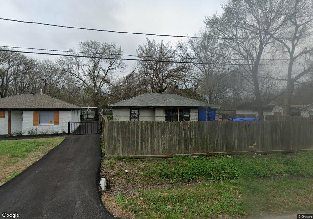
1210 Eubanks St Houston, TX 77022
Northside-Northline NeighborhoodEstimated Value: $183,000 - $261,000
4
Beds
2
Baths
1,862
Sq Ft
$117/Sq Ft
Est. Value
About This Home
This home is located at 1210 Eubanks St, Houston, TX 77022 and is currently estimated at $217,510, approximately $116 per square foot. 1210 Eubanks St is a home located in Harris County with nearby schools including Janowski Elementary School, Burbank Middle School, and Sam Houston Math, Science & Technology Center.
Ownership History
Date
Name
Owned For
Owner Type
Purchase Details
Closed on
Apr 17, 2014
Sold by
Saldierna Stacy S and Saldierna Francisco E
Bought by
Guerrero Maria A Martinez
Current Estimated Value
Home Financials for this Owner
Home Financials are based on the most recent Mortgage that was taken out on this home.
Original Mortgage
$53,200
Interest Rate
4.32%
Mortgage Type
Purchase Money Mortgage
Create a Home Valuation Report for This Property
The Home Valuation Report is an in-depth analysis detailing your home's value as well as a comparison with similar homes in the area
Home Values in the Area
Average Home Value in this Area
Purchase History
| Date | Buyer | Sale Price | Title Company |
|---|---|---|---|
| Guerrero Maria A Martinez | -- | None Available |
Source: Public Records
Mortgage History
| Date | Status | Borrower | Loan Amount |
|---|---|---|---|
| Closed | Guerrero Maria A Martinez | $53,200 |
Source: Public Records
Tax History Compared to Growth
Tax History
| Year | Tax Paid | Tax Assessment Tax Assessment Total Assessment is a certain percentage of the fair market value that is determined by local assessors to be the total taxable value of land and additions on the property. | Land | Improvement |
|---|---|---|---|---|
| 2025 | $2,041 | $181,906 | $79,382 | $102,524 |
| 2024 | $2,041 | $173,491 | $72,854 | $100,637 |
| 2023 | $2,041 | $204,516 | $44,391 | $160,125 |
| 2022 | $3,175 | $170,001 | $44,391 | $125,610 |
| 2021 | $3,055 | $136,166 | $44,391 | $91,775 |
| 2020 | $2,885 | $124,707 | $44,391 | $80,316 |
| 2019 | $2,741 | $122,577 | $36,558 | $86,019 |
| 2018 | $1,702 | $98,474 | $30,552 | $67,922 |
| 2017 | $2,490 | $98,474 | $30,552 | $67,922 |
| 2016 | $2,563 | $108,977 | $28,724 | $80,253 |
| 2015 | $2,368 | $92,134 | $20,890 | $71,244 |
| 2014 | $2,368 | $92,134 | $20,890 | $71,244 |
Source: Public Records
Map
Nearby Homes
- 8109 W Hardy Rd
- 1016 Apache St
- 743 Apache St
- 1104 Charnwood St
- 1817 Mcdaniel St
- 741 Mcdaniel St
- 726 Mcdaniel St
- 729 Caperton St
- 714 Apache St
- 631 Apache St
- 2017 Sadler St
- 8411 Berry Brush Ln
- 2401 Mcdaniel St
- 8402 Berry Green Ln
- 802 Berry Sage Ln
- 1009 Wainwright St
- 1928 E Crosstimbers St
- 8718 Brannon St
- 2413 E Crosstimbers St
- 1207 Firnat St
- 1202 Eubanks St
- 1218 Eubanks St
- 1222 Eubanks St
- 1112 Eubanks St
- 1205 Eubanks St
- 7817 W Hardy Rd
- 1110 Eubanks St
- 1203 Eubanks St
- 1111 Eubanks St
- 1106 Eubanks St
- 1107 Eubanks St
- 1222 Apache St
- 1218 Apache St
- 1212 Apache St
- 1102 Eubanks St
- 1105 Eubanks St
- 1103 Mcdaniel St
- 1202 Apache St
- 1103 Eubanks St
- 1100 Eubanks St