Estimated Value: $104,000 - $126,000
Studio
1
Bath
1,093
Sq Ft
$103/Sq Ft
Est. Value
About This Home
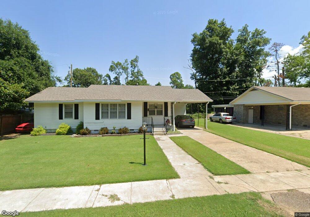
This home is located at 1210 Forrest Ave E, Wynne, AR 72396 and is currently estimated at $112,255, approximately $102 per square foot. 1210 Forrest Ave E is a home located in Cross County with nearby schools including Wynne Primary School, Wynne Intermediate School, and Wynne Junior High School.
Ownership History
Date
Name
Owned For
Owner Type
Purchase Details
Closed on
Dec 16, 2015
Sold by
Jackson Bobby L and Jackson Lisa G
Bought by
Stonecipher Amy
Current Estimated Value
Home Financials for this Owner
Home Financials are based on the most recent Mortgage that was taken out on this home.
Original Mortgage
$67,866
Outstanding Balance
$53,577
Interest Rate
3.98%
Estimated Equity
$58,678
Purchase Details
Closed on
Mar 18, 2009
Sold by
Swindle Ronald K and Swindle Bedford E
Bought by
Jackson Bobby L and Jackson Lisa G
Home Financials for this Owner
Home Financials are based on the most recent Mortgage that was taken out on this home.
Original Mortgage
$35,115
Interest Rate
5.14%
Purchase Details
Closed on
Feb 28, 2001
Bought by
Swindle Jessie E
Purchase Details
Closed on
Jun 24, 1992
Bought by
Swindle Bedford E
Create a Home Valuation Report for This Property
The Home Valuation Report is an in-depth analysis detailing your home's value as well as a comparison with similar homes in the area
Purchase History
We collect this data history from publicly available records. To have your information removed, we recommend requesting removal directly through your county’s website.
| Date | Buyer | Sale Price | Title Company |
|---|---|---|---|
| Stonecipher Amy | $65,000 | -- | |
| Jackson Bobby L | $57,000 | None Available | |
| Swindle Jessie E | -- | -- | |
| Swindle Bedford E | -- | -- |
Source: Public Records
Mortgage History
We collect this data history from publicly available records. To have your information removed, we recommend requesting removal directly through your county’s website.
| Date | Status | Borrower | Loan Amount |
|---|---|---|---|
| Open | Stonecipher Amy | $67,866 | |
| Previous Owner | Jackson Bobby L | $35,115 |
Source: Public Records
Tax History
| Year | Tax Paid | Tax Assessment Tax Assessment Total Assessment is a certain percentage of the fair market value that is determined by local assessors to be the total taxable value of land and additions on the property. | Land | Improvement |
|---|---|---|---|---|
| 2025 | $130 | $22,220 | $3,320 | $18,900 |
| 2024 | $195 | $14,070 | $2,900 | $11,170 |
| 2023 | $271 | $14,070 | $2,900 | $11,170 |
| 2022 | $321 | $14,070 | $2,900 | $11,170 |
| 2021 | $320 | $14,070 | $2,900 | $11,170 |
| 2020 | $288 | $14,070 | $2,900 | $11,170 |
| 2019 | $257 | $12,760 | $2,620 | $10,140 |
| 2018 | $282 | $12,760 | $2,620 | $10,140 |
| 2017 | $632 | $12,760 | $2,620 | $10,140 |
| 2016 | $282 | $12,760 | $2,620 | $10,140 |
| 2015 | $282 | $12,760 | $2,620 | $10,140 |
| 2014 | $632 | $11,430 | $2,390 | $9,040 |
Source: Public Records
Map
Nearby Homes
- 1206 Forrest Ave E
- 226 Nathan Dr E
- 1112 Poplar Ave E
- 108 Nathan Dr E
- 109 Nathan Dr E
- 1203 Marion Dr
- 909 Killough Rd N
- 1008 Killough Rd N
- 621 Lemons St N
- 1420 Hamilton Ave E
- 1729 N Lemons St
- 10 Shannon Dr
- 1308 Killough Rd N
- 809 Forrest Ave E
- 802 Poplar Ave E
- 39 Morningside Dr
- 813 Hamilton Ave E
- 222 Hamlin St S
- 1448 Killough Rd N
- 8 Acres Arkansas 1
- 310 Nathan Dr E
- 1212 Forrest Ave E
- 807 Pinewood Cove
- 1207 Forrest Ave E
- 1209 Forrest Ave E
- 1205 Forrest Ave E
- 809 Pinewood Cove
- 304 Nathan Dr E
- 1251 Forrest Ave E
- 309 Nathan Dr E
- 1302 Forrest Ave E
- 1127 Forrest Ave E
- 305 Nathan Dr E
- 805 Pinewood Cove
- 1303 Forrest Ave E
- 811 Pinewood Cove
- 1123 Forrest Ave E
- 1208 Poplar Ave E
- 1204 Poplar Ave E
- 301 Nathan Dr E
Your Personal Tour Guide
Ask me questions while you tour the home.