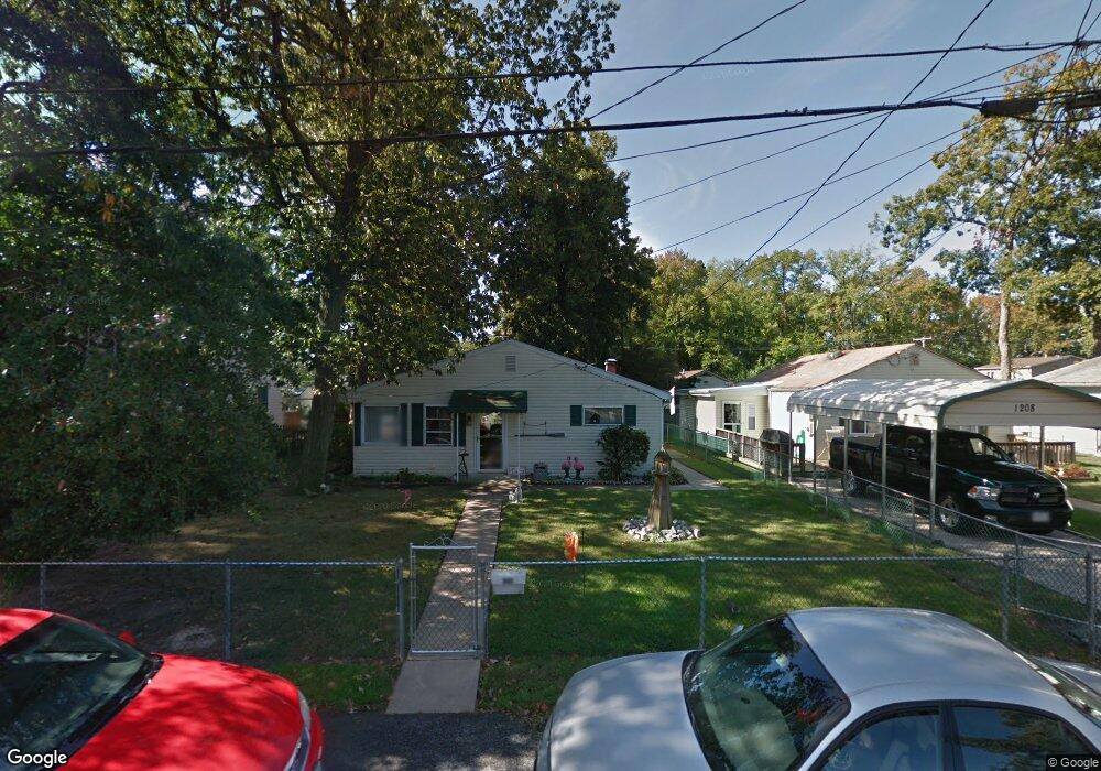
1210 Fourth Rd Middle River, MD 21220
Estimated Value: $287,000 - $324,000
Studio
1
Bath
1,312
Sq Ft
$232/Sq Ft
Est. Value
About This Home
This home is located at 1210 Fourth Rd, Middle River, MD 21220 and is currently estimated at $304,913, approximately $232 per square foot. 1210 Fourth Rd is a home located in Baltimore County with nearby schools including Hawthorne Elementary School, Stemmers Run Middle School, and Kenwood High.
Ownership History
Date
Name
Owned For
Owner Type
Purchase Details
Closed on
Jun 12, 2017
Sold by
Wetzelberger Richard Joseph and Wetzelberger Emma V
Bought by
Sauer Stephanie
Current Estimated Value
Home Financials for this Owner
Home Financials are based on the most recent Mortgage that was taken out on this home.
Original Mortgage
$162,011
Outstanding Balance
$136,493
Interest Rate
4.5%
Mortgage Type
FHA
Estimated Equity
$168,420
Purchase Details
Closed on
Mar 12, 2004
Sold by
Wetzelberger Richard Joseph
Bought by
Wetzelberger Richard Joseph and Wetzelberger Emma V
Purchase Details
Closed on
Sep 24, 1987
Sold by
Spicer John Delbert
Bought by
Wetzelberger Richard Joseph
Create a Home Valuation Report for This Property
The Home Valuation Report is an in-depth analysis detailing your home's value as well as a comparison with similar homes in the area
Home Values in the Area
Average Home Value in this Area
Purchase History
| Date | Buyer | Sale Price | Title Company |
|---|---|---|---|
| Sauer Stephanie | $165,000 | Lakeside Title Co | |
| Wetzelberger Richard Joseph | -- | -- | |
| Wetzelberger Richard Joseph | -- | -- | |
| Wetzelberger Richard Joseph | $57,000 | -- |
Source: Public Records
Mortgage History
| Date | Status | Borrower | Loan Amount |
|---|---|---|---|
| Open | Sauer Stephanie | $162,011 |
Source: Public Records
Tax History
| Year | Tax Paid | Tax Assessment Tax Assessment Total Assessment is a certain percentage of the fair market value that is determined by local assessors to be the total taxable value of land and additions on the property. | Land | Improvement |
|---|---|---|---|---|
| 2025 | $2,737 | $218,067 | -- | -- |
| 2024 | $2,737 | $198,633 | -- | -- |
| 2023 | $1,319 | $179,200 | $60,000 | $119,200 |
| 2022 | $2,722 | $170,400 | $0 | $0 |
| 2021 | $2,206 | $161,600 | $0 | $0 |
| 2020 | $2,380 | $152,800 | $60,000 | $92,800 |
| 2019 | $2,098 | $140,867 | $0 | $0 |
| 2018 | $2,079 | $128,933 | $0 | $0 |
| 2017 | $1,927 | $117,000 | $0 | $0 |
| 2016 | $1,661 | $117,000 | $0 | $0 |
| 2015 | $1,661 | $117,000 | $0 | $0 |
| 2014 | $1,661 | $122,400 | $0 | $0 |
Source: Public Records
Map
Nearby Homes
- 1306 Third Rd
- 21 Dogwood Dr
- 40 Dogwood Dr
- 34 Dogwood Dr
- 60 Dogwood Dr
- 1318 Wilson Point Rd
- 116 Kingston Park Ln
- 1507 Shore Rd
- 725 Kingston Rd
- 84 Kingston Park Ln
- 203 Antietam Rd
- 2218 Southorn Rd
- 2224 Middleborough Rd
- 221 Antietam Rd
- 2222 Graythorn Rd
- 2247 Graythorn Rd
- 78 W Kingston Park Ln
- 522 Grovethorn Rd
- 2162 Vailthorn Rd
- 215 Nanticoke Rd
Your Personal Tour Guide
Ask me questions while you tour the home.