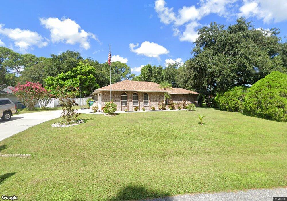
1210 Grogan Ave NE Palm Bay, FL 32907
Estimated Value: $387,000 - $412,000
4
Beds
3
Baths
2,135
Sq Ft
$188/Sq Ft
Est. Value
About This Home
This home is located at 1210 Grogan Ave NE, Palm Bay, FL 32907 and is currently estimated at $401,363, approximately $187 per square foot. 1210 Grogan Ave NE is a home located in Brevard County with nearby schools including Lockmar Elementary School, Central Middle School, and Palm Bay Magnet Senior High School.
Ownership History
Date
Name
Owned For
Owner Type
Purchase Details
Closed on
Feb 12, 2010
Sold by
Mckinley Ray
Bought by
Reinecke Kevin S and Reinecke Jennifer R
Current Estimated Value
Purchase Details
Closed on
May 31, 2001
Sold by
Campbell Fisley
Bought by
Mckinley Ray and Mckinley Icylin D
Home Financials for this Owner
Home Financials are based on the most recent Mortgage that was taken out on this home.
Original Mortgage
$113,600
Interest Rate
7.11%
Purchase Details
Closed on
Jun 25, 1997
Sold by
Fisley Campbell & Edna L Campbell Tr
Bought by
Campbell Fisley
Purchase Details
Closed on
Dec 6, 1993
Sold by
Campbell Fisely and Campbell Edna L
Bought by
Fisely Campbell & Edna L Campbell Tr
Create a Home Valuation Report for This Property
The Home Valuation Report is an in-depth analysis detailing your home's value as well as a comparison with similar homes in the area
Home Values in the Area
Average Home Value in this Area
Purchase History
| Date | Buyer | Sale Price | Title Company |
|---|---|---|---|
| Reinecke Kevin S | $112,500 | Security First Title & Escro | |
| Mckinley Ray | $142,000 | -- | |
| Campbell Fisley | -- | -- | |
| Fisely Campbell & Edna L Campbell Tr | -- | -- |
Source: Public Records
Mortgage History
| Date | Status | Borrower | Loan Amount |
|---|---|---|---|
| Previous Owner | Mckinley Ray | $113,600 |
Source: Public Records
Tax History Compared to Growth
Tax History
| Year | Tax Paid | Tax Assessment Tax Assessment Total Assessment is a certain percentage of the fair market value that is determined by local assessors to be the total taxable value of land and additions on the property. | Land | Improvement |
|---|---|---|---|---|
| 2025 | $1,478 | $120,590 | -- | -- |
| 2024 | $1,431 | $117,200 | -- | -- |
| 2023 | $1,431 | $113,790 | $0 | $0 |
| 2022 | $1,353 | $110,480 | $0 | $0 |
| 2021 | $1,368 | $107,270 | $0 | $0 |
| 2020 | $1,337 | $105,790 | $0 | $0 |
| 2019 | $1,541 | $103,420 | $0 | $0 |
| 2018 | $1,507 | $101,500 | $0 | $0 |
| 2017 | $1,529 | $99,420 | $0 | $0 |
| 2016 | $1,276 | $97,380 | $9,000 | $88,380 |
| 2015 | $1,299 | $96,710 | $7,000 | $89,710 |
| 2014 | $1,301 | $95,950 | $7,000 | $88,950 |
Source: Public Records
Map
Nearby Homes
- 1213 Coosa Ave NE
- 1170 Mina Ave NE
- 1249 Coosa Ave NE
- 1060 Mina Ave NE
- 1202 Bolin Ave NE
- 1298 Bolin Ave NE
- 914 Sierra Place NE
- 1320 Altamont Ave NE
- 1361 Altamont Ave NE
- 755 Haftez St NE
- 940 Tavernier Cir NE
- 1351 Welser Ave NE
- 1391 Welser Ave NE
- 1440 Malibu Cir NE Unit 108
- 915 Sonesta Ave NE Unit 102
- 901 Sonesta Ave NE Unit 103
- 269 Olivick Cir NE
- 824 Emerson Dr NE
- 867 Huntington St NE
- 784 Emerson Dr NE
- 1200 Grogan Ave NE
- 634 Carol Dr NE
- 602 Carol Dr NE
- 650 Carol Dr NE
- 1201 Coosa Ave NE
- 598 Carol Dr NE
- 1200 Coosa Ave NE
- 591 Narragansett St NE
- 1200 Cone Ave NE Unit 21
- 1200 Cone Ave NE
- 573 Narragansett St NE
- 668 Carol Dr NE
- 668 Carol Dr NE Unit 21
- 601 Narragansett St NE
- 1212 Coosa Ave NE
- 600 Narragansett St NE
- 599 Carol Dr NE
- 555 Narragansett St NE
- 1201 Cone (Corner of Carol) Ave NE
- 682 Carol Dr NE