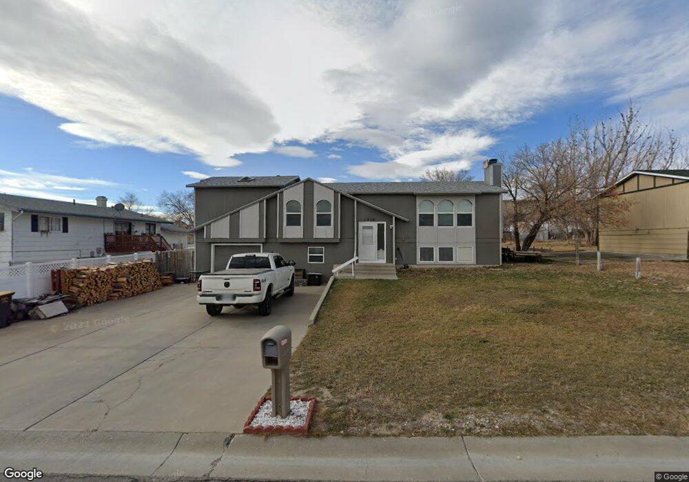
1210 Harshman St Rawlins, WY 82301
Estimated Value: $269,039 - $282,000
--
Bed
--
Bath
1,478
Sq Ft
$187/Sq Ft
Est. Value
About This Home
This home is located at 1210 Harshman St, Rawlins, WY 82301 and is currently estimated at $276,010, approximately $186 per square foot. 1210 Harshman St is a home with nearby schools including Rawlins Elementary School, Rawlins Middle School, and Rawlins High School.
Ownership History
Date
Name
Owned For
Owner Type
Purchase Details
Closed on
Aug 1, 2006
Sold by
Adams Robert C and Adams Joellen
Bought by
Smith Randy L
Current Estimated Value
Home Financials for this Owner
Home Financials are based on the most recent Mortgage that was taken out on this home.
Original Mortgage
$171,612
Outstanding Balance
$102,247
Interest Rate
6.62%
Mortgage Type
VA
Estimated Equity
$173,763
Create a Home Valuation Report for This Property
The Home Valuation Report is an in-depth analysis detailing your home's value as well as a comparison with similar homes in the area
Home Values in the Area
Average Home Value in this Area
Purchase History
| Date | Buyer | Sale Price | Title Company |
|---|---|---|---|
| Smith Randy L | -- | None Available |
Source: Public Records
Mortgage History
| Date | Status | Borrower | Loan Amount |
|---|---|---|---|
| Open | Smith Randy L | $171,612 |
Source: Public Records
Tax History Compared to Growth
Tax History
| Year | Tax Paid | Tax Assessment Tax Assessment Total Assessment is a certain percentage of the fair market value that is determined by local assessors to be the total taxable value of land and additions on the property. | Land | Improvement |
|---|---|---|---|---|
| 2025 | $1,980 | $21,075 | $2,851 | $18,224 |
| 2024 | $1,980 | $27,421 | $3,801 | $23,620 |
| 2023 | $2,086 | $28,892 | $3,455 | $25,437 |
| 2022 | $1,821 | $24,876 | $3,455 | $21,421 |
| 2021 | $1,821 | $22,621 | $2,998 | $19,623 |
| 2020 | $1,636 | $67,878 | $8,994 | $58,884 |
| 2019 | $1,559 | $21,677 | $2,652 | $19,025 |
| 2018 | $1,648 | $22,545 | $2,652 | $19,893 |
| 2017 | $1,617 | $22,245 | $2,652 | $19,593 |
| 2016 | $1,594 | $21,927 | $2,652 | $19,275 |
| 2015 | -- | $21,096 | $2,652 | $18,444 |
| 2014 | -- | $20,422 | $2,652 | $17,770 |
Source: Public Records
Map
Nearby Homes
- 0 Mobile Only Unit 20253971
- 620 E Murray St
- 1624 Murray Lot 115 St
- 506 Rodeo St
- 524 E Murray St
- 504 Rodeo St
- 503 E Maple St
- 313 Daley St
- 213 E Kendrick St
- 508 Rodeo Ct
- 510 Rodeo Ct
- 305 E Spruce St
- 116 W Heath St
- 2002 Happy Hollow Cir
- 214 E Spruce St
- 221 E Pine St
- 1318 Arizona St
- 208 E Pine St
- 717 Scarlet Dr
- 2401 Cutty Sark Blvd
- 1025 E Murray St
- 1216 Harshman St
- 1211 Sigma Dr
- 1211 Sigma Dr Unit Murray
- 1224 Harshman St
- 1215 Sigma Dr
- 1203 Sigma Dr
- 1203 Sigma Dr Unit Corner Murray and Si
- 1219 Sigma Dr
- 1223 Sigma Dr
- 1306 Harshman St
- 1227 Sigma Dr
- 1301 Sigma Dr
- 1212 Sigma Dr Unit Murray
- 1208 Sigma Dr
- 1216 Sigma Dr Unit Murray
- 1216 Sigma Dr
- 1202 Sigma Dr Unit Murray St
- 1202 Sigma Dr
- 1220 Sigma Dr