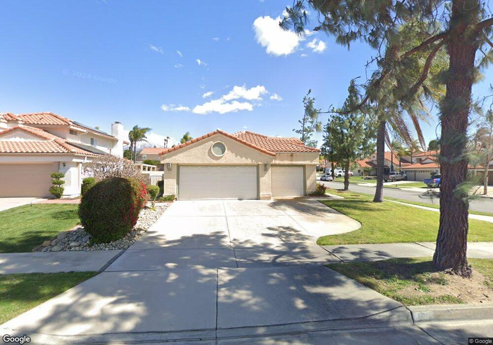
1210 Heath St Redlands, CA 92374
North Redlands NeighborhoodEstimated Value: $606,555 - $660,000
3
Beds
2
Baths
1,750
Sq Ft
$368/Sq Ft
Est. Value
About This Home
This home is located at 1210 Heath St, Redlands, CA 92374 and is currently estimated at $644,139, approximately $368 per square foot. 1210 Heath St is a home located in San Bernardino County with nearby schools including Crafton Elementary School, Clement Middle School, and Redlands East Valley High School.
Ownership History
Date
Name
Owned For
Owner Type
Purchase Details
Closed on
Aug 24, 2010
Sold by
Anderson Mark A
Bought by
Anderson Mark A
Current Estimated Value
Home Financials for this Owner
Home Financials are based on the most recent Mortgage that was taken out on this home.
Original Mortgage
$110,000
Outstanding Balance
$36,795
Interest Rate
4.51%
Mortgage Type
New Conventional
Estimated Equity
$607,344
Purchase Details
Closed on
Dec 20, 2006
Sold by
Anderson Roger L and Anderson Janice J
Bought by
Anderson Mark A
Purchase Details
Closed on
Mar 19, 2003
Sold by
Anderson Roger L and Anderson Janice J
Bought by
Anderson Roger L and Anderson Janice J
Purchase Details
Closed on
Nov 19, 1999
Sold by
Drury Michael
Bought by
Anderson Roger L and Anderson Janice J
Home Financials for this Owner
Home Financials are based on the most recent Mortgage that was taken out on this home.
Original Mortgage
$119,600
Interest Rate
7.96%
Create a Home Valuation Report for This Property
The Home Valuation Report is an in-depth analysis detailing your home's value as well as a comparison with similar homes in the area
Home Values in the Area
Average Home Value in this Area
Purchase History
We collect this data history from publicly available records. To have your information removed, we recommend requesting removal directly through your county’s website.
| Date | Buyer | Sale Price | Title Company |
|---|---|---|---|
| Anderson Mark A | -- | First American Title Company | |
| Anderson Mark A | -- | None Available | |
| Anderson Roger L | -- | Atc | |
| Anderson Roger L | $171,000 | Commonwealth Land Title Co |
Source: Public Records
Mortgage History
We collect this data history from publicly available records. To have your information removed, we recommend requesting removal directly through your county’s website.
| Date | Status | Borrower | Loan Amount |
|---|---|---|---|
| Open | Anderson Mark A | $110,000 | |
| Previous Owner | Anderson Roger L | $119,600 |
Source: Public Records
Tax History
| Year | Tax Paid | Tax Assessment Tax Assessment Total Assessment is a certain percentage of the fair market value that is determined by local assessors to be the total taxable value of land and additions on the property. | Land | Improvement |
|---|---|---|---|---|
| 2025 | $3,426 | $280,853 | $70,211 | $210,642 |
| 2024 | $3,198 | $275,346 | $68,834 | $206,512 |
| 2023 | $3,193 | $269,947 | $67,484 | $202,463 |
| 2022 | $3,145 | $264,654 | $66,161 | $198,493 |
| 2021 | $3,200 | $259,465 | $64,864 | $194,601 |
| 2020 | $3,152 | $256,805 | $64,199 | $192,606 |
| 2019 | $3,063 | $251,769 | $62,940 | $188,829 |
| 2018 | $2,985 | $246,832 | $61,706 | $185,126 |
| 2017 | $2,958 | $241,992 | $60,496 | $181,496 |
| 2016 | $2,923 | $237,247 | $59,310 | $177,937 |
| 2015 | $2,901 | $233,683 | $58,419 | $175,264 |
| 2014 | $2,847 | $229,106 | $57,275 | $171,831 |
Source: Public Records
Map
Nearby Homes
- 1141 Via Antibes
- 1214 Country Place
- 1160 Via Ravenna
- 1129 Via Nice
- 1125 Via Nice
- 927 Knightsbridge Ln
- 1418 Revelation Way
- 1721 E Colton Ave
- 1721 E Colton Ave Unit 69
- 1721 E Colton Ave Unit 33
- 1721 E Colton Ave Unit 50
- 1721 E Colton Ave Unit 115
- 0 E Colton Ave
- 626 N Dearborn St Unit 7
- 626 N Dearborn St Unit 17
- 626 N Dearborn St Unit 205
- 626 N Dearborn St Unit 61
- 1700 Sandpiper Ave
- 1718 Sandpiper Ave
- 1502 Stillman Ave
Your Personal Tour Guide
Ask me questions while you tour the home.