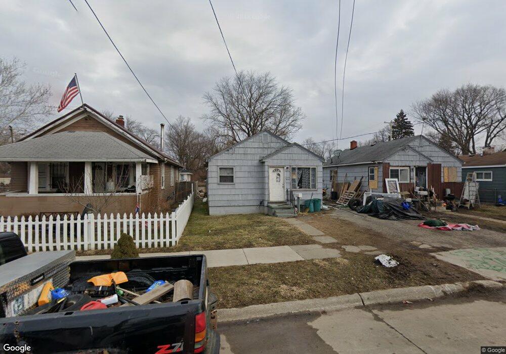
1210 Huron St Flint, MI 48507
Westgate NeighborhoodEstimated Value: $41,594 - $54,000
2
Beds
1
Bath
683
Sq Ft
$68/Sq Ft
Est. Value
About This Home
This home is located at 1210 Huron St, Flint, MI 48507 and is currently estimated at $46,399, approximately $67 per square foot. 1210 Huron St is a home located in Genesee County with nearby schools including Neithercut Elementary School, Flint Southwestern Classical Academy, and International Academy of Flint (K-12).
Ownership History
Date
Name
Owned For
Owner Type
Purchase Details
Closed on
Sep 20, 2022
Sold by
Perkins Daniel E
Bought by
Hoffmann Derek
Current Estimated Value
Purchase Details
Closed on
Dec 11, 2014
Sold by
Parker Brian J and The William J Parker Trust
Bought by
Perkins Daniel E and Perkins Louise S
Purchase Details
Closed on
Aug 23, 2011
Sold by
Perkins Ilona Paula
Bought by
Perkins Daniel Eugene
Purchase Details
Closed on
Jan 6, 2010
Sold by
Perkins Daniel E
Bought by
The William J Parker Trust
Purchase Details
Closed on
Dec 16, 2008
Sold by
Smith Richard William and Smith Kathleen M
Bought by
Parker William J and The William J Parker Trust
Purchase Details
Closed on
Dec 15, 2004
Sold by
Rupert Teresa L and Donald R Roberts Revocable Tru
Bought by
Smith Richard W
Create a Home Valuation Report for This Property
The Home Valuation Report is an in-depth analysis detailing your home's value as well as a comparison with similar homes in the area
Home Values in the Area
Average Home Value in this Area
Purchase History
| Date | Buyer | Sale Price | Title Company |
|---|---|---|---|
| Hoffmann Derek | $70,000 | -- | |
| Perkins Daniel E | $8,000 | None Available | |
| Perkins Daniel Eugene | -- | None Available | |
| The William J Parker Trust | -- | Sargents Title Company | |
| The William J Parker Trust | -- | Sargent Title Company | |
| Parker William J | $22,264 | None Available | |
| Smith Richard W | $15,500 | Guaranty Title Company |
Source: Public Records
Tax History
| Year | Tax Paid | Tax Assessment Tax Assessment Total Assessment is a certain percentage of the fair market value that is determined by local assessors to be the total taxable value of land and additions on the property. | Land | Improvement |
|---|---|---|---|---|
| 2025 | $948 | $11,100 | $0 | $0 |
| 2024 | $882 | $11,400 | $0 | $0 |
| 2023 | $866 | $9,100 | $0 | $0 |
| 2022 | $0 | $7,700 | $0 | $0 |
| 2021 | $717 | $7,000 | $0 | $0 |
| 2020 | $669 | $7,000 | $0 | $0 |
| 2019 | $660 | $7,100 | $0 | $0 |
| 2018 | $631 | $6,200 | $0 | $0 |
| 2017 | $617 | $0 | $0 | $0 |
| 2016 | $613 | $0 | $0 | $0 |
| 2015 | -- | $0 | $0 | $0 |
| 2014 | -- | $0 | $0 | $0 |
| 2012 | -- | $7,500 | $0 | $0 |
Source: Public Records
Map
Nearby Homes
- 1234 Huron St
- 1310 Alvord Ave
- 1310 Huron St
- 1318 Ingleside Ave
- 1210 Pinehurst Ave
- 1410 Berrywood Ln
- 1028 Campbell St
- 1122 Markham St
- 1130 W Atherton Rd
- 939 Ingleside Ave
- 912 Huron St
- 1514 W Atherton Rd
- 1826 Greenbrook Ln
- 1902 Crestbrook Ln
- 934 Campbell St
- 1627 Blackberry Ln
- 4117 Brunswick Ave
- 845 Alvord Ave
- 1506 Pettibone Ave
- 1413 Lincoln Ave
Your Personal Tour Guide
Ask me questions while you tour the home.