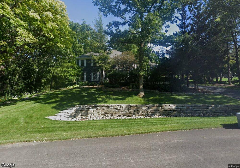
1210 Macintosh Dr Wauconda, IL 60084
Estimated Value: $550,000 - $642,000
4
Beds
3
Baths
3,159
Sq Ft
$188/Sq Ft
Est. Value
About This Home
This home is located at 1210 Macintosh Dr, Wauconda, IL 60084 and is currently estimated at $595,165, approximately $188 per square foot. 1210 Macintosh Dr is a home located in Lake County with nearby schools including Fremont Elementary School, Fremont Intermediate School, and Fremont Jr High/Middle School.
Ownership History
Date
Name
Owned For
Owner Type
Purchase Details
Closed on
Jul 29, 1994
Sold by
Brucato David M and Brucato Cathleen D
Bought by
Mikrut Jerome W and Mikrut Judith A
Current Estimated Value
Home Financials for this Owner
Home Financials are based on the most recent Mortgage that was taken out on this home.
Original Mortgage
$215,000
Interest Rate
8.62%
Create a Home Valuation Report for This Property
The Home Valuation Report is an in-depth analysis detailing your home's value as well as a comparison with similar homes in the area
Home Values in the Area
Average Home Value in this Area
Purchase History
We collect this data history from publicly available records. To have your information removed, we recommend requesting removal directly through your county’s website.
| Date | Buyer | Sale Price | Title Company |
|---|---|---|---|
| Mikrut Jerome W | $325,000 | Chicago Title Insurance Co |
Source: Public Records
Mortgage History
We collect this data history from publicly available records. To have your information removed, we recommend requesting removal directly through your county’s website.
| Date | Status | Borrower | Loan Amount |
|---|---|---|---|
| Closed | Mikrut Jerome W | $215,000 |
Source: Public Records
Tax History
| Year | Tax Paid | Tax Assessment Tax Assessment Total Assessment is a certain percentage of the fair market value that is determined by local assessors to be the total taxable value of land and additions on the property. | Land | Improvement |
|---|---|---|---|---|
| 2025 | $15,533 | $198,429 | $21,632 | $176,797 |
| 2024 | $15,533 | $189,920 | $20,704 | $169,216 |
| 2023 | $15,234 | $174,015 | $18,970 | $155,045 |
| 2022 | $15,234 | $166,264 | $20,828 | $145,436 |
| 2021 | $14,605 | $160,440 | $20,098 | $140,342 |
| 2020 | $14,641 | $156,025 | $19,545 | $136,480 |
| 2019 | $14,219 | $150,894 | $18,902 | $131,992 |
| 2018 | $12,552 | $137,323 | $31,562 | $105,761 |
| 2017 | $12,395 | $133,001 | $30,569 | $102,432 |
| 2016 | $11,940 | $126,319 | $29,033 | $97,286 |
| 2015 | $11,493 | $118,421 | $27,218 | $91,203 |
| 2014 | $11,055 | $114,006 | $26,297 | $87,709 |
| 2012 | $11,416 | $115,018 | $26,530 | $88,488 |
Source: Public Records
Map
Nearby Homes
- 1205 E Bonner Rd
- 1203 Macintosh Dr
- 1017 Grand Blvd
- 806 Wauconda Rd
- 905 Grand Blvd
- 1112 Adams Ave
- 818 Sheridan Dr
- 0 Bonner Rd
- 28722 N Madison Ave
- 24092 W Old Oak Dr
- 507 Woodland Ave
- 28855 N Garland Rd
- 29564 N Garland Rd
- 428 Country Lane Ct Unit 301
- 902 Highland Ave
- 330 Stillwater Ct Unit 1504
- 25817 W Cook St
- 227 Brett Cir Unit D
- 304 Hill St Unit 1004
- 365 Lake Ave Unit C
- 1208 Jonathon Ct
- 1201 E Bonner Rd
- 1211 Macintosh Dr
- 1206 Jonathon Ct
- 1215 E Bonner Rd
- 1209 Macintosh Dr
- 1203 E Bonner Rd
- 1204 Jonathon Ct
- 1221 Cortland Ln
- 1219 Cortland Ln
- 1202 Jonathon Ct
- 1223 Cortland Ln
- 1217 Cortland Ln
- 1215 Cortland Ln
- 1225 Cortland Ln
- 1207 Macintosh Dr
- 1200 Macintosh Dr
- 1213 Cortland Ln
- 1222 Cortland Ln
- 1220 Cortland Ln
Your Personal Tour Guide
Ask me questions while you tour the home.