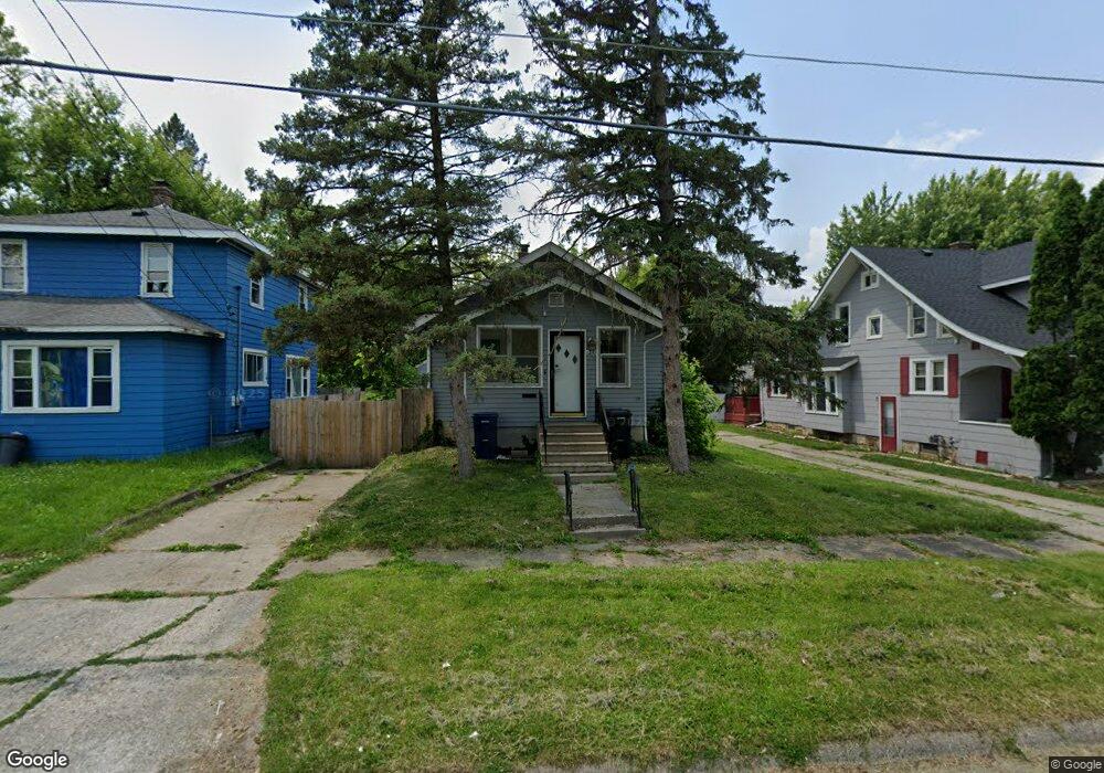
1210 Mann Ave Flint, MI 48503
Mannhall Park NeighborhoodEstimated Value: $34,853 - $65,000
2
Beds
1
Bath
870
Sq Ft
$57/Sq Ft
Est. Value
About This Home
This home is located at 1210 Mann Ave, Flint, MI 48503 and is currently estimated at $49,963, approximately $57 per square foot. 1210 Mann Ave is a home located in Genesee County with nearby schools including Durant-Tuuri-Mott Elementary School, Flint Southwestern Classical Academy, and St. Paul Lutheran School.
Ownership History
Date
Name
Owned For
Owner Type
Purchase Details
Closed on
Jun 2, 2021
Sold by
Snapshot Bpo Llc
Bought by
Karbel Jamie
Current Estimated Value
Purchase Details
Closed on
Apr 12, 2021
Sold by
Lloyd Craig Allen
Bought by
Snapshot Bpo Llc
Purchase Details
Closed on
Nov 6, 2019
Sold by
Jubenville Jay K
Bought by
Wells Fargo Bank Na
Purchase Details
Closed on
Feb 18, 2005
Sold by
Lytle Judith L and The Estate Of Mary Ann Phillip
Bought by
Lytle Judith L
Home Financials for this Owner
Home Financials are based on the most recent Mortgage that was taken out on this home.
Original Mortgage
$54,150
Interest Rate
5.64%
Mortgage Type
FHA
Create a Home Valuation Report for This Property
The Home Valuation Report is an in-depth analysis detailing your home's value as well as a comparison with similar homes in the area
Home Values in the Area
Average Home Value in this Area
Purchase History
| Date | Buyer | Sale Price | Title Company |
|---|---|---|---|
| Karbel Jamie | -- | Liberty Title | |
| Snapshot Bpo Llc | $18,000 | Liberty Title | |
| Wells Fargo Bank Na | $10,875 | None Available | |
| Lytle Judith L | -- | Citizens Title Services | |
| Jubenville Jay K | $55,000 | Citizens Title Services |
Source: Public Records
Mortgage History
| Date | Status | Borrower | Loan Amount |
|---|---|---|---|
| Previous Owner | Jubenville Jay K | $54,150 | |
| Closed | Karbel Jamie | $0 |
Source: Public Records
Tax History
| Year | Tax Paid | Tax Assessment Tax Assessment Total Assessment is a certain percentage of the fair market value that is determined by local assessors to be the total taxable value of land and additions on the property. | Land | Improvement |
|---|---|---|---|---|
| 2025 | $1,046 | $22,400 | $0 | $0 |
| 2024 | $946 | $20,600 | $0 | $0 |
| 2023 | $928 | $15,900 | $0 | $0 |
| 2022 | $0 | $13,300 | $0 | $0 |
| 2021 | $994 | $11,500 | $0 | $0 |
| 2020 | $736 | $9,900 | $0 | $0 |
| 2019 | $1,127 | $10,400 | $0 | $0 |
| 2018 | $712 | $9,500 | $0 | $0 |
| 2017 | $719 | $0 | $0 | $0 |
| 2016 | $714 | $0 | $0 | $0 |
| 2015 | -- | $0 | $0 | $0 |
| 2014 | -- | $0 | $0 | $0 |
| 2012 | -- | $13,200 | $0 | $0 |
Source: Public Records
Map
Nearby Homes
- 1122 Stocker Ave
- 3413 Augusta St
- 1308 Barney Ave
- 1202 Knapp Ave
- 3317 Arlene Ave
- 1017 Stocker Ave
- 3217 Arlene Ave
- 1412 S Ballenger Hwy
- 3214 Clairmont St
- 976 Barney Ave
- 960 Mann Ave
- 3801 Augusta St
- 3805 Brown St
- 1114 Clancy Ave
- 3310 Larchmont St
- 2805 Reynolds St
- 3915 Augusta St
- 3825 Arlene Ave
- 916 Mann Ave
- 3510 Hogarth Ave
Your Personal Tour Guide
Ask me questions while you tour the home.