
Seller's Agent in 2025
Brittany Stockdale
The Brokerage House
(614) 302-0030
15 in this area
55 Total Sales
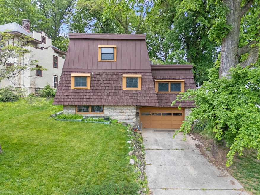
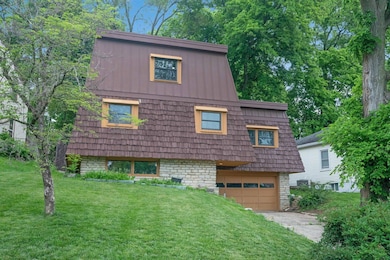
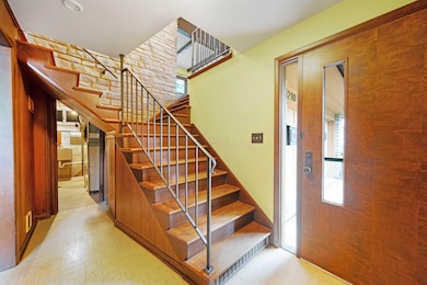
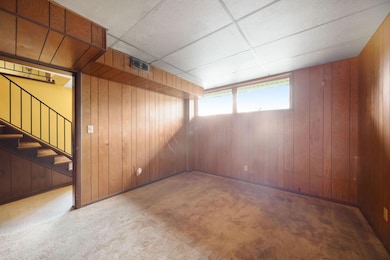
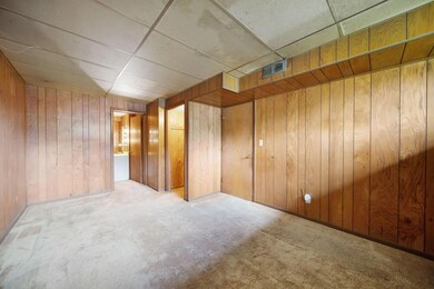
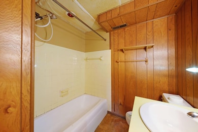
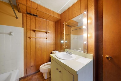
**OFFER DEADLINE OF MONDAY, JUNE 2nd 2 2 pm***Welcome to 1210 Mulford Road—a true standout nestled in one of Central Ohio's most beloved communities. With four bedrooms, two full bathrooms, over 1,800 finished square feet, and a two-car garage, there's plenty of space to reimagine, redesign, and make it truly your own. Situated on nearly a quarter-acre lot, this architecturally unique home offers a rare chance to own a property that breaks the mold in Grandview Heights.
It's ready for your love and vision—but that's exactly where the opportunity lies. Priced with potential in mind, this is your chance to invest in a home that reflects your style, in a neighborhood where homes are deeply cherished and rarely leave the hands of long-time owners.
Step outside and you're less than five minutes from Stevenson Elementary, Pierce Field, and some of the community's favorite local spots—coffee shops, restaurants, Grandview Municipal Pool, and parks all within easy reach. With top-rated schools, a walkable lifestyle, and a tight-knit neighborhood feel, Grandview Heights is more than a place to live—it's a place to belong.
Whether you're dreaming of a design-forward renovation or seeking a smart investment in a prime location, 1210 Mulford is your blank canvas.
Last Agent to Sell the Property
The Brokerage House License #2022004823 Listed on: 05/30/2025
| Date | Type | Sale Price | Title Company |
|---|---|---|---|
| Warranty Deed | $450,000 | World Class Title | |
| Warranty Deed | -- | None Available | |
| Deed | $109,900 | -- |
| Date | Status | Loan Amount | Loan Type |
|---|---|---|---|
| Open | $430,877 | New Conventional |
| Date | Event | Price | List to Sale | Price per Sq Ft |
|---|---|---|---|---|
| 06/24/2025 06/24/25 | Sold | $450,000 | 0.0% | $239 / Sq Ft |
| 05/30/2025 05/30/25 | For Sale | $449,900 | -- | $239 / Sq Ft |
| Year | Tax Paid | Tax Assessment Tax Assessment Total Assessment is a certain percentage of the fair market value that is determined by local assessors to be the total taxable value of land and additions on the property. | Land | Improvement |
|---|---|---|---|---|
| 2025 | $10,773 | $184,700 | $112,140 | $72,560 |
| 2024 | $10,773 | $184,700 | $112,140 | $72,560 |
| 2023 | $9,437 | $184,695 | $112,140 | $72,555 |
| 2022 | $8,096 | $134,930 | $68,740 | $66,190 |
| 2021 | $7,579 | $134,930 | $68,740 | $66,190 |
| 2020 | $7,548 | $134,930 | $68,740 | $66,190 |
| 2019 | $7,331 | $115,990 | $68,740 | $47,250 |
| 2018 | $6,945 | $115,990 | $68,740 | $47,250 |
| 2017 | $6,836 | $115,990 | $68,740 | $47,250 |
| 2016 | $6,590 | $95,730 | $53,170 | $42,560 |
| 2015 | $6,590 | $95,730 | $53,170 | $42,560 |
| 2014 | $6,611 | $95,730 | $53,170 | $42,560 |
| 2013 | $2,904 | $87,010 | $48,335 | $38,675 |
Seller's Agent in 2025
Brittany Stockdale
The Brokerage House
(614) 302-0030
15 in this area
55 Total Sales
Buyer's Agent in 2025
Lacey Wheeler
Red 1 Realty
(614) 530-7617
50 in this area
466 Total Sales
Buyer Co-Listing Agent in 2025
Audra Wheeler
Red 1 Realty
(614) 530-7911
29 in this area
184 Total Sales
Source: Columbus and Central Ohio Regional MLS
MLS Number: 225018939
APN: 030-001635
Disclaimer: Certain information contained herein is derived from information provided by parties other than Homes.com. All information provided is deemed reliable, but is not guaranteed to be accurate and should be independently verified.
![]() IDX information is provided exclusively for personal, non-commercial use, and may not be used for any purpose other than to identify prospective properties consumers may be interested in purchasing.
IDX information is provided exclusively for personal, non-commercial use, and may not be used for any purpose other than to identify prospective properties consumers may be interested in purchasing.
Information is deemed reliable but not guaranteed.
Ask me questions while you tour the home.