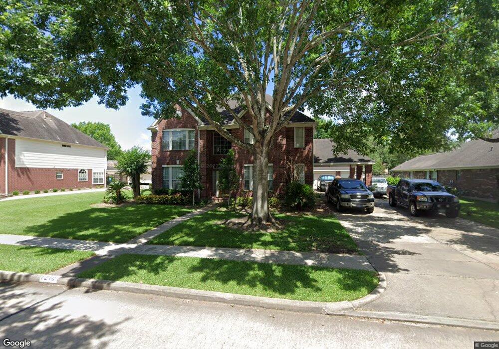
1210 Red Wing Dr Friendswood, TX 77546
Estimated Value: $564,000 - $634,808
--
Bed
3
Baths
3,875
Sq Ft
$154/Sq Ft
Est. Value
About This Home
This home is located at 1210 Red Wing Dr, Friendswood, TX 77546 and is currently estimated at $596,952, approximately $154 per square foot. 1210 Red Wing Dr is a home located in Galveston County with nearby schools including C.W. Cline Elementary School, Windsong Elementary School, and Friendswood Junior High School.
Ownership History
Date
Name
Owned For
Owner Type
Purchase Details
Closed on
Jul 29, 1997
Sold by
Bronczyk Douglas A
Bought by
Coltharp Richard Duane and Coltharp Linda R
Current Estimated Value
Home Financials for this Owner
Home Financials are based on the most recent Mortgage that was taken out on this home.
Original Mortgage
$153,600
Outstanding Balance
$23,124
Interest Rate
7.59%
Mortgage Type
Purchase Money Mortgage
Estimated Equity
$573,828
Create a Home Valuation Report for This Property
The Home Valuation Report is an in-depth analysis detailing your home's value as well as a comparison with similar homes in the area
Home Values in the Area
Average Home Value in this Area
Purchase History
| Date | Buyer | Sale Price | Title Company |
|---|---|---|---|
| Coltharp Richard Duane | -- | -- |
Source: Public Records
Mortgage History
| Date | Status | Borrower | Loan Amount |
|---|---|---|---|
| Open | Coltharp Richard Duane | $153,600 |
Source: Public Records
Tax History Compared to Growth
Tax History
| Year | Tax Paid | Tax Assessment Tax Assessment Total Assessment is a certain percentage of the fair market value that is determined by local assessors to be the total taxable value of land and additions on the property. | Land | Improvement |
|---|---|---|---|---|
| 2025 | $6,495 | $591,718 | -- | -- |
| 2024 | $6,495 | $537,925 | -- | -- |
| 2023 | $6,495 | $489,023 | $0 | $0 |
| 2022 | $9,792 | $444,566 | $0 | $0 |
| 2021 | $9,440 | $489,810 | $51,030 | $438,780 |
| 2020 | $8,852 | $367,410 | $51,030 | $316,380 |
| 2019 | $10,192 | $401,380 | $51,030 | $350,350 |
| 2018 | $10,347 | $405,090 | $51,030 | $354,060 |
| 2017 | $9,749 | $412,450 | $51,030 | $361,420 |
| 2016 | $8,862 | $385,220 | $51,030 | $334,190 |
| 2015 | $2,818 | $350,220 | $51,030 | $299,190 |
| 2014 | $2,654 | $273,080 | $51,030 | $222,050 |
Source: Public Records
Map
Nearby Homes
- 1217 Red Wing Dr
- 1906 Blue Quail Dr
- 1305 Edgewater Dr
- 1010 High Ridge Dr
- 1802 Creekside Dr
- 2202 Calm Pond Ct
- 705 High Ridge Dr
- 2120 Lila Sky Ln
- 1532 River Point Dr
- 1556 River Point Dr
- 1673 Birch Lake Bend
- 1572 River Point Dr
- 1568 River Point Dr
- 1588 River Point Dr
- 2220 Lila Sky Ln
- 2124 Lila Sky Ln
- 1601 Birch Lake Bend
- 1608 Keystone Dr
- 1657 Birch Lake Ln
- 1673 Birch Lake Ln
- 1208 Red Wing Dr
- 1212 Red Wing Dr
- 1211 Eagle Lakes Dr
- 1209 Eagle Lakes Dr
- 1214 Red Wing Dr
- 1213 Eagle Lakes Dr
- 1904 Dove Ct
- 1902 Dove Ct
- 1209 Red Wing Dr
- 1207 Eagle Lakes Dr
- 1207 Red Wing Dr
- 1211 Red Wing Dr
- 1216 Red Wing Dr
- 1215 Eagle Lakes Dr
- 1205 Red Wing Dr
- 1213 Red Wing Dr
- 1205 Eagle Lakes Dr
- 1210 Peregrine Dr
- 1212 Eagle Lakes Dr
- 1214 Eagle Lakes Dr