Estimated Value: $257,000 - $321,000
3
Beds
1
Bath
1,378
Sq Ft
$214/Sq Ft
Est. Value
About This Home
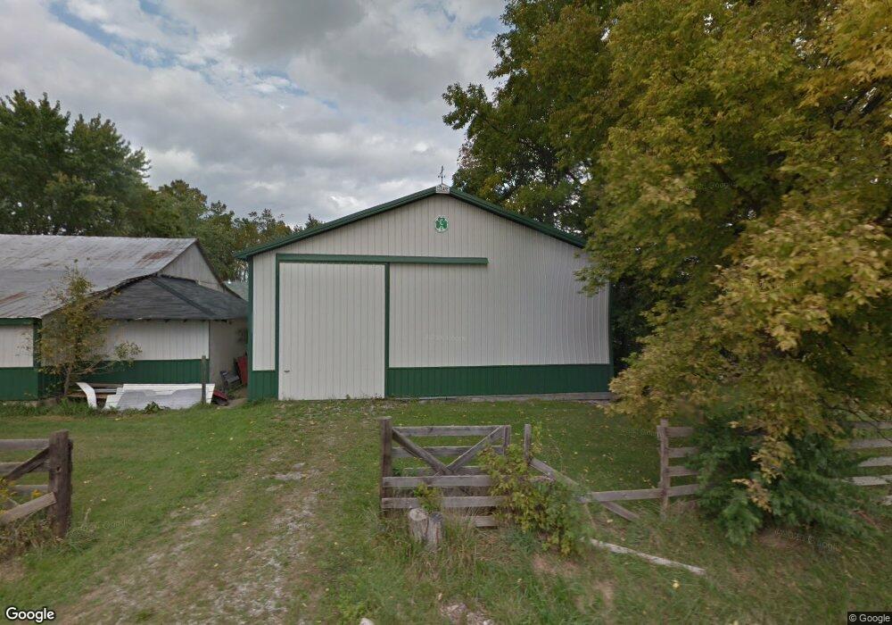
This home is located at 1210 Richland Rd, Xenia, OH 45385 and is currently estimated at $294,238, approximately $213 per square foot. 1210 Richland Rd is a home located in Greene County with nearby schools including Xenia High School and Summit Academy Community School for Alternative Learners - Xenia.
Ownership History
Date
Name
Owned For
Owner Type
Purchase Details
Closed on
Jun 16, 2014
Sold by
Lewis James O
Bought by
Kozee Gary
Current Estimated Value
Home Financials for this Owner
Home Financials are based on the most recent Mortgage that was taken out on this home.
Original Mortgage
$100,000
Outstanding Balance
$76,062
Interest Rate
4.2%
Mortgage Type
New Conventional
Estimated Equity
$218,176
Purchase Details
Closed on
Jan 25, 2010
Sold by
Estate Of Orville Lewis
Bought by
Lewis James O
Create a Home Valuation Report for This Property
The Home Valuation Report is an in-depth analysis detailing your home's value as well as a comparison with similar homes in the area
Home Values in the Area
Average Home Value in this Area
Purchase History
| Date | Buyer | Sale Price | Title Company |
|---|---|---|---|
| Kozee Gary | $125,000 | None Available | |
| Lewis James O | -- | None Available |
Source: Public Records
Mortgage History
| Date | Status | Borrower | Loan Amount |
|---|---|---|---|
| Open | Kozee Gary | $100,000 |
Source: Public Records
Tax History Compared to Growth
Tax History
| Year | Tax Paid | Tax Assessment Tax Assessment Total Assessment is a certain percentage of the fair market value that is determined by local assessors to be the total taxable value of land and additions on the property. | Land | Improvement |
|---|---|---|---|---|
| 2024 | $3,786 | $74,340 | $22,030 | $52,310 |
| 2023 | $3,786 | $74,340 | $22,030 | $52,310 |
| 2022 | $3,552 | $60,220 | $20,650 | $39,570 |
| 2021 | $3,594 | $60,220 | $20,650 | $39,570 |
| 2020 | $3,300 | $60,220 | $20,650 | $39,570 |
| 2019 | $3,073 | $52,560 | $17,680 | $34,880 |
| 2018 | $3,031 | $52,560 | $17,680 | $34,880 |
| 2017 | $2,873 | $52,560 | $17,680 | $34,880 |
| 2016 | $2,874 | $50,850 | $16,980 | $33,870 |
| 2015 | $2,152 | $50,850 | $16,980 | $33,870 |
| 2014 | $2,764 | $50,810 | $16,940 | $33,870 |
Source: Public Records
Map
Nearby Homes
- 102 Water St
- 196 Mound St
- 881 Spring Valley Painters Rd
- 1068 Hedges Rd
- Henley Plan at Edenbridge
- Holcombe Plan at Edenbridge
- Newcastle Plan at Edenbridge
- Bellamy Plan at Edenbridge
- Chatham Plan at Edenbridge
- 1474 Hawkshead St
- 2821 Raxit Ct
- 1272 Baybury Ave
- 1292 Baybury Ave
- 2852 Raxit Ct
- 1293 Baybury Ave
- 1061 Mcpherson Rd
- 1591 Valley Heights Rd
- 1248 Prem Place
- 1711 Mcclellan Rd
- 1213 Prem Place
- 0 Richland Rd Unit 784191
- 0 Richland Rd Unit 782563
- 0 Richland Rd Unit 396182
- 0 Richland Rd Unit Tr. 7 396180
- 0 Richland Rd Unit T.6-7 396178
- 0 Richland Rd Unit Tr. 4 396175
- 0 Richland Rd Unit Tr. 3 396172
- 0 Richland Rd Unit Tr. 2 396165
- 0 Richland Rd Unit Tr. 1 396159
- 4 Richland Rd
- 0 Richland Rd Unit 498326
- 2071 Richland Rd
- 2020 Us Route 42 S
- 2020 U S 42 S
- 1170 Richland Rd
- 1150 Richland Rd
- 2001 Us Route 42 S
- 2001 Us Route 42 S
- 1140 Richland Rd
- 1290 Richland Rd