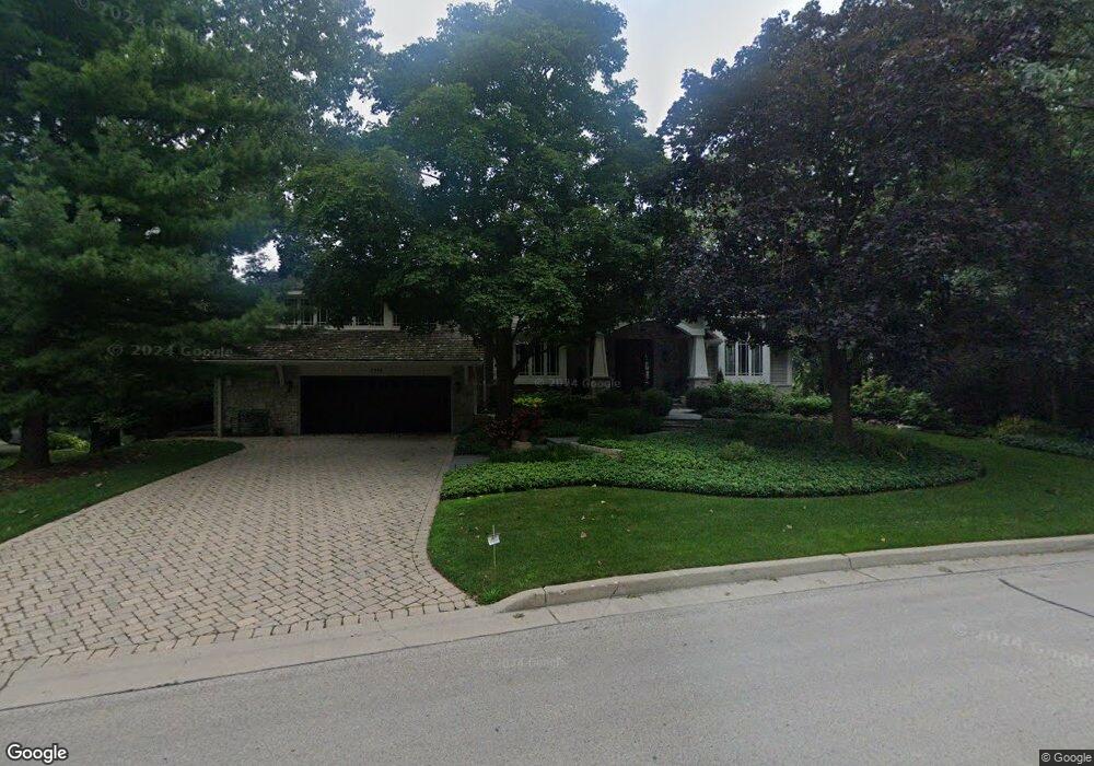
1210 Sandstone Dr Libertyville, IL 60048
Estimated Value: $1,026,000 - $1,629,000
--
Bed
4
Baths
2,922
Sq Ft
$469/Sq Ft
Est. Value
About This Home
This home is located at 1210 Sandstone Dr, Libertyville, IL 60048 and is currently estimated at $1,370,601, approximately $469 per square foot. 1210 Sandstone Dr is a home located in Lake County with nearby schools including Adler Park School, Highland Middle School, and Libertyville High School.
Ownership History
Date
Name
Owned For
Owner Type
Purchase Details
Closed on
Jul 19, 2023
Sold by
Leonard Warren Aldridge Trust and Margaret E Aldridge Trust
Bought by
Aldridge Family Limited Partnership
Current Estimated Value
Purchase Details
Closed on
Oct 27, 2011
Sold by
Aldridge L Warren and L Warren Aldridge Trust
Bought by
Aldridge Leonard Warren and Leonard Warren Aldridge Trust
Purchase Details
Closed on
Feb 23, 2004
Sold by
The Northern Trust Co
Bought by
Aldridge Family Lp
Purchase Details
Closed on
Apr 11, 1997
Sold by
Aldridge L Warren and Aldridge Margaret
Bought by
Aldridge L Warren and L Warren Aldridge Trust
Create a Home Valuation Report for This Property
The Home Valuation Report is an in-depth analysis detailing your home's value as well as a comparison with similar homes in the area
Home Values in the Area
Average Home Value in this Area
Purchase History
| Date | Buyer | Sale Price | Title Company |
|---|---|---|---|
| Aldridge Family Limited Partnership | -- | None Listed On Document | |
| Aldridge Leonard Warren | -- | Napa Land Title | |
| Aldridge Family Lp | -- | -- | |
| Aldridge L Warren | -- | -- |
Source: Public Records
Tax History Compared to Growth
Tax History
| Year | Tax Paid | Tax Assessment Tax Assessment Total Assessment is a certain percentage of the fair market value that is determined by local assessors to be the total taxable value of land and additions on the property. | Land | Improvement |
|---|---|---|---|---|
| 2024 | $31,397 | $422,689 | $178,492 | $244,197 |
| 2023 | $29,759 | $389,862 | $164,630 | $225,232 |
| 2022 | $29,759 | $378,102 | $209,367 | $168,735 |
| 2021 | $28,665 | $369,963 | $204,860 | $165,103 |
| 2020 | $31,536 | $414,811 | $201,416 | $213,395 |
| 2019 | $30,749 | $410,867 | $199,501 | $211,366 |
| 2018 | $17,707 | $453,785 | $215,453 | $238,332 |
| 2017 | $32,460 | $439,459 | $208,651 | $230,808 |
| 2016 | $31,428 | $437,925 | $197,830 | $240,095 |
| 2015 | $32,819 | $424,034 | $184,905 | $239,129 |
| 2014 | $29,691 | $363,477 | $165,840 | $197,637 |
| 2012 | $27,419 | $373,338 | $167,279 | $206,059 |
Source: Public Records
Map
Nearby Homes
- 1211 Parliament Ct
- 31132-31140 N Milwaukee Ave
- 922 N Milwaukee Ave Unit A
- 204 W Ellis Ave
- 224 Newberry Ave
- 208 W Ellis Ave
- 212 W Ellis Ave
- 16108 W Des Plaines Dr
- 16051 W Des Plaines Dr
- 616 Parkside Ct
- 619 Parkside Ct
- 662 Parkside Ct
- 217 E Church St
- 694 Parkside Ct
- 505 Lange Ct
- 420 W Cook Ave
- 212 Elm Ct
- 601 Broadway St
- 15734 W Buckley Rd
- 121 4th St
- 1200 Sandstone Dr
- 405 E Winchester Rd
- 1201 Sandstone Dr
- 331 E Winchester Rd
- 326 Hyatt Dr
- 419 E Winchester Rd
- 325 E Winchester Rd
- 402 E Winchester Rd
- 1110 Sandstone Dr
- 334 E Winchester Rd
- 1115 Sandstone Dr
- 420 E Winchester Rd
- 320 Hyatt Dr
- 319 E Winchester Rd
- 328 E Winchester Rd
- 325 Hyatt Dr
- 322 E Winchester Rd
- 319 Hyatt Dr
- 1210 Avalon Ln
- 310 Hyatt Dr