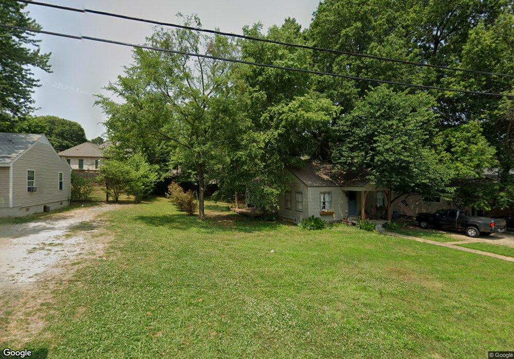
1210 Sims Ave Jonesboro, AR 72401
Estimated Value: $74,000 - $104,000
2
Beds
1
Bath
900
Sq Ft
$101/Sq Ft
Est. Value
About This Home
This home is located at 1210 Sims Ave, Jonesboro, AR 72401 and is currently estimated at $90,773, approximately $100 per square foot. 1210 Sims Ave is a home located in Craighead County with nearby schools including Annie Camp Junior High School, The Academies at Jonesboro High School, and Concordia Christian Academy.
Ownership History
Date
Name
Owned For
Owner Type
Purchase Details
Closed on
Mar 25, 2020
Sold by
Little Joe and Little Pam
Bought by
Little Joseph F and Little Pamela J
Current Estimated Value
Home Financials for this Owner
Home Financials are based on the most recent Mortgage that was taken out on this home.
Original Mortgage
$67,500
Outstanding Balance
$46,077
Interest Rate
2.9%
Mortgage Type
New Conventional
Estimated Equity
$44,696
Purchase Details
Closed on
Nov 21, 2017
Sold by
Timmermann Trust
Bought by
Little Joe and Little Pam
Home Financials for this Owner
Home Financials are based on the most recent Mortgage that was taken out on this home.
Original Mortgage
$47,000
Interest Rate
3.91%
Mortgage Type
New Conventional
Purchase Details
Closed on
Sep 6, 1996
Bought by
Timmermann Trust
Create a Home Valuation Report for This Property
The Home Valuation Report is an in-depth analysis detailing your home's value as well as a comparison with similar homes in the area
Home Values in the Area
Average Home Value in this Area
Purchase History
| Date | Buyer | Sale Price | Title Company |
|---|---|---|---|
| Little Joseph F | -- | None Available | |
| Little Joe | $38,000 | -- | |
| Timmermann Trust | -- | -- |
Source: Public Records
Mortgage History
| Date | Status | Borrower | Loan Amount |
|---|---|---|---|
| Open | Little Joseph F | $67,500 | |
| Closed | Little Joe | $47,000 |
Source: Public Records
Tax History Compared to Growth
Tax History
| Year | Tax Paid | Tax Assessment Tax Assessment Total Assessment is a certain percentage of the fair market value that is determined by local assessors to be the total taxable value of land and additions on the property. | Land | Improvement |
|---|---|---|---|---|
| 2025 | $307 | $9,583 | $2,200 | $7,383 |
| 2024 | $307 | $9,583 | $2,200 | $7,383 |
| 2023 | $277 | $9,583 | $2,200 | $7,383 |
| 2022 | $254 | $9,583 | $2,200 | $7,383 |
| 2021 | $236 | $5,600 | $2,200 | $3,400 |
| 2020 | $236 | $5,600 | $2,200 | $3,400 |
| 2019 | $236 | $5,600 | $2,200 | $3,400 |
| 2018 | $236 | $5,600 | $2,200 | $3,400 |
| 2017 | $236 | $5,600 | $2,200 | $3,400 |
| 2016 | $217 | $5,150 | $2,200 | $2,950 |
| 2015 | $217 | $5,150 | $2,200 | $2,950 |
| 2014 | $217 | $5,150 | $2,200 | $2,950 |
Source: Public Records
Map
Nearby Homes
- 2305 Anne St
- 1202 Wood Cove
- 2005 Wood St
- 2311 Wood St
- 1823 James St
- 1821 James St
- 724 Locust Dr
- 718 Owens Ave
- 2318 Redbud Dr
- 1808 Roy St
- 2000 Broadmoor Rd
- 1104 Neville St
- 795 S Hill Dr
- 1608 Colonial Rd
- 700 Amberwood Cove
- 806 Amberwood Cove
- 625 Shadow Ln
- 800 Southwest Dr
- 1919 Sherwood Dr
- 0 Woodland Point Unit 10119892
- 1208 Sims Ave
- 1214 Sims Ave
- 1205 Wood Cove
- 1206 Sims Ave
- 2220 Wood St
- 1203 Wood Cove
- 1201 Sims Ave
- 1105 Sims Ave
- 1202 Sims Ave
- 1109 Sims Ave
- 1219 Sims Ave
- 2303 Anne St
- 0 Wood St Unit 10070456
- 0 Wood St Unit 10070136
- 1106 Sims Ave
- 2019 Wood St
- 1201 Wood Cove
- 1110 Owens Ave
- 1112 Owens Ave
- 1108 Owens Ave