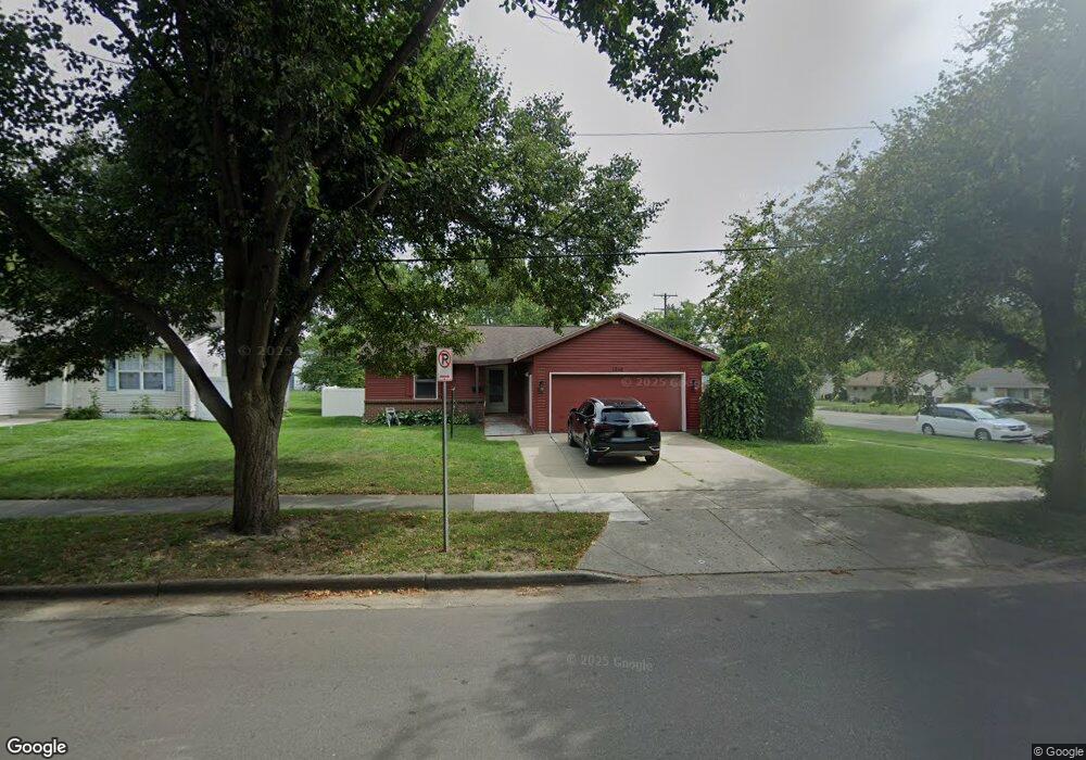
1210 Travis St NE Grand Rapids, MI 49505
North East Citizens Action NeighborhoodEstimated Value: $258,611 - $322,000
--
Bed
1
Bath
1,004
Sq Ft
$290/Sq Ft
Est. Value
About This Home
This home is located at 1210 Travis St NE, Grand Rapids, MI 49505 and is currently estimated at $291,153, approximately $289 per square foot. 1210 Travis St NE is a home located in Kent County with nearby schools including Kent Hills School, Riverside Middle School, and Union High School.
Ownership History
Date
Name
Owned For
Owner Type
Purchase Details
Closed on
Oct 21, 2016
Sold by
Murray Rosemary B and Burns Rosemary B
Bought by
Murray Paul W and Murray Rosemary B
Current Estimated Value
Home Financials for this Owner
Home Financials are based on the most recent Mortgage that was taken out on this home.
Original Mortgage
$113,960
Outstanding Balance
$92,191
Interest Rate
3.75%
Mortgage Type
FHA
Estimated Equity
$198,962
Purchase Details
Closed on
Dec 3, 1996
Bought by
Burns Burns R and Burns Rosemary B
Purchase Details
Closed on
Jul 31, 1984
Sold by
Frmwld Dev and Frmwld Burns R
Bought by
Burns Rosemary B
Create a Home Valuation Report for This Property
The Home Valuation Report is an in-depth analysis detailing your home's value as well as a comparison with similar homes in the area
Home Values in the Area
Average Home Value in this Area
Purchase History
| Date | Buyer | Sale Price | Title Company |
|---|---|---|---|
| Murray Paul W | -- | None Available | |
| Burns Burns R | -- | -- | |
| Burns Rosemary B | $57,900 | -- |
Source: Public Records
Mortgage History
| Date | Status | Borrower | Loan Amount |
|---|---|---|---|
| Open | Murray Paul W | $113,960 |
Source: Public Records
Tax History Compared to Growth
Tax History
| Year | Tax Paid | Tax Assessment Tax Assessment Total Assessment is a certain percentage of the fair market value that is determined by local assessors to be the total taxable value of land and additions on the property. | Land | Improvement |
|---|---|---|---|---|
| 2025 | $1,943 | $131,500 | $0 | $0 |
| 2024 | $1,943 | $121,300 | $0 | $0 |
| 2023 | $1,861 | $104,000 | $0 | $0 |
| 2022 | $1,871 | $90,000 | $0 | $0 |
| 2021 | $1,830 | $84,400 | $0 | $0 |
| 2020 | $1,749 | $80,200 | $0 | $0 |
| 2019 | $1,832 | $71,700 | $0 | $0 |
| 2018 | $1,769 | $64,400 | $0 | $0 |
| 2017 | $1,722 | $55,700 | $0 | $0 |
| 2016 | $1,709 | $50,100 | $0 | $0 |
| 2015 | $1,590 | $50,100 | $0 | $0 |
| 2013 | -- | $48,300 | $0 | $0 |
Source: Public Records
Map
Nearby Homes
- 1237 Dale Ct NE
- 1119 Kentwood Dr NE
- 1824 Herrick Ave NE
- 1666 Carlton Ave NE
- 1444 Sweet St NE
- 1119 Spencer St NE
- 1452 Carlton Ave NE
- 1848 Emerald Ave NE
- 1335 Knapp St NE
- 1524 Sweet St NE
- 1339 Fuller Ave NE
- 2027 Joan Ave NE
- 2100 Dawson Ave NE
- 1825 Meadowfield Dr NE
- 1757 Westlane Dr NE
- 1455 Ball Ave NE
- 1256 Diamond Ave NE
- 1228 Spring Ave NE
- 1238 Carlton Ave NE
- 1250 Mayfield Ave NE
- 1218 Travis St NE
- 1217 Dale Ct NE
- 1209 Dale Ct NE
- 1226 Travis St NE
- 1713 Fuller Ave NE
- 1719 Fuller Ave NE
- 1217 Travis St NE
- 1232 Travis St NE
- 1693 Fuller Ave NE
- 1725 Fuller Ave NE
- 1225 Dale Ct NE
- 2034 Fuller Ave NE
- 1225 Travis St NE
- 1681 Fuller Ave NE
- 1733 Fuller Ave NE
- 1238 Travis St NE
- 1708 Herrick Ave NE
- 1718 Herrick Ave NE
- 1210 Dale Ct NE
- 1210 Dale Ct NE Unit 1212