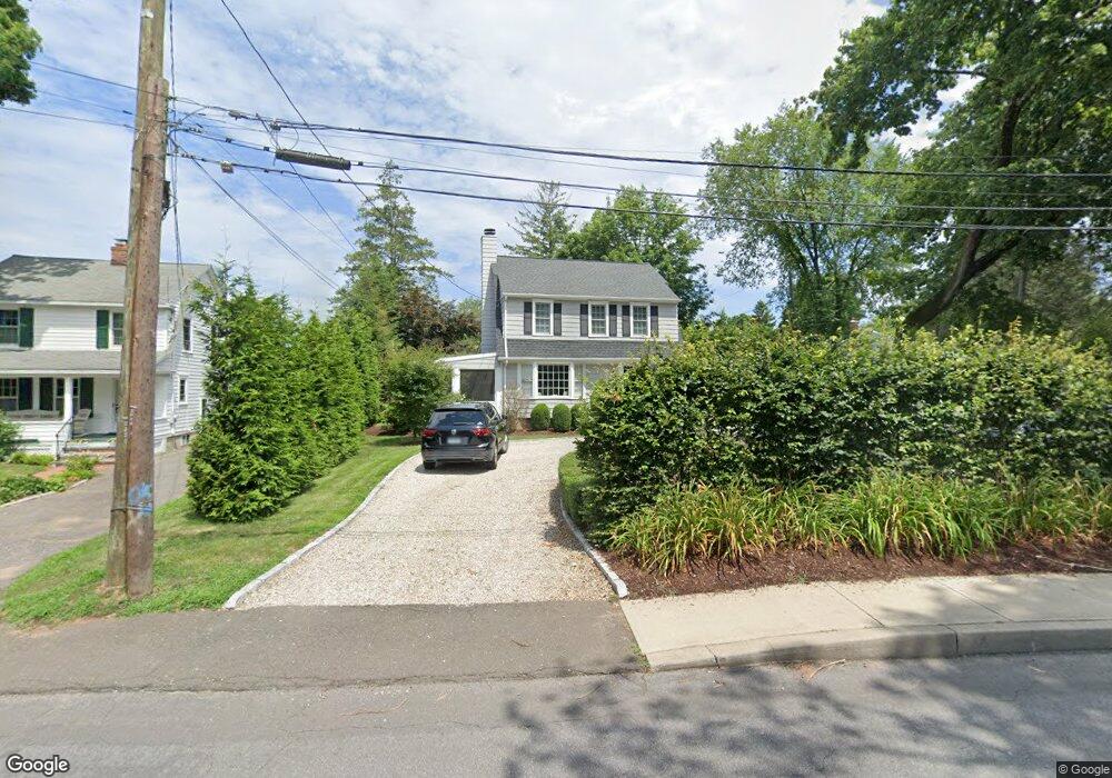
1210 Unquowa Rd W Fairfield, CT 06824
University NeighborhoodEstimated Value: $1,034,574 - $1,295,000
4
Beds
2
Baths
1,747
Sq Ft
$669/Sq Ft
Est. Value
About This Home
This home is located at 1210 Unquowa Rd W, Fairfield, CT 06824 and is currently estimated at $1,168,144, approximately $668 per square foot. 1210 Unquowa Rd W is a home located in Fairfield County with nearby schools including Riverfield Elementary School, Roger Ludlowe Middle School, and Fairfield Ludlowe High School.
Ownership History
Date
Name
Owned For
Owner Type
Purchase Details
Closed on
Jun 14, 2011
Sold by
Ballou Thomas C
Bought by
Ricci Scott A
Current Estimated Value
Purchase Details
Closed on
Jan 22, 1990
Sold by
Hayes Michael H
Bought by
Ballou Thomas C
Create a Home Valuation Report for This Property
The Home Valuation Report is an in-depth analysis detailing your home's value as well as a comparison with similar homes in the area
Home Values in the Area
Average Home Value in this Area
Purchase History
| Date | Buyer | Sale Price | Title Company |
|---|---|---|---|
| Ricci Scott A | $599,000 | -- | |
| Ricci Scott A | $599,000 | -- | |
| Ballou Thomas C | $265,000 | -- |
Source: Public Records
Mortgage History
| Date | Status | Borrower | Loan Amount |
|---|---|---|---|
| Open | Ballou Thomas C | $466,100 | |
| Closed | Ballou Thomas C | $58,000 |
Source: Public Records
Tax History Compared to Growth
Tax History
| Year | Tax Paid | Tax Assessment Tax Assessment Total Assessment is a certain percentage of the fair market value that is determined by local assessors to be the total taxable value of land and additions on the property. | Land | Improvement |
|---|---|---|---|---|
| 2025 | $11,602 | $408,660 | $281,260 | $127,400 |
| 2024 | $11,402 | $408,660 | $281,260 | $127,400 |
| 2023 | $11,242 | $408,660 | $281,260 | $127,400 |
| 2022 | $11,132 | $408,660 | $281,260 | $127,400 |
| 2021 | $11,026 | $408,660 | $281,260 | $127,400 |
| 2020 | $11,248 | $419,860 | $278,320 | $141,540 |
| 2019 | $11,248 | $419,860 | $278,320 | $141,540 |
| 2018 | $11,068 | $419,860 | $278,320 | $141,540 |
| 2017 | $10,841 | $419,860 | $278,320 | $141,540 |
| 2016 | $10,685 | $419,860 | $278,320 | $141,540 |
| 2015 | $10,297 | $415,380 | $292,950 | $122,430 |
| 2014 | $10,077 | $413,000 | $292,950 | $120,050 |
Source: Public Records
Map
Nearby Homes
- 647 Bronson Rd
- 476 Mill Hill Terrace
- 232 Pell Meadow Dr
- 83 Pell Meadow Dr
- 53 Hilltop Dr
- 21 Beaumont St
- 245 Unquowa Rd Unit 34
- 245 Unquowa Rd Unit 11
- 245 Unquowa Rd Unit 33
- 65 Thorpe St Unit 65
- 88 Overhill Rd
- 100 Overhill Rd
- 43 Helen St
- 844 Mill Hill Terrace
- 1135 Mill Hill Rd
- 28 Mill Hill Rd Unit 28
- 209 S Pine Creek Rd
- 57 Beaumont Place
- 20 Ermine St
- 226 Ruane St
- 1220 Unquowa Rd W
- 1198 Samuel Ln
- 1230 Unquowa Rd
- 446 Sturges Rd
- 1194 Unquowa Rd
- 468 Sturges Rd
- 1172 Unquowa Rd
- 488 Sturges Rd
- 171 Sycamore Ln
- 420 Sturges Rd
- 420 Sturges Rd
- 1237 Unquowa Rd
- 1163 Unquowa Rd
- 1160 Unquowa Rd
- 1200 Samuel Ln
- 289 Old Mill Rd
- 299 Old Mill Rd
- 145 Sycamore Ln
- 311 Old Mill Rd
- 221 Old Mill Rd